


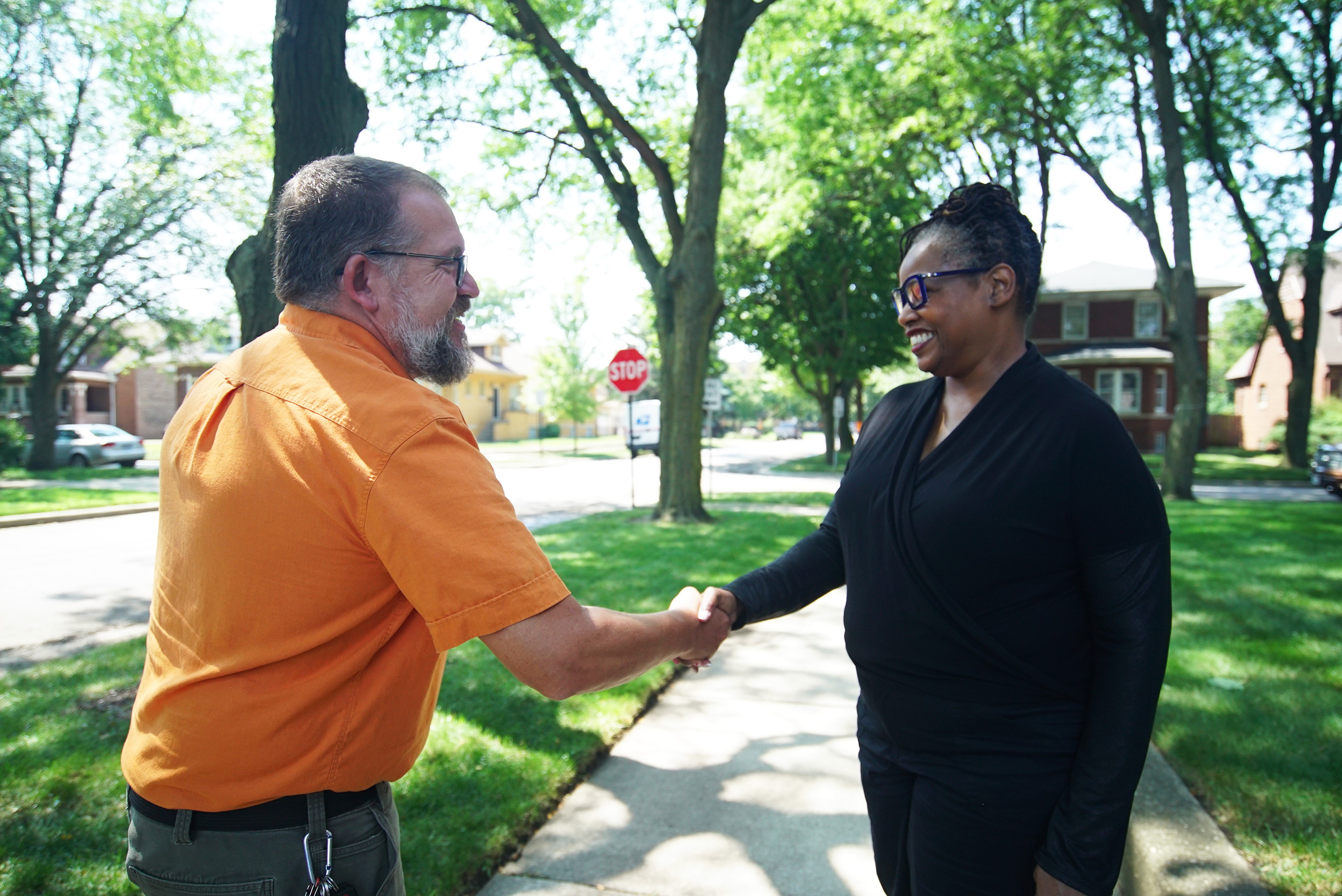
It was a hazy August day on Chicago’s South Side, and Nedra Sims Fears was hosting a small gathering to talk about the air. Interstate-94, which bisects her Chatham neighborhood, hummed nearby.
“This was the summer I spent watching summer out my window,” Fears said.
That’s because asthma runs in her family, and smoke from wildfires in Canada had wafted into Chicago, making it difficult for her to breathe. Many of her neighbors don’t have air conditioning, which means they don’t have the luxury of shutting their windows against the tiny hazardous particles contained in the smoke.
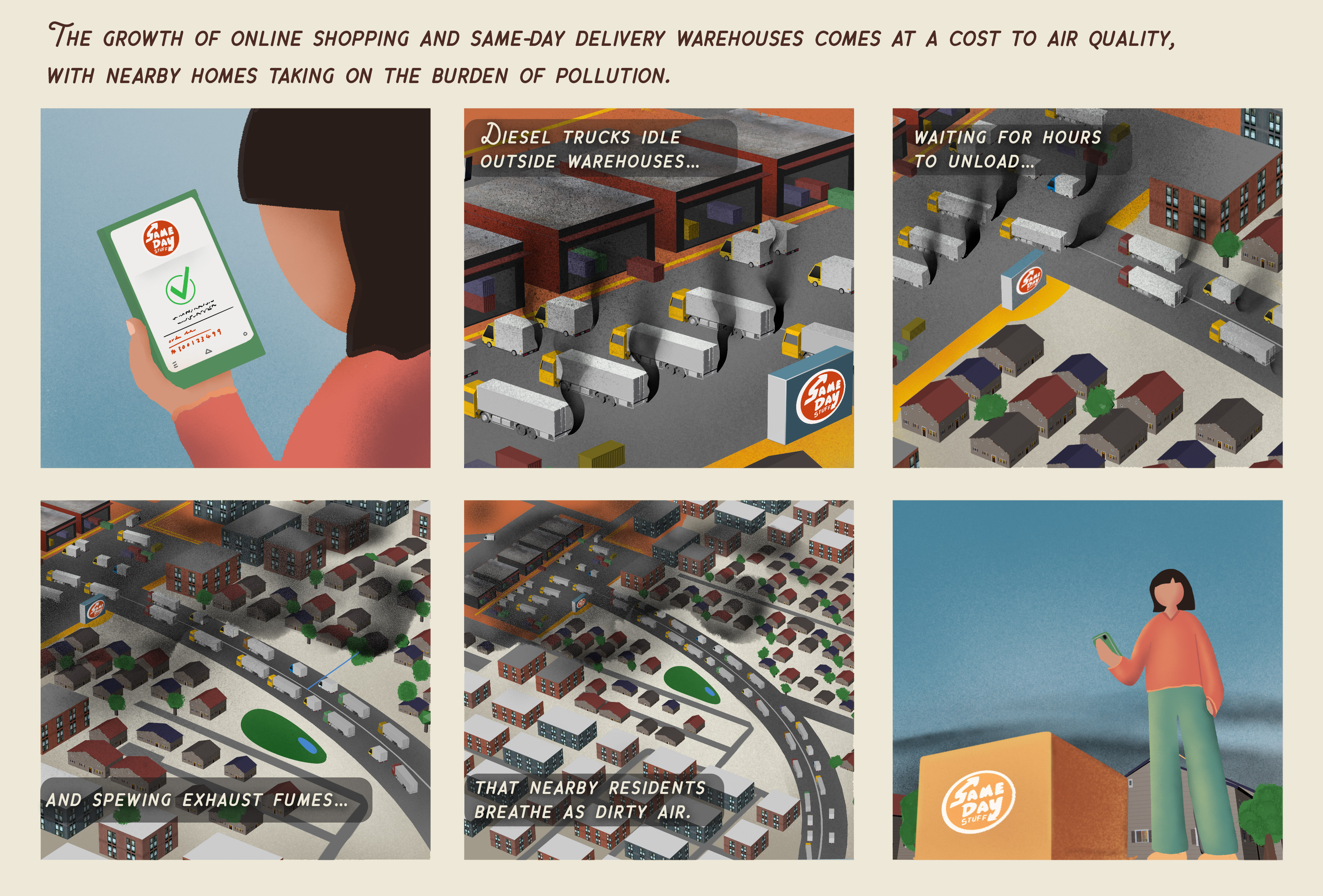
The fine particles, called PM2.5, are more than 35 times smaller than a grain of sand and can infiltrate deep into lung tissue. They degrade air quality in Chicago neighborhoods that are already disproportionately exposed to fossil fuel emissions. These include South and West Side neighborhoods located near highways, warehouses, and intermodal facilities, where freight-loaded trains and trucks converge. Thousands of such facilities are spread throughout Illinois, and they are hot spots of diesel exhaust and nitrogen oxides.
“Walking down the road, you see truck after truck after truck going into these facilities,” said Fears, who leads the Greater Chatham Initiative to revitalize a host of South Side neighborhoods. “Those neighborhoods live with day-to-day air pollution. It doesn’t take Canada being on fire for them to suffer.”
This was the summer I spent watching summer out my window.

Nedra Sims Fears
Chicago community leader
The result is that residents of Chicago and communities downwind are breathing harmful air pollutants including PM2.5, fossil fuel emissions, and smog. These pollutants move throughout the atmosphere and change by the hour, periodically exceeding the levels considered safe by the U.S. Environmental Protection Agency.
A version of this story plays out in every city in America. In New York and Los Angeles, tailpipe emissions spew from congested streets. In Phoenix, record-breaking heat stokes ozone formation. In port cities like Baltimore and Houston, emissions from ships, as well as oil refineries and chemical plants, contribute to dirty air.
While air quality monitors are distributed throughout the country, they are sparse in some regions, which means they cannot tell every neighborhood’s story. A NASA mission aims to change that with new tools to monitor air pollutants from the streets to the stratosphere.
STAQing Up Observations
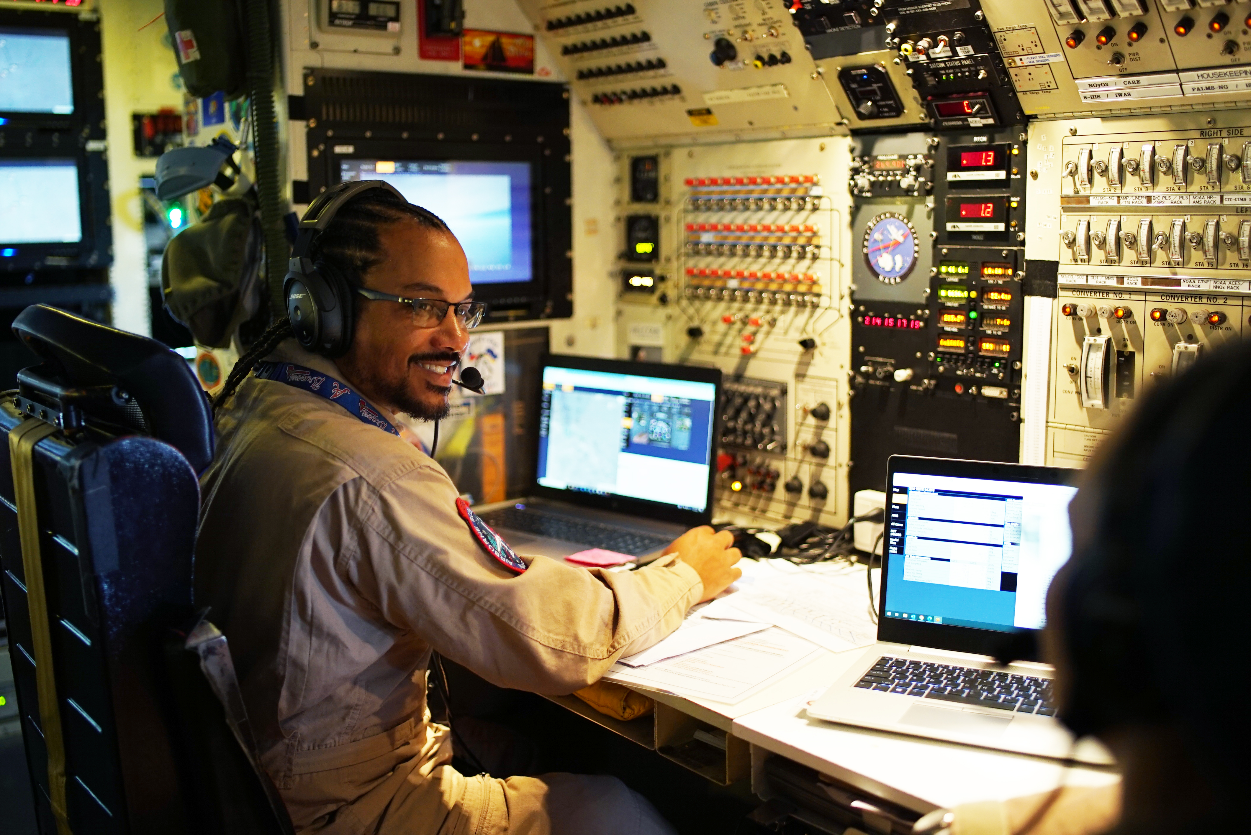
Several thousand feet above the Fears’ home, one of the largest flying laboratories in the world circled the skies over Chicago.
The plane – NASA’s four-engine DC-8 jet – is a storied research craft. Over the past 25 years it has supported field campaigns across all seven continents. On this August 2023 day, it carried 40 researchers and a pack of scientific instruments investigating air pollution over the cities and pasturelands of the Midwest.
From his seat over the wing, Barry Lefer watched the city’s iconic skyline rise from Lake Michigan.
“Air pollution has dramatically improved across the U.S. in the past few decades due to environmental regulations, but some communities are still hot spots of poor air quality,” said Lefer, head of the Tropospheric Composition Program at NASA Headquarters in Washington.
The researchers onboard – from NASA, NOAA, and multiple universities – converged this summer on cities across North America. In coordinated research campaigns, they studied a range of air pollutants from industrial emissions to volatile chemical products used in cleaning agents and personal care items.
NASA’s part of the mission was called STAQS, short for Synergistic TEMPO Air Quality Science, and it focused on Chicago, New York City, Los Angeles, and Toronto. STAQS included two Gulfstream jets equipped with state-of-the-art sensors and ground crews deployed in mobile research trailers across the country.
At the heart of the mission were two overarching questions: How do air pollutants change and move through the atmosphere, and which communities are disproportionately exposed?
A Vivid New Picture
2023 was a noteworthy summer for another reason: More than 22,000 miles above Earth’s surface, a new NASA-funded instrument started scanning Earth. TEMPO, short for Tropospheric Emissions: Monitoring of Pollution, is the first space-based instrument designed to continuously measure daytime air quality over North America at the resolution of a few square miles. TEMPO launched in April, and NASA and the Smithsonian Astrophysical Observatory released its first data maps in August.
TEMPO plus field campaigns like STAQS are giving scientists a more vivid picture of the air pollutants that contribute to disease and premature deaths in the U.S. These include nitrogen oxides, a byproduct of fossil fuel combustion commonly emitted by tailpipes and smokestacks; aerosols such as dust and soot particles; volatile organic compounds; and heat-trapping greenhouse gases such as methane and water vapor. As that new data is gathered and analyzed, air pollution scientists will have details down to a level that matters to people on the street.
The data will be freely accessible, Lefer said, and particularly useful to researchers, state agencies, and local policymakers working to develop solutions. “The hope is that the detailed new data we’re collecting will help communities make their air safer to breathe,” Lefer said.
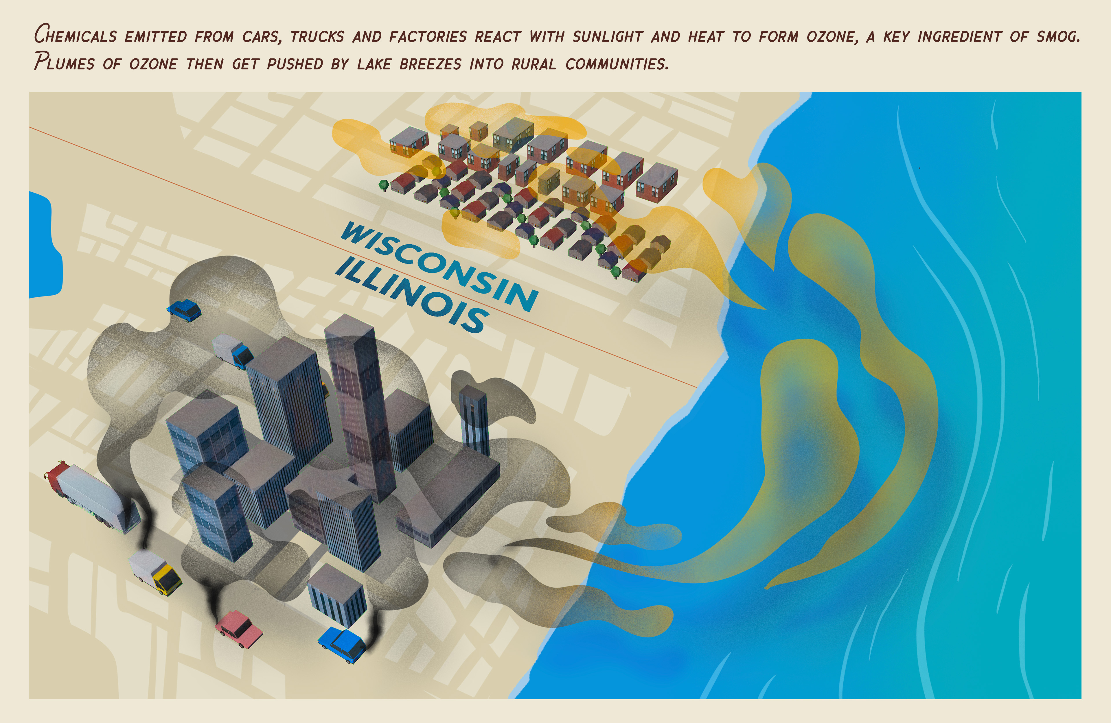
Ground-level ozone, a main ingredient in smog, is a particularly compelling target for Lefer and the STAQS team. While ozone high in the atmosphere protects Earth from dangerous solar radiation, ground-level ozone aggravates respiratory diseases. It often spikes after rush hour, as nitrogen oxides react with chemicals called volatile organic compounds and sunlight. Each year, ground-level ozone and PM2.5 particles lead to more than 100,000 premature deaths and billions of dollars in annual damages in the U.S, according to the National Weather Service.
In the Chicago area, Lake Michigan’s powerful influence on local weather and winds cause ozone plumes to “travel on air currents, causing pollution levels to exceed EPA standards in rural communities hundreds of miles away,” Lefer said.
Plume Over the Prairie
A short drive up Interstate-94 from Chicago, ozone was on the mind of Todd McKinney, who was scrambling in the dark. A raging Lake Michigan storm had knocked out power in his research trailer nestled in a Wisconsin prairie blooming with wildflowers just across the state line from Illinois. McKinney, a graduate student from the University of Alabama-Huntsville, was trying to get the lights back on before members of a Wisconsin environmental agency arrived for a tour.
For much of the summer, he has been living and working in the trailer, which is one part camper van, two parts high-tech laboratory. Its centerpiece is a custom-built lidar for measuring ozone in different layers of the lower atmosphere, also known as the troposphere. The mobile facility is part of NASA’s Tropospheric Ozone Lidar Network (TOLNet), a high-powered array of lasers used to identify and locate air pollutants.
Is the ozone that we’re seeing coming from an industrial source or the whole city? Is it caused by people idling in their cars at rush hour? We don’t know yet, but we’re working to track it back.
Todd McKinney
University of Alabama, Huntsville Graduate Student
The instruments were originally designed to be stationary. But McKinney said that the development of TEMPO was an inspiration for many researchers, who wanted to get out into the field and contribute real-time data to the summer’s air quality campaign. The trailer he’s working from has been in the making for 10 years – ever since the first announcement of TEMPO. Such ground-based measurements -- which also include hourly drone flights and a continual stream of high-altitude weather balloons -- help crosscheck the early data coming down from TEMPO in space.
Located downwind from Chicago, shoreline areas like Chiwaukee Prairie are occasionally dosed with ozone that has blown in from the city, he said. But the source is often difficult to pinpoint.
“Is the ozone that we’re seeing coming from an industrial source or the whole city?” he said. “Is it caused by people idling in their cars at rush hour? We don’t know yet, but we’re working to track it back.”
And tracking it back is the first step to developing a solution.
Empowering communities
Using advanced computer modeling to map air pollution hotspots across Chicago, a research team from Northwestern University found that neighborhoods alongside Lake Michigan experience more ground-level ozone pollution than the rest of the city. The researchers also found that neighborhoods located near highways like I-94 experience twice the concentration of nitrogen dioxide and dust than communities with the best air quality in the city.
“Empowering communities with data is an environmental justice issue,” said Daniel Horton, assistant professor in the department of earth and planetary sciences at Northwestern, who leads this research. He hopes that NASA measurements will inform clean-air solutions, such as the electrification of heavy-duty trucks and buses, and more green space in urban neighborhoods.
Air pollution is not an intractable problem, emphasized Zac Adelman, whose regional consortium works with state agencies in the Upper Midwest to improve air quality. The solution lies in devoting resources where they’ll be most effective.
“The question is, what do we control?" said Adelman, executive director of the Lake Michigan Air Directors Consortium. "What are the sources that we need to be concerned about, and what's actionable information that we can bring to the state regulators and to the federal government, too?”
Empowering communities with data is an environmental justice issue.
Daniel Horton
Northwestern University professor and researcher
“The STAQS campaign and associated monitoring activities that are growing up around it are giving us an opportunity to try to answer those questions," he added. "That’s a pretty empowering concept, right?”
Sacred Space Requires Clean Air
Back in her living room, Nedra Fears and atmospheric scientist Scott Collis of Argonne National Laboratory discussed how more trees, open spaces, and green rooftops might improve air quality in hard-hit neighborhoods. It’s part of a project they’re collaborating on called CROCUS, short for Community Research on Climate and Urban Science.
Combining scientific research and community guidance, the CROCUS team studies climate challenges in urban Chicago. Community input is critical, Collis said, to identify questions and topics – from localized flooding to heat waves – and ensure that research results directly benefit local residents. The team contributed to the summer’s air quality campaign using a network of sensors deployed throughout the region. CROCUS is funded by the Department of Energy.
Air quality is a complicated issue, but for Fears, the goal is simple. She wants to go on morning walks with her husband. She wants her neighbors’ concerns to be heard. Mostly, she wants to breathe clean air in her own living room, not shut the windows against the pollution she can often feel at the back of her throat.
“You don’t want that pollution in your house,” she said. “Your house is your sacred space where you can be joyful and well.”
Story by Sally Younger. Video and stills by Kathleen Gaeta.


