


before
after

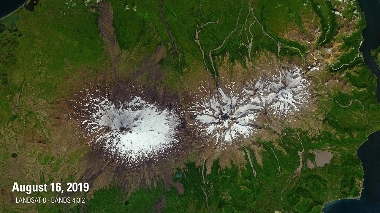
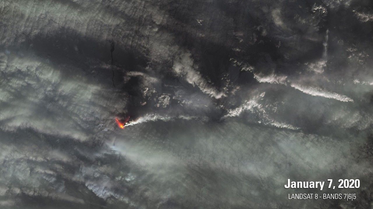
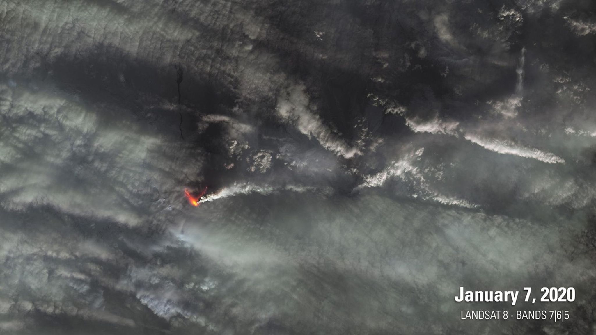
The 2019 image shows Mt. Shishaldin (left), a volcano on the eastern edge of Alaska's Aleutian Island chain, after a series of low-level eruptions that occurred the previous month. The 2020 image catches Shishaldin during a larger eruption that shot a plume of ash 5 miles (8 kilometers) into the sky. The bright yellow and red are false-color representations of what the satellite saw at infrared wavelengths. Images taken by Landsat 8. Source: U.S. Geological Survey’s National Land Imaging Image Collections
The 2019 image shows Mt. Shishaldin (left), a volcano on the eastern edge of Alaska's Aleutian Island chain, after a series of low-level eruptions that occurred the previous month. The 2020 image catches Shishaldin during a larger eruption that shot a plume of ash 5 miles (8 kilometers) into the sky. The bright yellow and red are false-color representations of what the satellite saw at infrared wavelengths. Images taken by Landsat 8. Source: U.S. Geological Survey’s National Land Imaging Image Collections
Before and After
Alaska's Mt. Shishaldin Erupts
Aug. 16, 2019 - Jan. 7, 2020
The 2019 image shows Mt. Shishaldin (left), a volcano on the eastern edge of Alaska's Aleutian Island chain, after a series of low-level eruptions that occurred the previous month. The 2020 image catches Shishaldin during a larger eruption that shot a plume of ash 5 miles (8 kilometers) into the sky. The bright yellow and red are false-color representations of what the satellite saw at infrared wavelengths. Images taken by Landsat 8. Source: U.S. Geological Survey’s National Land Imaging Image Collections


