


before
after
Before and After
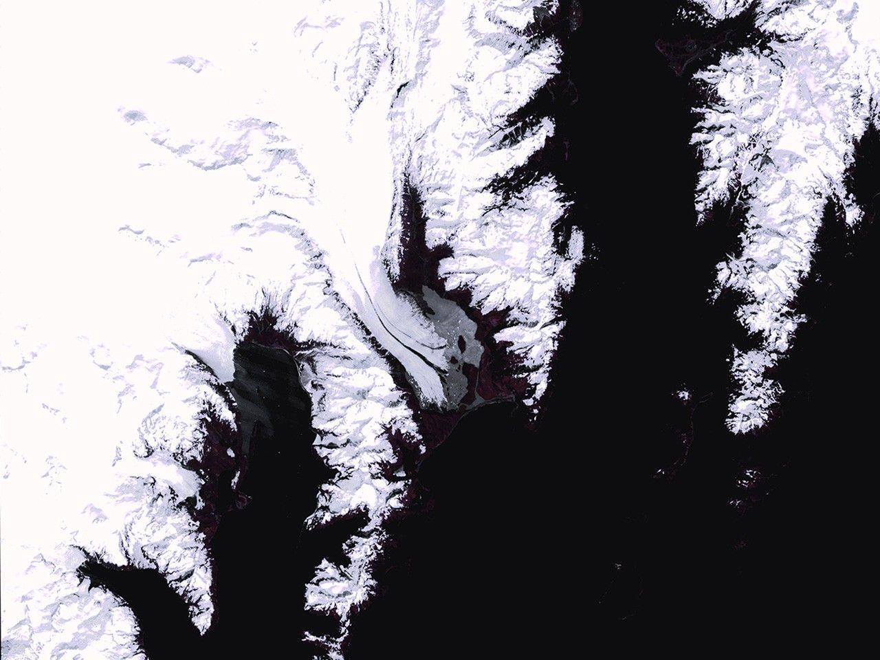
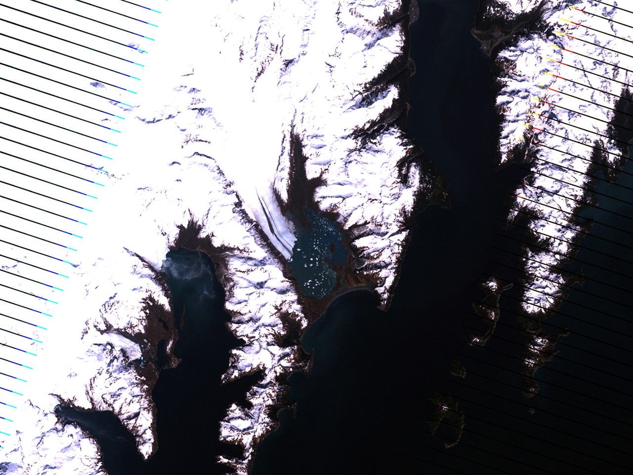
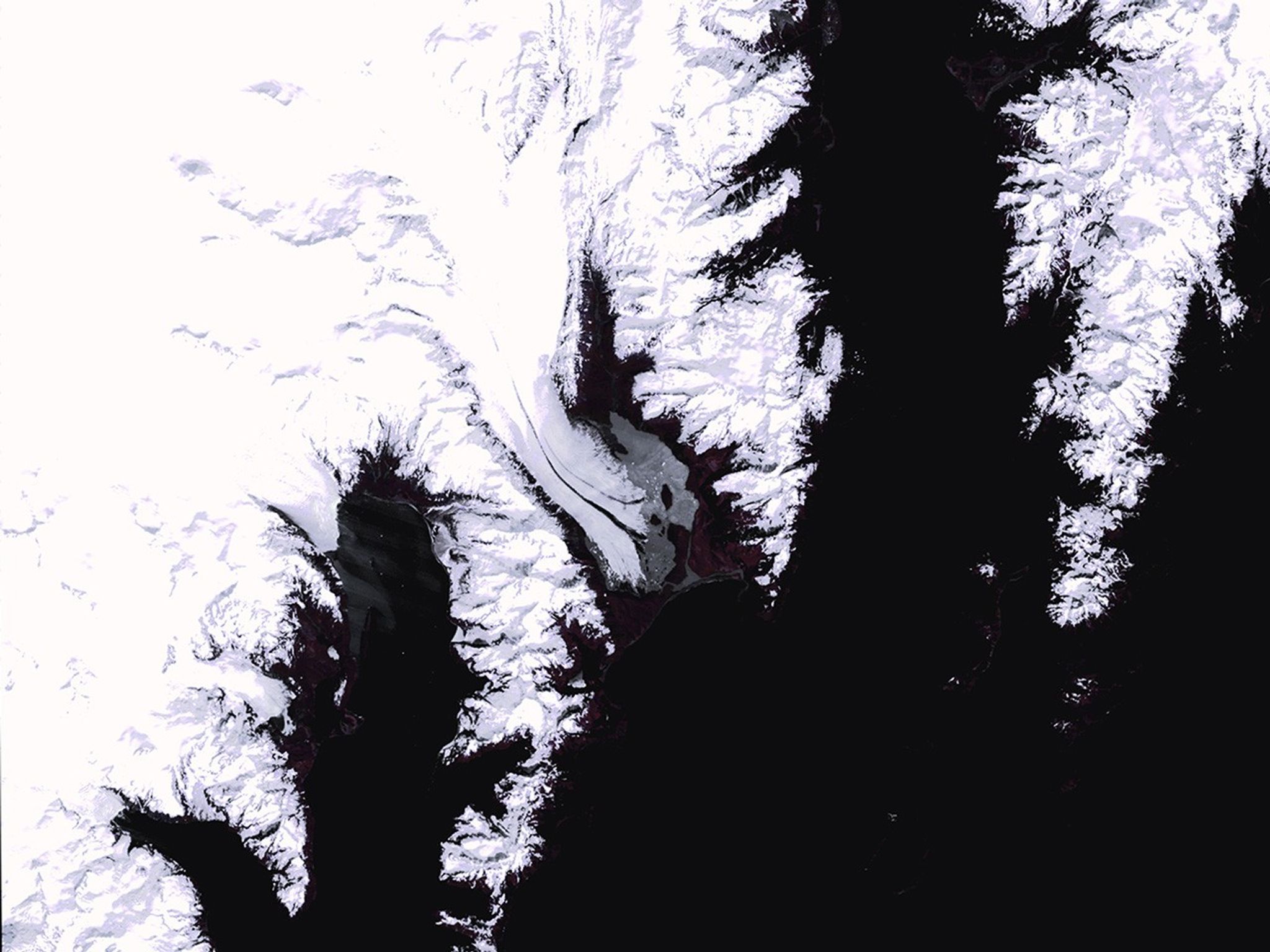
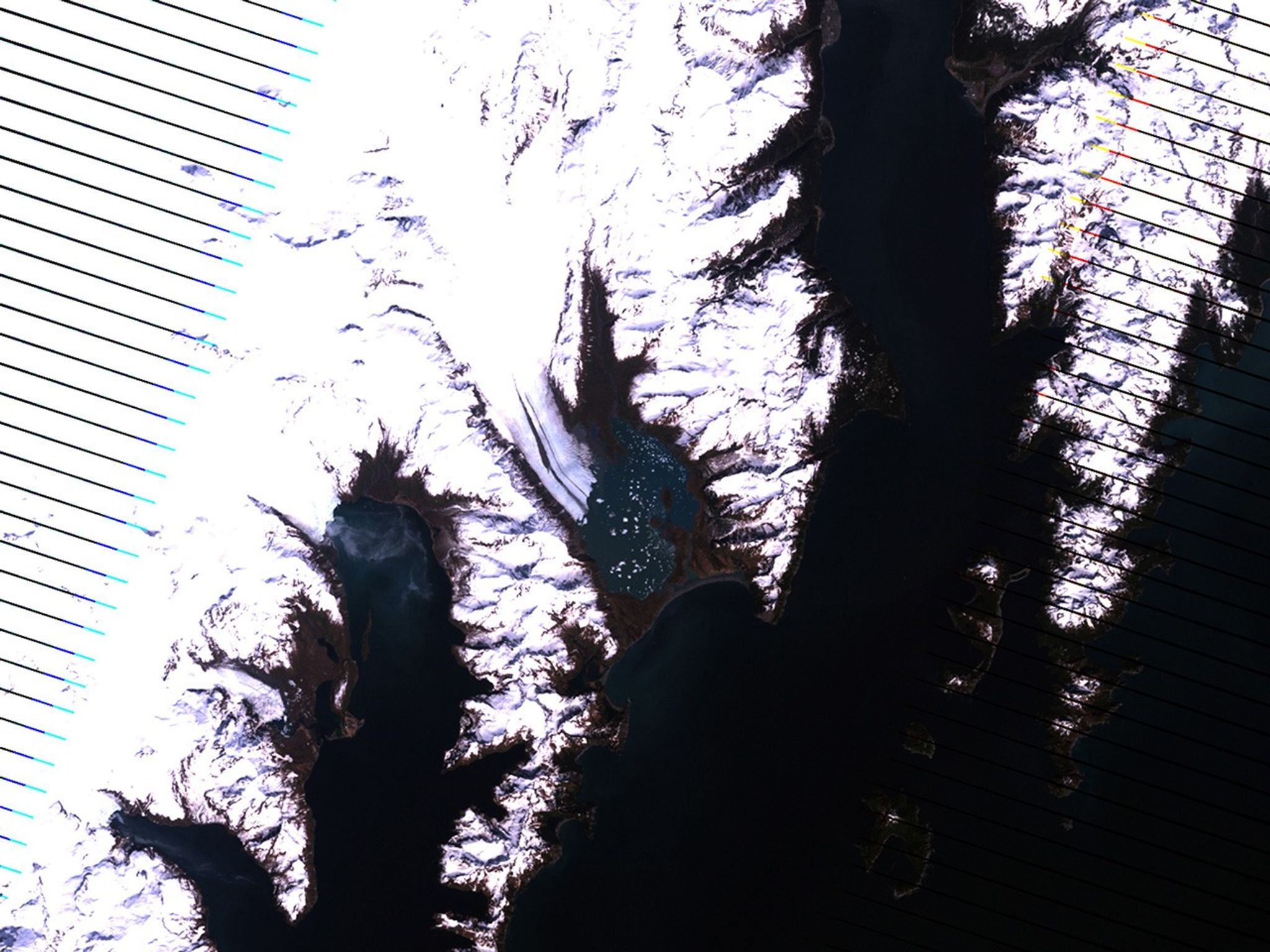
Bear Glacier melt, Alaska
June 5, 1980 - May 16, 1989
This series of images shows the shrinkage of Bear Glacier from 1980 to 2011. Warming in the region has caused less buildup of snow and therefore less material for glacial growth. As the glacier has receded, ice at the end of the glacier has broken off the main body, forming icebergs in the open water. The 2011 image shows considerable retreat of the glacier's "tongue." Also see this image pair of the same glacier. Left image taken by the Multispectral Scanner onboard Landsat 3. Center image taken by the Thematic Mapper sensor onboard Landsat 4. Right image taken by the Enhanced Thematic Mapper Plus sensor onboard Landsat 7. Source: U.S. Geological Survey (USGS) Landsat Missions Gallery, "Bear Glacier, Alaska," U.S. Department of the Interior / USGS and NASA.


