9 min read
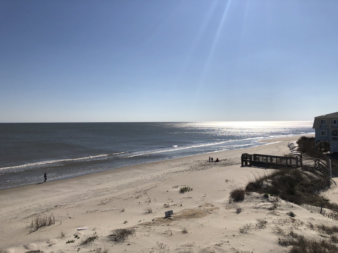
Recently I stayed in a lovely vacation rental at the eastern end of Ocean Isle Beach, a small town on North Carolina’s southern coast not far from Myrtle Beach, South Carolina. Located on a 5-mile-long (8-kilometer-long) barrier island, the community is separated from the mainland by the Atlantic Intracoastal Waterway and marsh savannas. It’s a pleasant seaside resort, with restaurants, tourist amenities, and row upon row of stilt homes, many right on the beach. My bedroom looked out over small sand dunes to the shimmering Atlantic, which, at high tide, ebbed and flowed not much farther than a stone’s throw away. From my vantage point, there were no clues that the sea here might not always be a friendly neighbor.
A short stroll along the beach quickly provided a starkly different perspective. Just a few dozen yards away, huge sandbags were piled high, guarding a number of homes from the sea. As I continued walking, I soon found myself in front of homes that were perched literally above the waves at high tide.
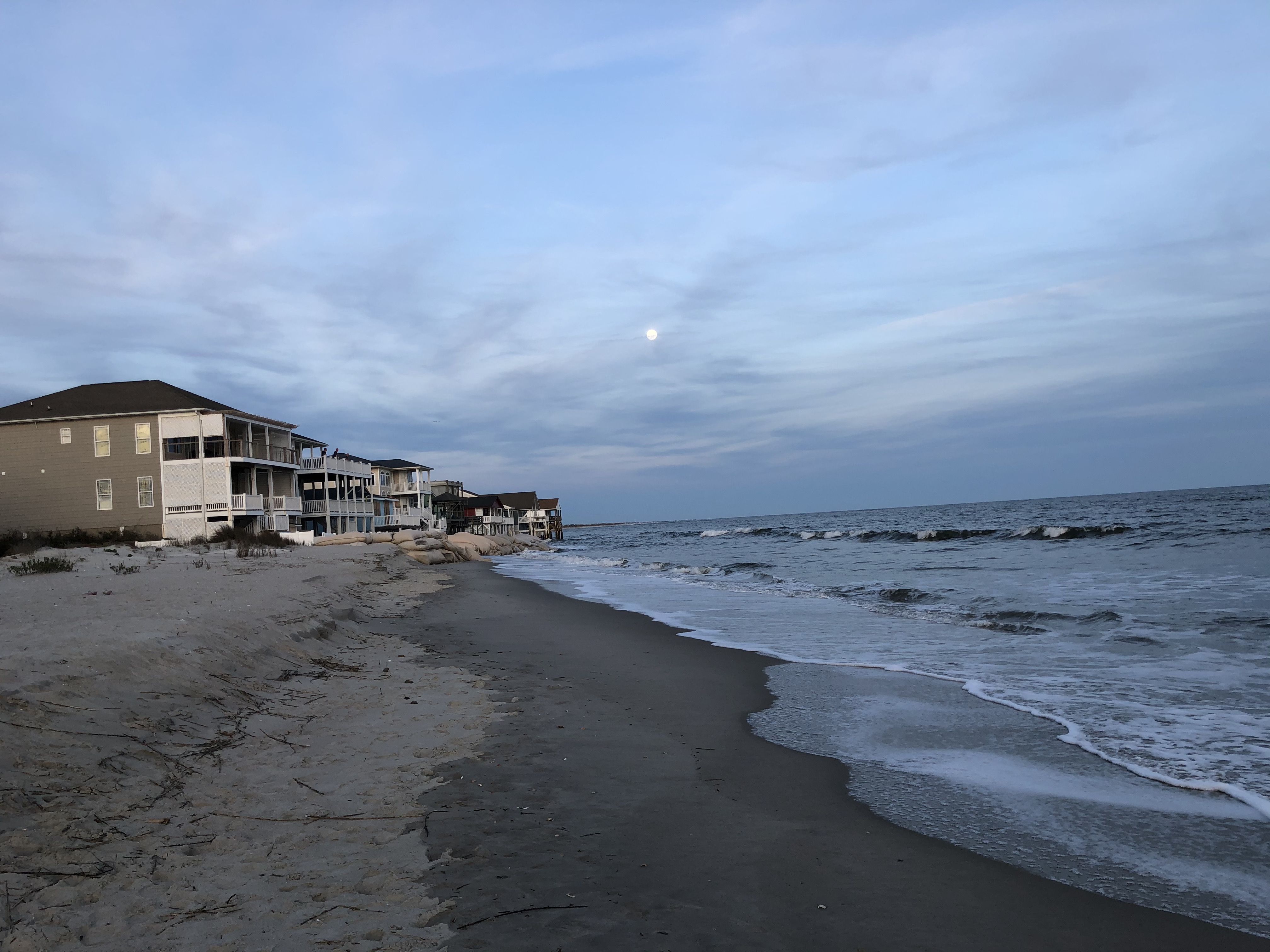
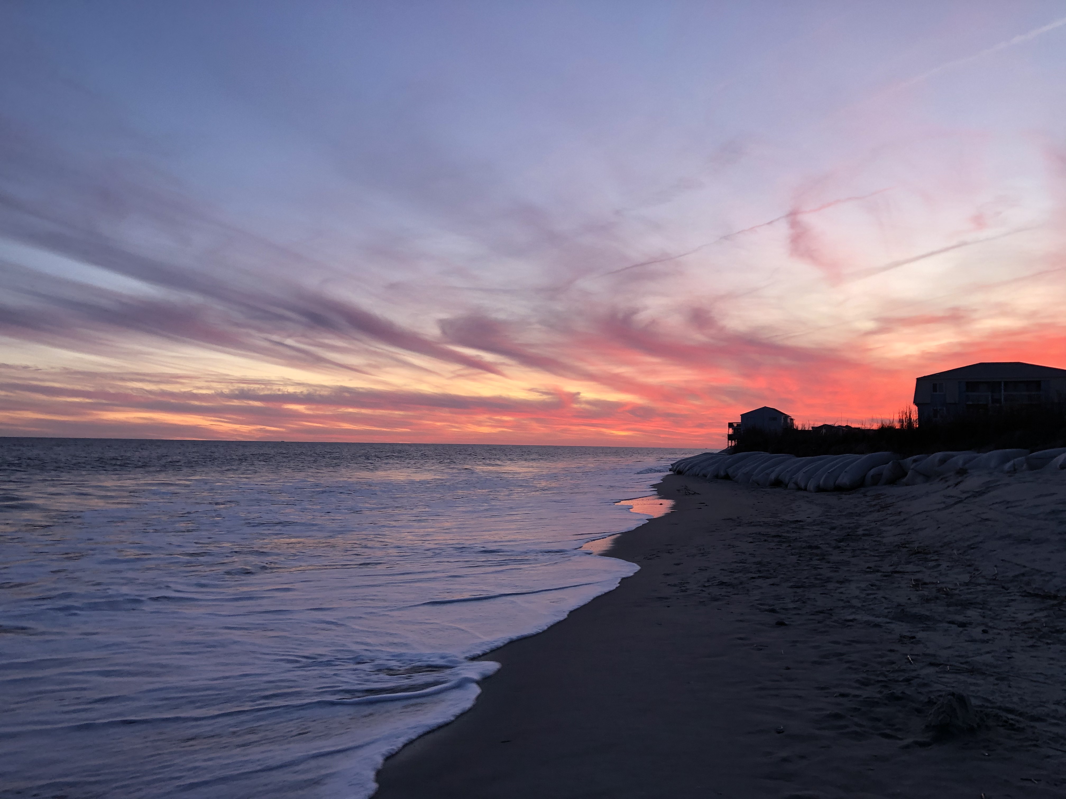
I passed a woman walking her dog and asked her about the homes. “There used to be two streets of houses in front of these homes,” she told me. “Now they’re oceanfront.”
It turns out the homes at the east end of Ocean Isle Beach were victims of coastal erosion, which is common at most beaches in North Carolina and throughout the world. An eroding beach can lose several feet of sand a year. Of course, storms, including hurricanes, can result in rapid beach erosion. But there’s also chronic, long-term erosion, caused by changes in the supply of sand to a beach and in relative sea level (how much the height of the ocean rises or falls relative to the land at a particular location). Records show sea level in this part of coastal North Carolina has risen about 7.6 centimeters (3 inches) since the early 1980s. According to the U.S. Global Change Research Program, coastal erosion results in U.S. coastal property losses of about a half billion dollars each year in the form of damaged structures and lost land.
NASA/JPL-Caltech
The case of Ocean Isle Beach illustrates a key paradox about sea level rise: since it occurs relatively slowly, it can be easy to think it’s not happening. But as oceanographer and climate scientist Josh Willis of NASA’s Jet Propulsion Laboratory in Pasadena, California, told me, if you’re not seeing it, you’re just not looking in the right place.
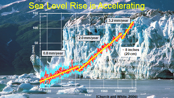
“Thanks to satellite and tide gauge data, we know that sea level is rising about 3.3 millimeters (0.13 inches) a year, a rate that grows by another 1 millimeter (0.04 inches) per year every decade or so,” Willis said. “Each year, global warming is currently adding about 750 gigatonnes of water to the ocean – enough to cover my home state of Texas about 1 meter (more than 3 feet) deep. We can’t really eyeball a few millimeters of sea level rise a year just by looking at the ocean because of waves, tides, etc. But we can definitely see the effects of it, both short- and long-term.”
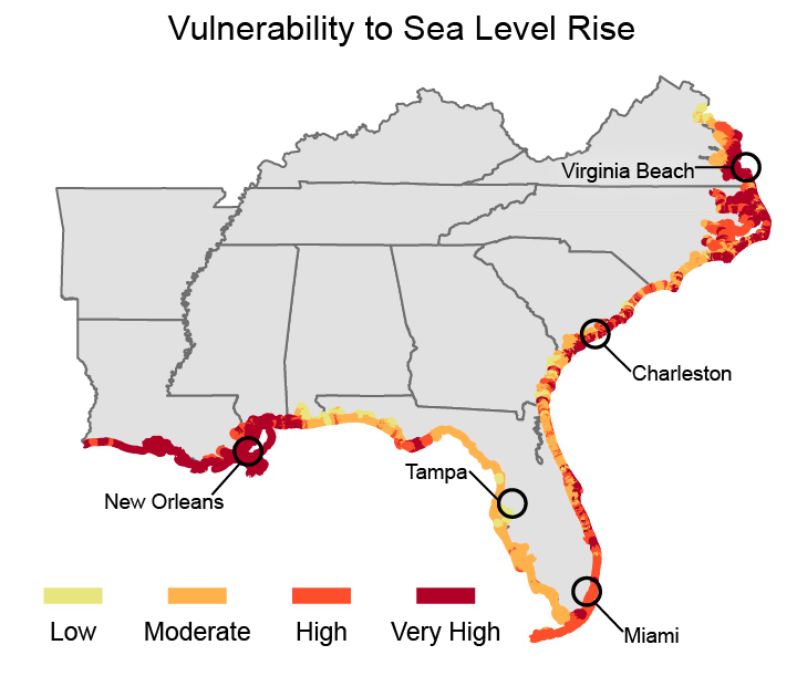
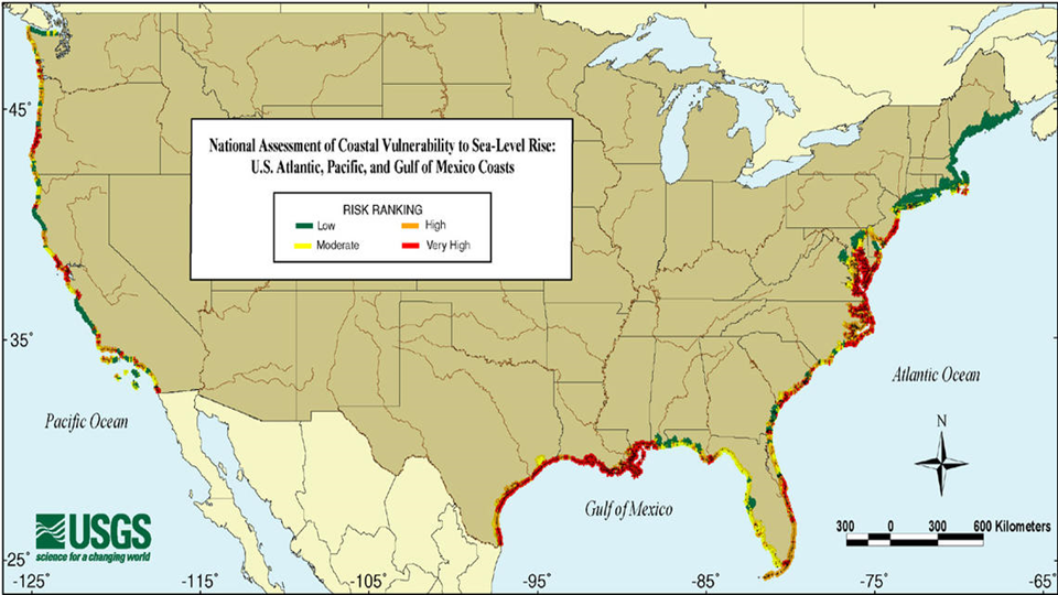
Willis said sea level rise accelerates and exacerbates the natural coastal erosion that’s continually taking place in locations like Ocean Isle Beach. “Sea level rise literally eats away at a coastline, making it more vulnerable to floods,” he said. “While floods happen naturally, it’s sea level rise that causes them to gradually begin topping natural barriers—like wetlands, mangrove forests and saltwater marshes—and even human-built barriers that typically protect coastal areas around the world from flooding. All of a sudden, that flood that you used to be protected from is now wiping you out.”
It’s the same story all over the world. You may not be able to eyeball sea level rise at your local beach, but its effects are being felt in many ways. Willis says a good rule of thumb is that every inch of sea level rise results in the loss of about 2.5 meters (100 inches) of beach, though recent studies suggest beach losses around the globe could happen even faster.
In many places, sea level rise has rendered sea walls erected decades ago to handle 100-year floods inadequate. Floods that used to occur once a century are now happening once a decade. You can also see the impacts of sea level rise reflected in gradual damage to infrastructure, such as the condition of coastal roads like California’s Pacific Coast Highway, which is continually battling the effects of coastal erosion.
Another phenomenon many people are experiencing more frequently but may not necessarily think is an impact of sea level rise is high tide flooding, otherwise known as “nuisance,” or “sunny day” flooding. This type of flooding, which is generally low-level, occurs year-round during high tides. Its effects range from inconveniences to the public, such as the closure of roads, businesses and schools, to long-term infrastructure damage and overwhelmed storm drains. Climate-related sea level rise is a primary contributor to high tide flooding, as is the loss of natural coastal barriers. Another contributor is the sinking of coastal lands due to adjustments related to the end of the last Ice Age, tectonics, compaction of sediments, and other dynamic processes. In the United States, high tide flooding is especially common along the East and Gulf Coasts. Over the last two decades, their frequency is up by roughly 50 percent; 100 percent if you go back three decades.
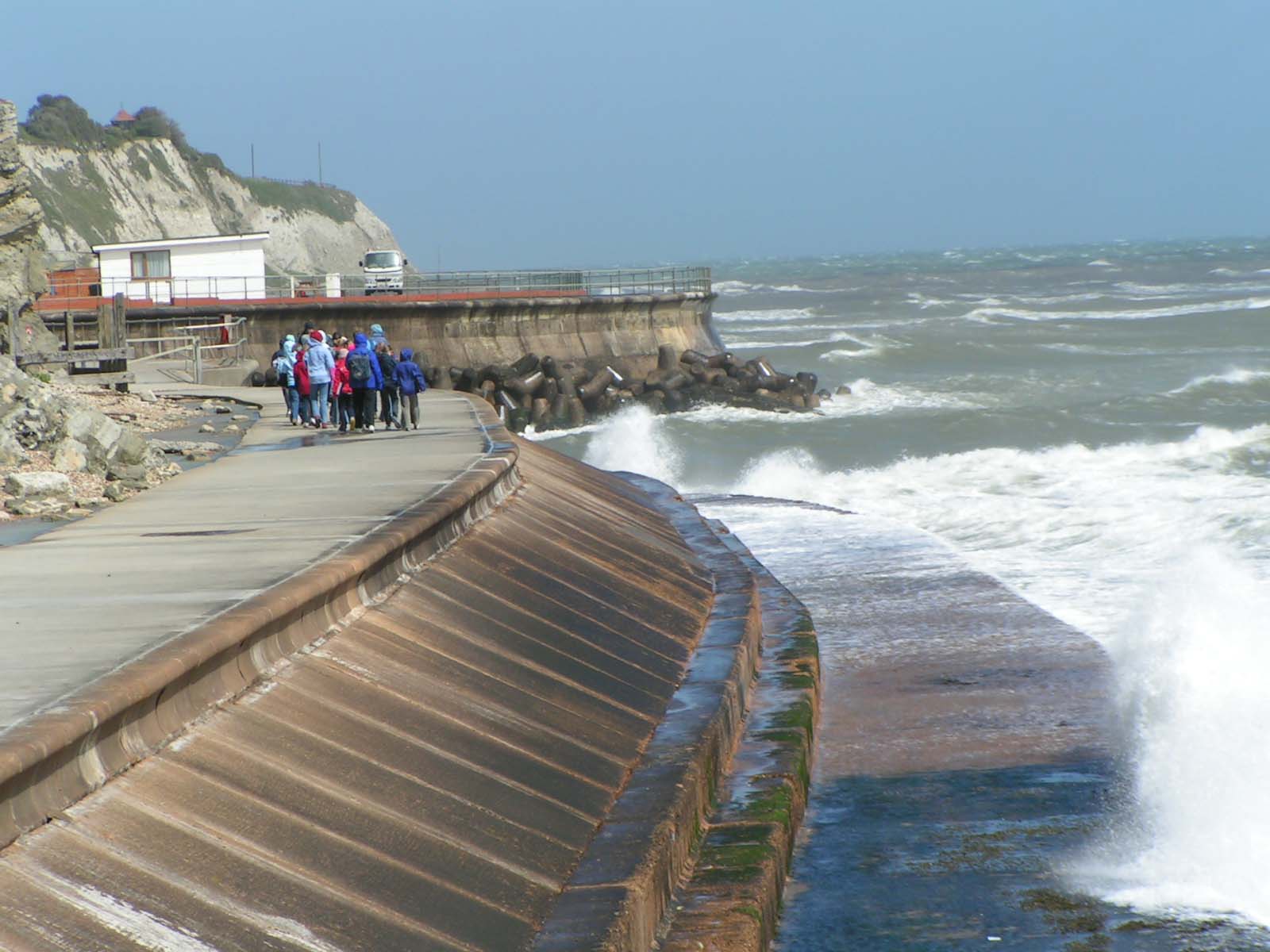
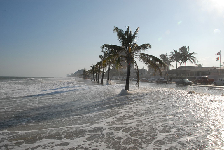
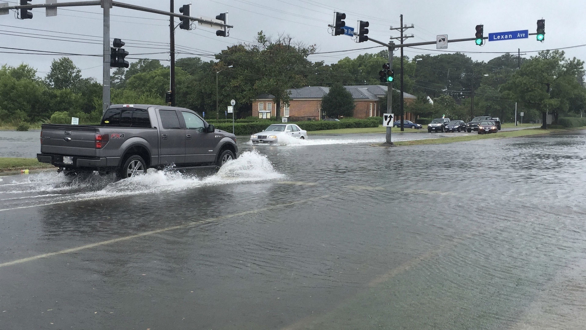
Norfolk, Virginia, is a good case in point. Norfolk, home to the world’s largest Naval base, is one of several municipalities that comprise Virginia’s Hampton Roads region, which has a population of more than 1.8 million. In the 20th century, sea level relative to land in Norfolk rose between 4 and 5 millimeters (0.16 to 0.2 inches) a year, in part because the land in this region is sinking as it continues to adjust to the melting of the Laurentide ice sheet that covered it during the last Ice Age. Over the past couple of decades, high tide flooding here has accelerated rapidly, and now occurs about 10 days a year, causing flooding in downtown Norfolk.
“We’ve had such a large amount of sea level rise in the past century that we’re now nearing a tipping point,” said Ben Hamlington, a research scientist in JPL’s Sea Level and Ice Group. “When many coastal communities like Norfolk were established, developers took into account where historical high tide lines were, then added a safety gap to account for floods. But long-term climate change is narrowing that safety gap and a storm event is no longer required to cause significant flooding. The combination of long-term sea level rise and natural variations in sea level caused by climate cycles such as El Niño and the Pacific Decadal Oscillation (PDO) is leading to a dramatic increase in high-tide flooding events. As a result, coastal communities must now take these different natural climate cycles into account in their planning.”

Willis says sea level rise is causing some cities around the world to face the ultimate choice: spend huge sums of money to combat sea level rise, or literally abandon ship and move away. Last year, Indonesia announced plans to move its capital inland from Jakarta, a city of 10 million that’s sinking and challenged by sea level rise. In cities all over the world, local officials are confronting their own battles. Even relatively affluent metropolitan areas like Southern California aren’t immune. But many places, such as Bangladesh, parts of southeast Asia and small island nation states, simply don’t have the resources.

Willis says California and the U.S. West Coast have been spared the worst effects of sea level rise over the past 20 years. But that may be about to change.
“Over the past 15 to 20 years, we’ve been watching warm waters in the Pacific Ocean move away from the West Coast due to a shift in the PDO, a long-term ocean fluctuation pattern that’s similar to the El Niño/La Niña cycles but that operates on a much larger scale, waxing and waning about every 20 to 30 years,” he said. “This has served to counteract the effects of global sea level rise, so that along the U.S. Pacific Coast, we’ve seen almost no sea level rise over that time. But those days are over. Since the major El Niño of 2015-16, the PDO has shifted and the West Coast is likely to see faster-than-average sea level rise in the next 20 years. We’re already beginning to see this. California, in particular, needs to prepare. We could see increases up to 1 centimeter (0.4 inch) a year, more than three times the global rate.”
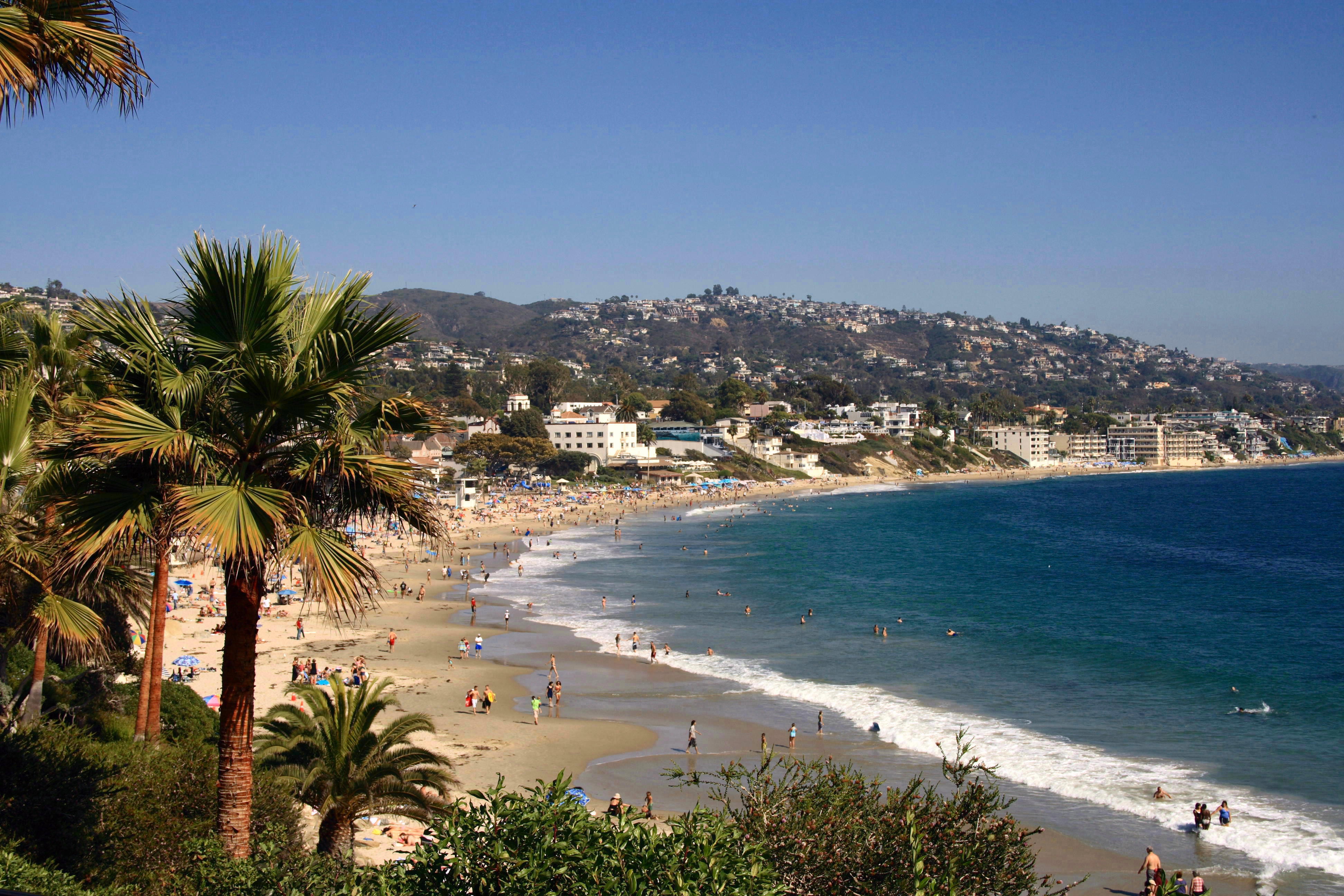
Such a rate of sea level rise would equate to more than 20 centimeters (8 inches) in the next two decades. To put that into perspective, over the past century, sea level along California’s coast has gone up about 23 centimeters (9 inches). This will pose major challenges for many parts of the Golden State, from San Francisco and San Diego Bays, to the Ports of Long Beach and Los Angeles, and cities in coastal Orange County, to name a few. “We think of California as having a lot of cliffs,” says Willis. “It does, but in between, there are lots of low-lying areas where sea level rise is going to cause problems.”
Whether you want to see it or not, sea level rise is a global problem. And that’s no day at the beach.


