


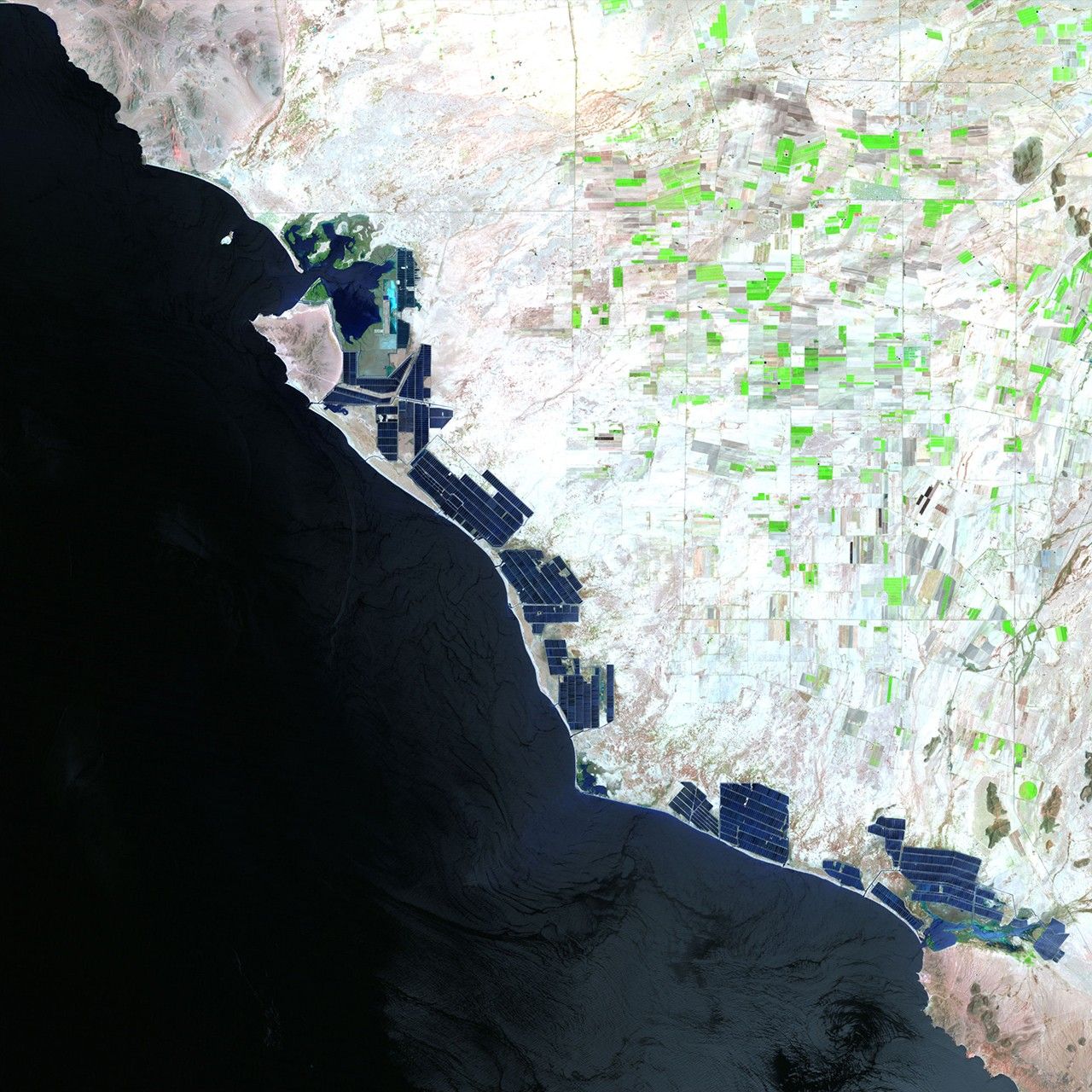
before
after
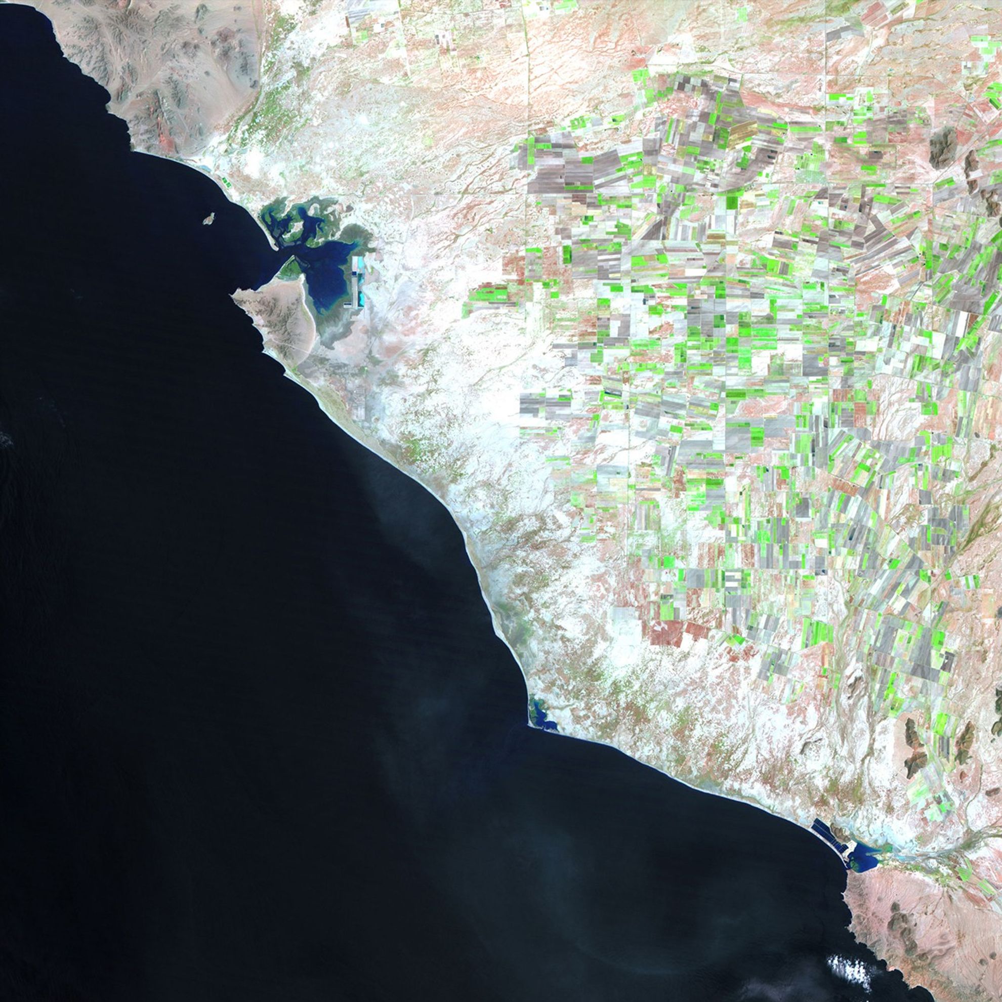
Left: August 7, 1993. Right: July 8, 2011. These images show changes to the western coastline of Sonora, Mexico due to the construction of shrimp farms over the past two decades. While the shrimp industry has generated profits and jobs, there have been concerns about its effect on the ecosystems of the region, and disputes have arisen about property rights to the communal coastal lands.
NASA/USGS
Before and After
Coastal change in Sonora, Mexico
August 7, 1993 - July 8, 2011
Left: August 7, 1993. Right: July 8, 2011. These images show changes to the western coastline of Sonora, Mexico due to the construction of shrimp farms over the past two decades. While the shrimp industry has generated profits and jobs, there have been concerns about its effect on the ecosystems of the region, and disputes have arisen about property rights to the communal coastal lands. Images taken by the Thematic Mapper sensor onboard Landsat 5. Source: USGS Landsat Missions Gallery, "Aquaculture Changes Mexican Shoreline," U.S. Department of the Interior / U.S. Geological Survey.


