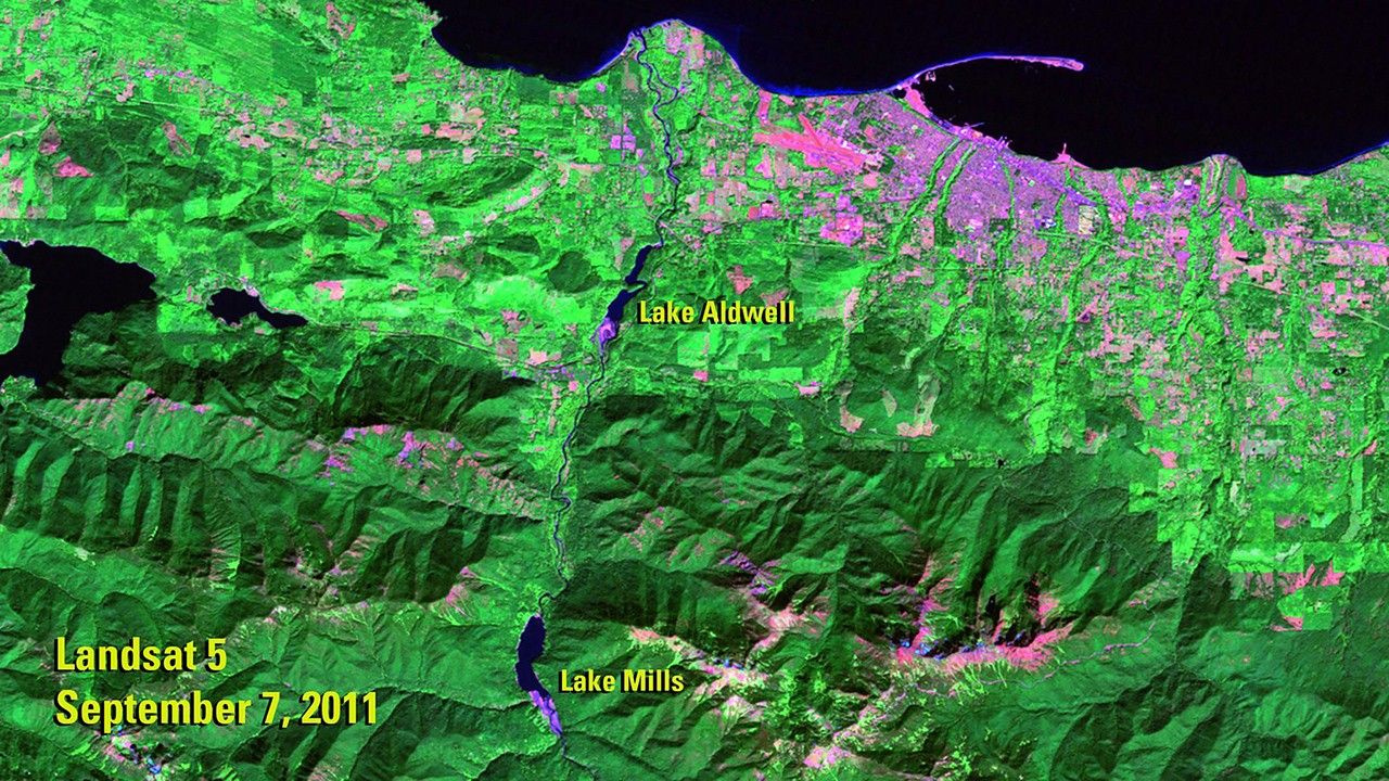
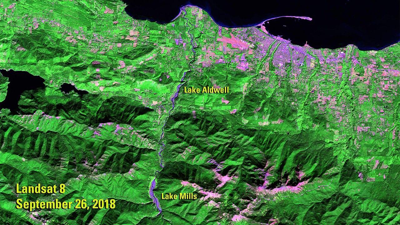
Due to the lapse in federal government funding, NASA is not updating this website.

Suggested Searches

1 min read

Dam Removal on Elwha River, Washington

before
after
The 2011 image shows the Elwha River, in northwestern Washington state, when it still hosted two dams that were built in the early 1900s: the Glines Canyon Dam, which created the Lake Mills reservoir, and the Elwha Dam, which created the Lake Aldwell reservoir. The dams blocked salmon migration and greatly reduced the amount of sediment flowing to the river’s delta. Following an act of Congress to restore the river’s ecosystem, both dams were removed—the largest such project in U.S. history. The 2018 image shows the river free of the dams, with sediment covering the beds of the former lakes. The 2011 image was taken by Landsat 5. The 2018 image was taken by Landsat 8. Sources: U.S. Geological Survey’s National Land Imaging Image Collections and the National Park Service.

Before and After

Dam Removal on Elwha River, Washington

Sept. 7, 2011 - Sept. 26, 2018

The 2011 image shows the Elwha River, in northwestern Washington state, when it still hosted two dams that were built in the early 1900s: the Glines Canyon Dam, which created the Lake Mills reservoir, and the Elwha Dam, which created the Lake Aldwell reservoir. The dams blocked salmon migration and greatly reduced the amount of sediment flowing to the river’s delta. Following an act of Congress to restore the river’s ecosystem, both dams were removed—the largest such project in U.S. history. The 2018 image shows the river free of the dams, with sediment covering the beds of the former lakes. The 2011 image was taken by Landsat 5. The 2018 image was taken by Landsat 8. Sources: U.S. Geological Survey’s National Land Imaging Image Collections and the National Park Service.

Downloads

Image 1

JPEG

(2 MB)

Image 2

JPEG

(2 MB)