


before
after
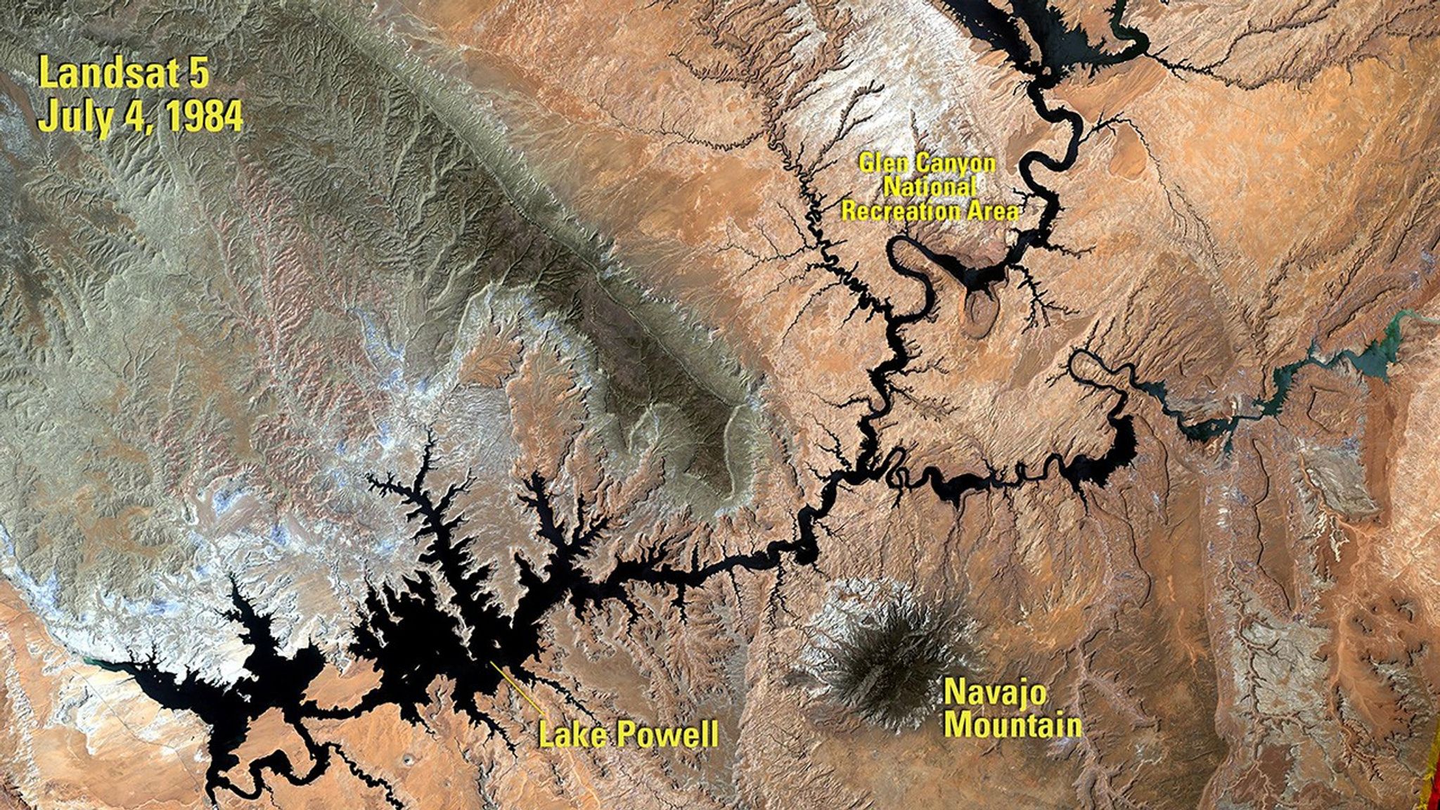
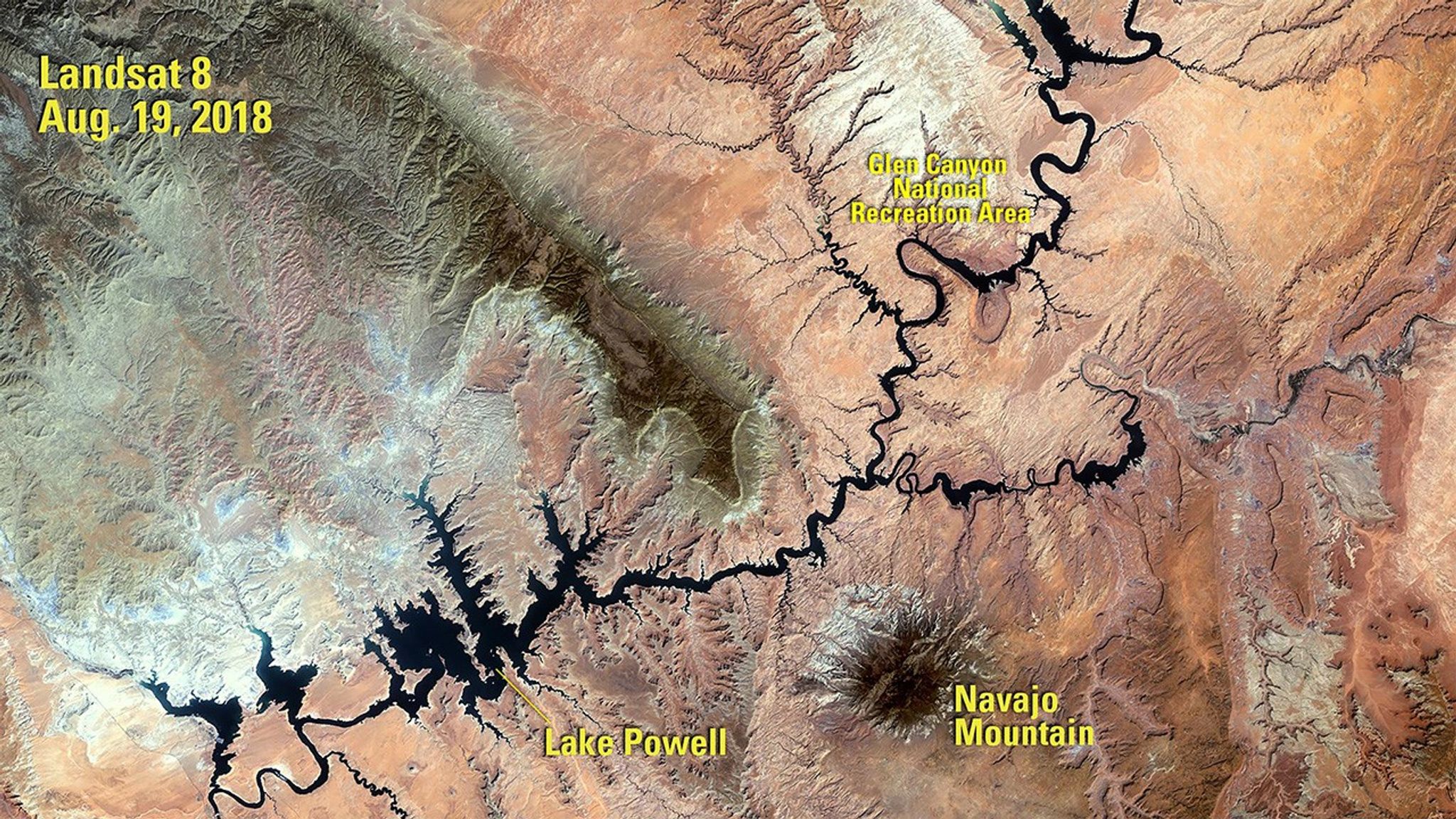
Before and After
Decline of Lake Powell, United States
1984 - 2018
The 1984 image shows Lake Powell a year after its highest water level was recorded. The 2018 image was taken following a period of drought that began in 2000. When the water volume was measured five months later, it was less than half of what the lake can hold. Powell is a reservoir, formed in 1963 when the Glen Canyon Dam was built on the Colorado River. It resides mostly in Utah, with its southern end at the dam in northern Arizona. See also Drought in Lake Powell, Arizona and Utah. The 1984 image was taken by Landsat 5. The 2018 image was taken by Landsat 8. Source: U.S. Geological Survey’s National Land Imaging Image Collections


