


before
after
Large areas within the Amazon rainforest have undergone large-scale deforestation over the past few decades. However, in locations like the Peruvian Amazon, most of the deforestation is caused in recent years by small-scale agriculture, according to the Monitoring of the Andean Amazon Project. These images show land about 25 miles (about 40 kilometers) northwest of Pucallpa along the Aguaytia River. Lush green dominates the 1986 image (left), while deforested land is light green or pink in the 2016 image. Two large-scale oil palm plantations dominate the 2016 image. Images taken by Landsat. Source: U.S. Geological Survey (USGS) Landsat Missions Gallery: “Monitoring Deforestation in the Amazon”; U.S. Department of the Interior / USGS and NASA.
Large areas within the Amazon rainforest have undergone large-scale deforestation over the past few decades. However, in locations like the Peruvian Amazon, most of the deforestation is caused in recent years by small-scale agriculture, according to the Monitoring of the Andean Amazon Project. These images show land about 25 miles (about 40 kilometers) northwest of Pucallpa along the Aguaytia River. Lush green dominates the 1986 image (left), while deforested land is light green or pink in the 2016 image. Two large-scale oil palm plantations dominate the 2016 image. Images taken by Landsat. Source: U.S. Geological Survey (USGS) Landsat Missions Gallery: “Monitoring Deforestation in the Amazon”; U.S. Department of the Interior / USGS and NASA.
Large areas within the Amazon rainforest have undergone large-scale deforestation over the past few decades. However, in locations like the Peruvian Amazon, most of the deforestation is caused in recent years by small-scale agriculture, according to the Monitoring of the Andean Amazon Project. These images show land about 25 miles (about 40 kilometers) northwest of Pucallpa along the Aguaytia River. Lush green dominates the 1986 image (left), while deforested land is light green or pink in the 2016 image. Two large-scale oil palm plantations dominate the 2016 image. Images taken by Landsat. Source: U.S. Geological Survey (USGS) Landsat Missions Gallery: “Monitoring Deforestation in the Amazon”; U.S. Department of the Interior / USGS and NASA.
Large areas within the Amazon rainforest have undergone large-scale deforestation over the past few decades. However, in locations like the Peruvian Amazon, most of the deforestation is caused in recent years by small-scale agriculture, according to the Monitoring of the Andean Amazon Project. These images show land about 25 miles (about 40 kilometers) northwest of Pucallpa along the Aguaytia River. Lush green dominates the 1986 image (left), while deforested land is light green or pink in the 2016 image. Two large-scale oil palm plantations dominate the 2016 image. Images taken by Landsat. Source: U.S. Geological Survey (USGS) Landsat Missions Gallery: “Monitoring Deforestation in the Amazon”; U.S. Department of the Interior / USGS and NASA.
before
after
Before and After
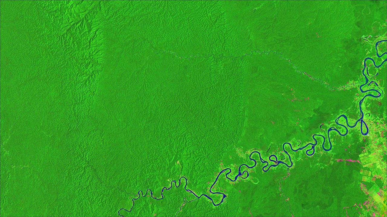
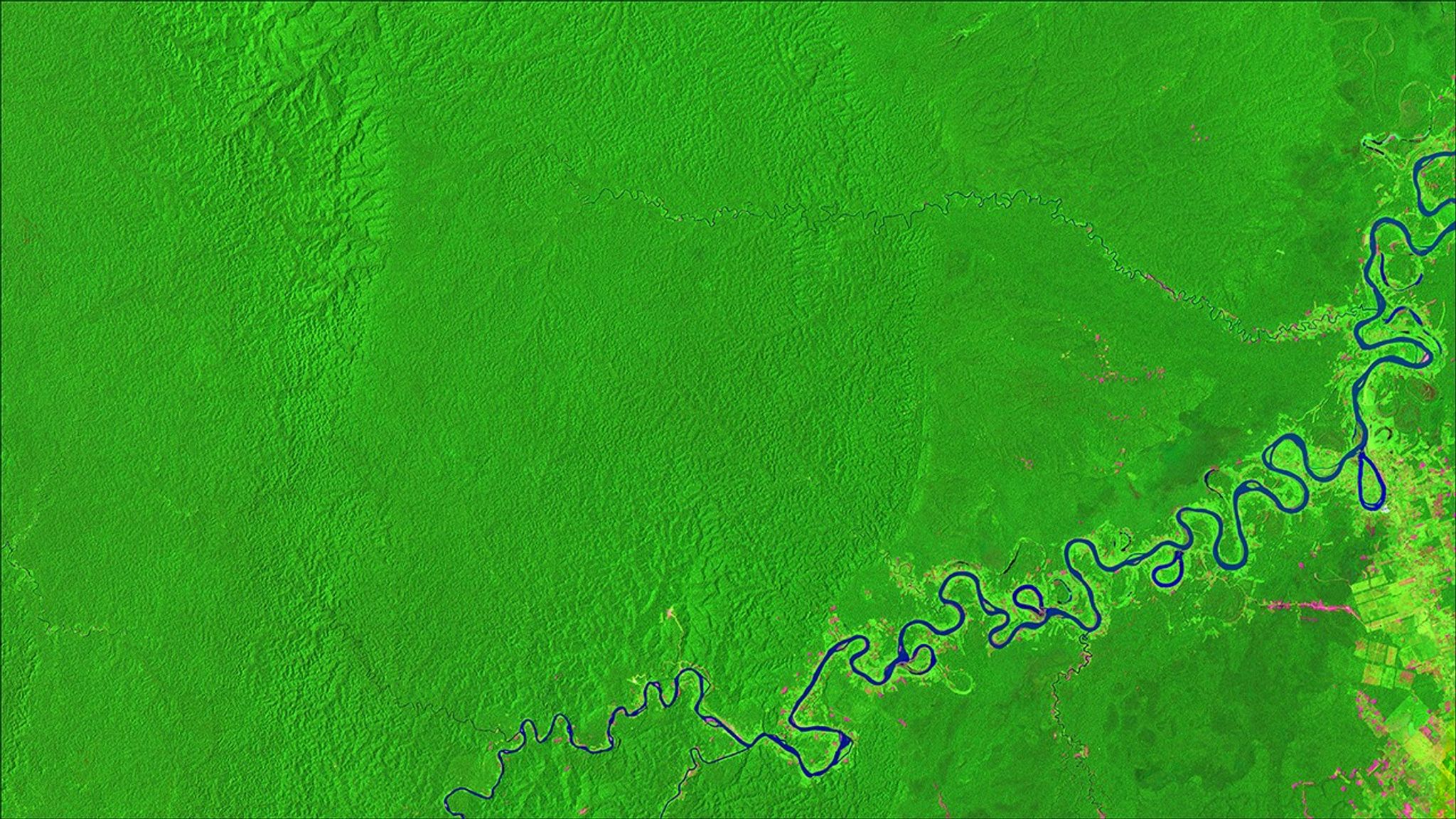
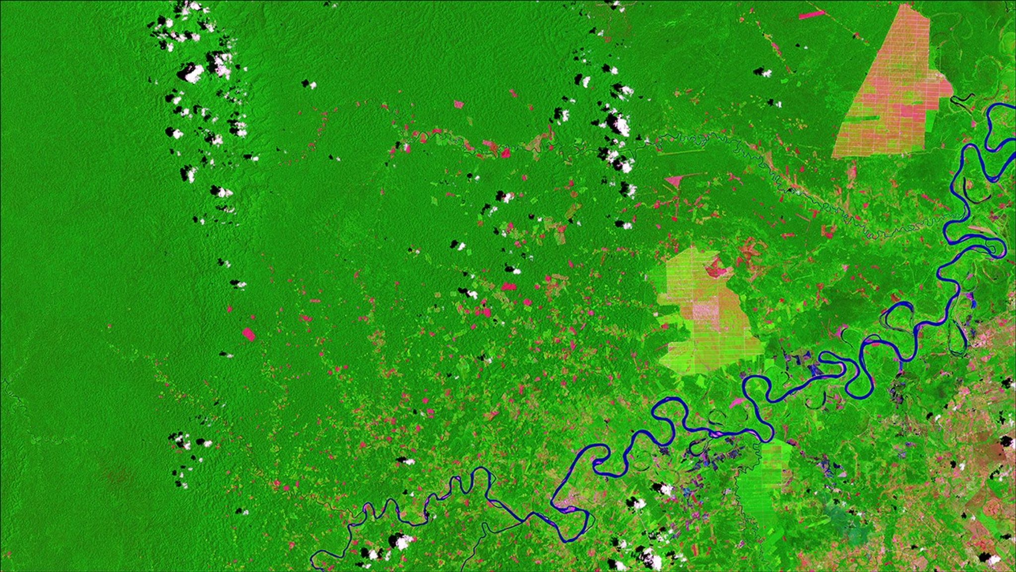
Deforestation near Pucallpa, Peruvian Amazon
November 13, 1986 - October 30, 2016
Large areas within the Amazon rainforest have undergone large-scale deforestation over the past few decades. However, in locations like the Peruvian Amazon, most of the deforestation is caused in recent years by small-scale agriculture, according to the Monitoring of the Andean Amazon Project. These images show land about 25 miles (about 40 kilometers) northwest of Pucallpa along the Aguaytia River. Lush green dominates the 1986 image (left), while deforested land is light green or pink in the 2016 image. Two large-scale oil palm plantations dominate the 2016 image. Images taken by Landsat. Source: U.S. Geological Survey (USGS) Landsat Missions Gallery: “Monitoring Deforestation in the Amazon”; U.S. Department of the Interior / USGS and NASA.


