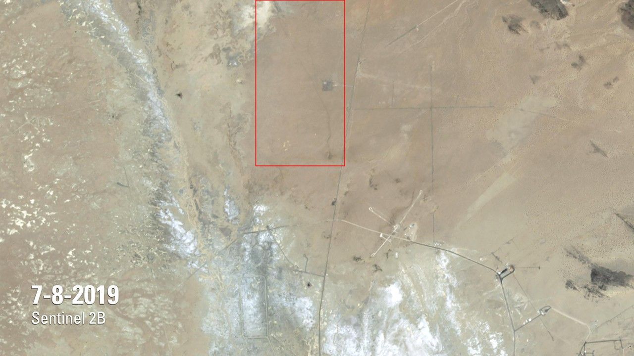
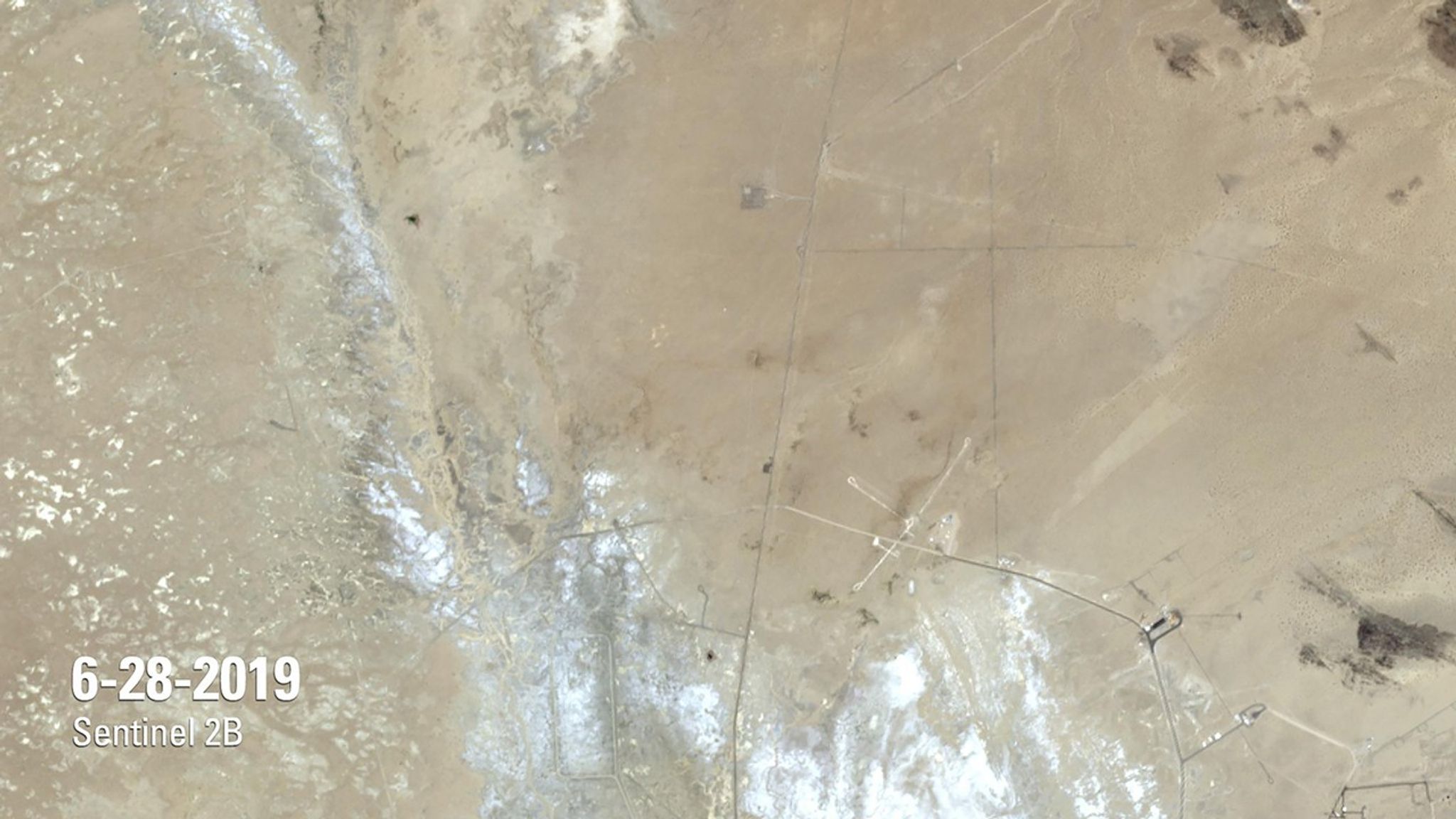
Due to the lapse in federal government funding, NASA is not updating this website.

Suggested Searches

1 min read

Earthquake Ruptures Mojave Desert

before
after
The July image shows a rupture in the Mojave Desert, caused by a magnitude 7.1 earthquake on July 5, 2019, the day after a magnitude 6.4 quake struck the same region. The rupture is about 30 miles (about 50 kilometers) long and cuts through Naval Air Weapons Station China Lake, a million-acre military installation reported to have sustained billions of dollars in damage. Radar analysis by NASA’s Jet Propulsion Laboratory estimates that each side of the fault shifted 2 feet or more from its original position.   Images taken by the European Space Agency’s Sentinel-2B satellite. Source: U.S. Geological Survey’s National Land Imaging Image Collections

Before and After

Earthquake Ruptures Mojave Desert

June 28, 2019 - July 8, 2019

The July image shows a rupture in the Mojave Desert, caused by a magnitude 7.1 earthquake on July 5, 2019, the day after a magnitude 6.4 quake struck the same region. The rupture is about 30 miles (about 50 kilometers) long and cuts through Naval Air Weapons Station China Lake, a million-acre military installation reported to have sustained billions of dollars in damage. Radar analysis by NASA’s Jet Propulsion Laboratory estimates that each side of the fault shifted 2 feet or more from its original position. Images taken by the European Space Agency’s Sentinel-2B satellite. Source: U.S. Geological Survey’s National Land Imaging Image Collections

Downloads

Image 1

JPEG

(960 KB)

Image 2

JPEG

(954 KB)