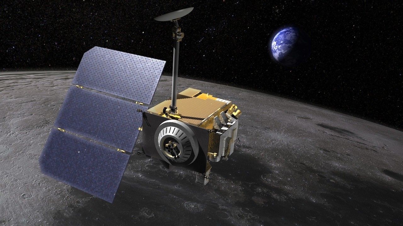
On June 23, 2009, NASA launched a mission that changed how humankind will view its closest neighbor for centuries to come. Ever since, NASA’s Lunar Reconnaissance Orbiter, also known as LRO, has helped us uncover some of the Moon’s deepest secrets. Here, we reflect on 10 of the many things the intrepid, orbiting explorer has taught us about the Moon.
1. It's Shrinking and Quaking
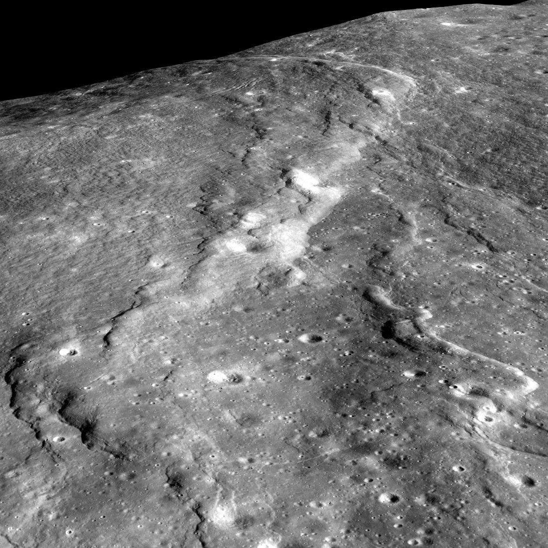
LRO observations helped confirm what seismometers placed on the Moon by Apollo astronauts 50 years ago first discovered: The Moon, long thought to be a dead, inactive world, is still losing heat and, as a result, shrinking. As it continues to slowly cool off, the Moon’s crust, or outer layer, is shriveling, like a grape turning into a raisin; the Moon has lost 150 feet (50 meters) of width over hundreds of millions of years, scientists estimate. This shrinking, plus the stress on the Moon’s outer layer produced by the tugging of Earth’s gravitational pull, cracks the Moon’s crust and leads to moonquakes. Some are fairly strong, reaching level 5 on the Richter scale used to measure earthquakes.
2. It had active volcanos more recently than we thought
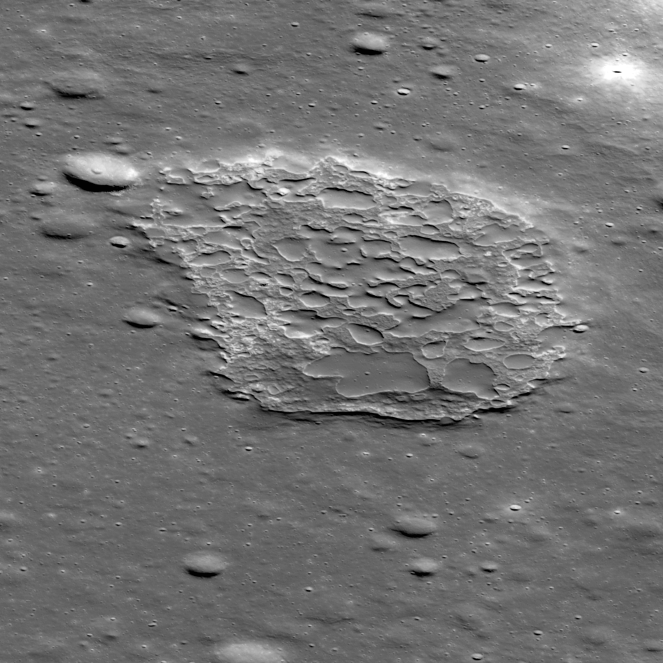
Scientists thought the Moon volcanoes had extinguished one billion years ago. But LRO has found evidence that volcanoes likely were still erupting within the last 50 million years — a time when mammals were overtaking dinosaurs as dominant lifeforms on Earth. With its high-resolution cameras, LRO photographed old, hardened lava patches on the surface of the Moon’s nearside. Then, scientists determined the approximate ages of these patches by counting the number of craters left on them by meteoroid strikes. Fewer craters implied younger lava. Along with moonquakes, these young lava flows are hinting that the Moon’s interior is warmer than we thought. Other scientists have an alternative explanation for the youthful appearance of the lava patches, though. Some say that they are billions of years old but were formed by foamy lava (the kind responsible for the common volcanic rock called pumice) which responds differently to meteor impacts, making the craters appear much younger.
3. The far side of the Moon is older than the side we see
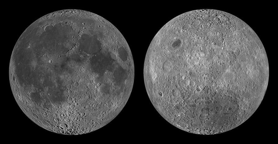
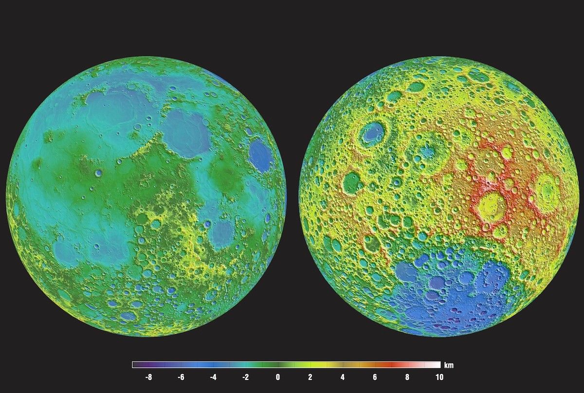
Because the Moon is gravitationally locked to Earth, we only see one side of it. But LRO sees both sides, and it has found that the far side has way more craters than the near side. Did the far side get smashed by more asteroids? Likely not. We see fewer craters on the side facing us because they’ve probably been filled in by lava from volcanoes. The far side has a much thicker crust (we don’t know why), which may have prevented magma from spewing through the surface, leaving a well-preserved record of asteroid bombardment for scientists to probe.
4. Its craters provide a timeline of solar system history
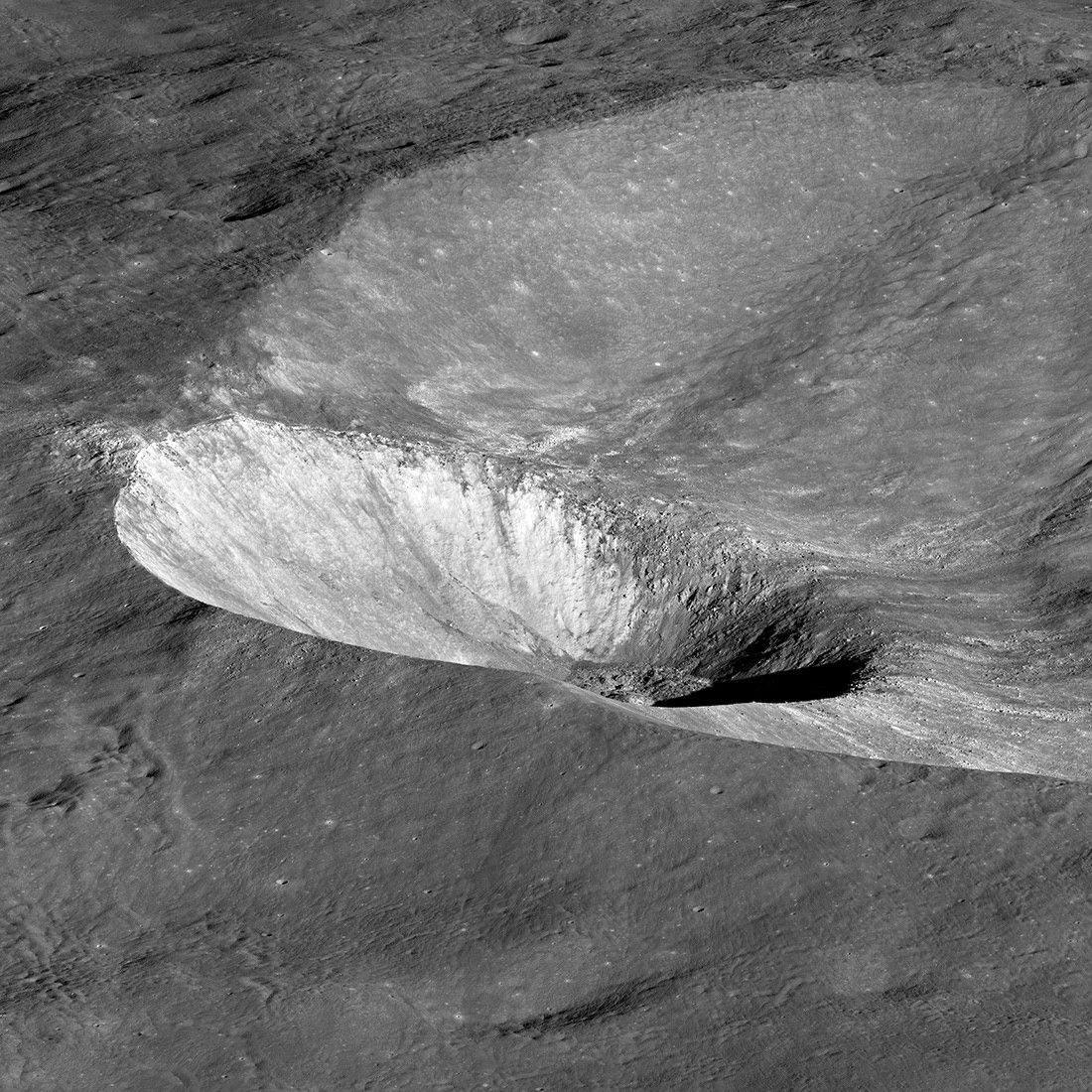
LRO data has allowed scientists to construct a timeline of asteroid bombardment history on the Moon, providing insight not only into the Moon's formation, but of the whole solar system. Since the Moon doesn’t have wind, storms, or plate tectonics, its craters don’t get eroded away like on Earth. Using tools on LRO, scientists can count and age them. By doing so, we can look back billions of years at the mayhem of the early solar system, when giant collisions (like the one that formed the Moon) were jostling planets and their satellites. Among the questions scientists still have is how these early impacts influenced the building blocks of life that would have been stacking up on Earth and possibly elsewhere.
5. It gets unimaginably cold
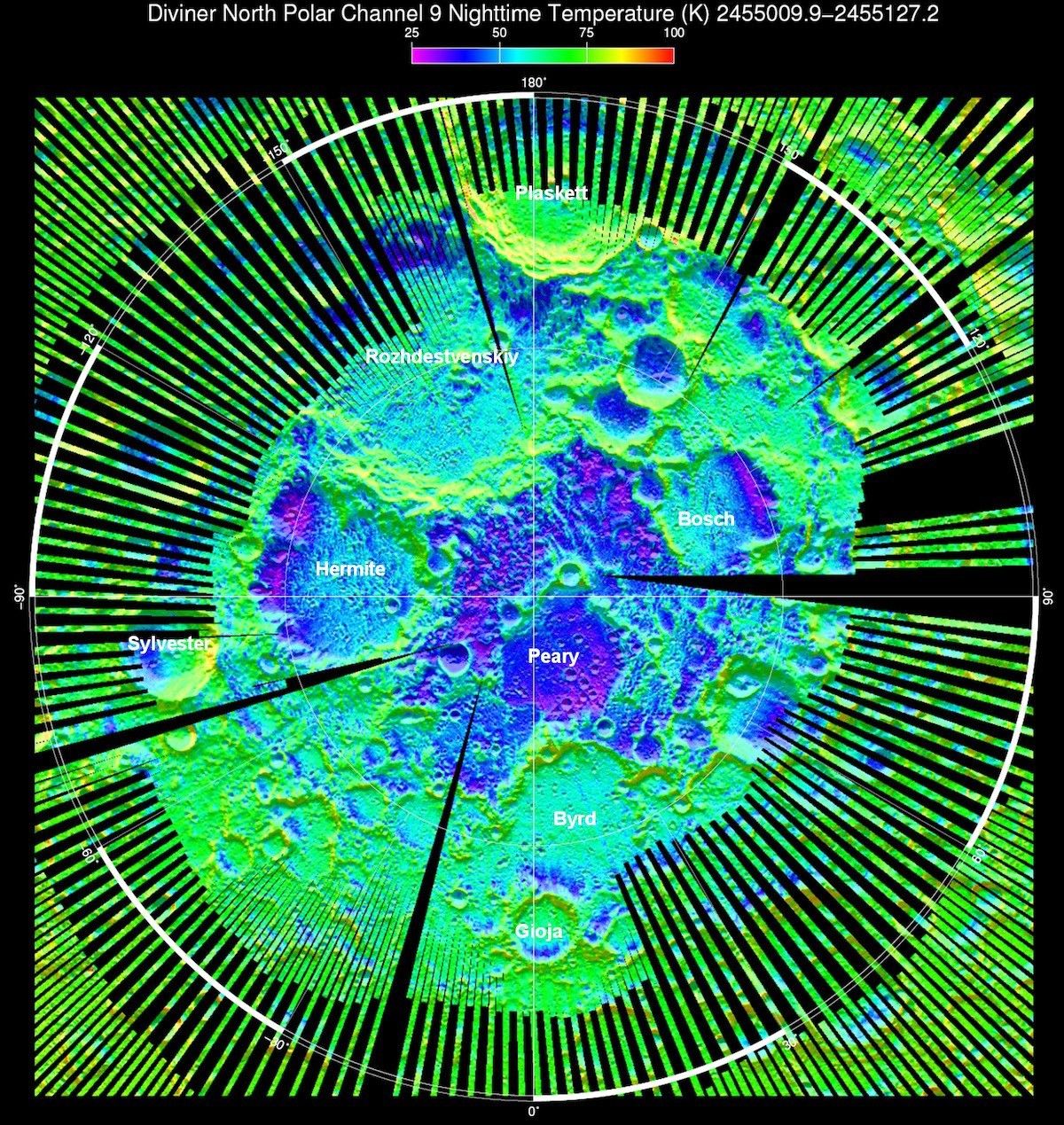
Scientists always knew permanently shadowed craters at the Moon’s poles were cold, but LRO measurements surpassed their estimates by a considerable margin. LRO’s Diviner instrument, which measures heat radiating off the Moon’s surface, has recorded some of the coldest temperatures on record at crater bottoms, down to -414.4 degrees Fahrenheit (-248 degrees Celsius). That is about seven times as cold as the lowest temperature ever recorded on Earth! The frigid temperatures on the Moon result from the low angle of sunlight striking the surface at the poles, allowing light to skim the rims of some craters while leaving their deep interiors in shadow. These dark craters are expected to be reservoirs of water.
NASA/GSFC/Scientific Visualization Studio
6. Instead of a dry, dead rock, the Moon is a dynamic and wet world
LRO and other instruments have returned evidence of frozen water on the Moon. Although there are still many questions about the amount and locations of water, the substance has huge implications for the astronauts who will work on the Moon and, ultimately, on Mars. Water (H2O) can be split into its components — hydrogen (H) and oxygen (O) — and used separately or in a new combination. Astronauts will need oxygen for breathing and to burn with the hydrogen fuel used in rocket engines. One of the biggest challenges to long-distance space travel is fuel, which is heavy and expensive to bring from Earth, so the goal is to figure out how to make it from water on the Moon.
7. It preserves footprints for a long time
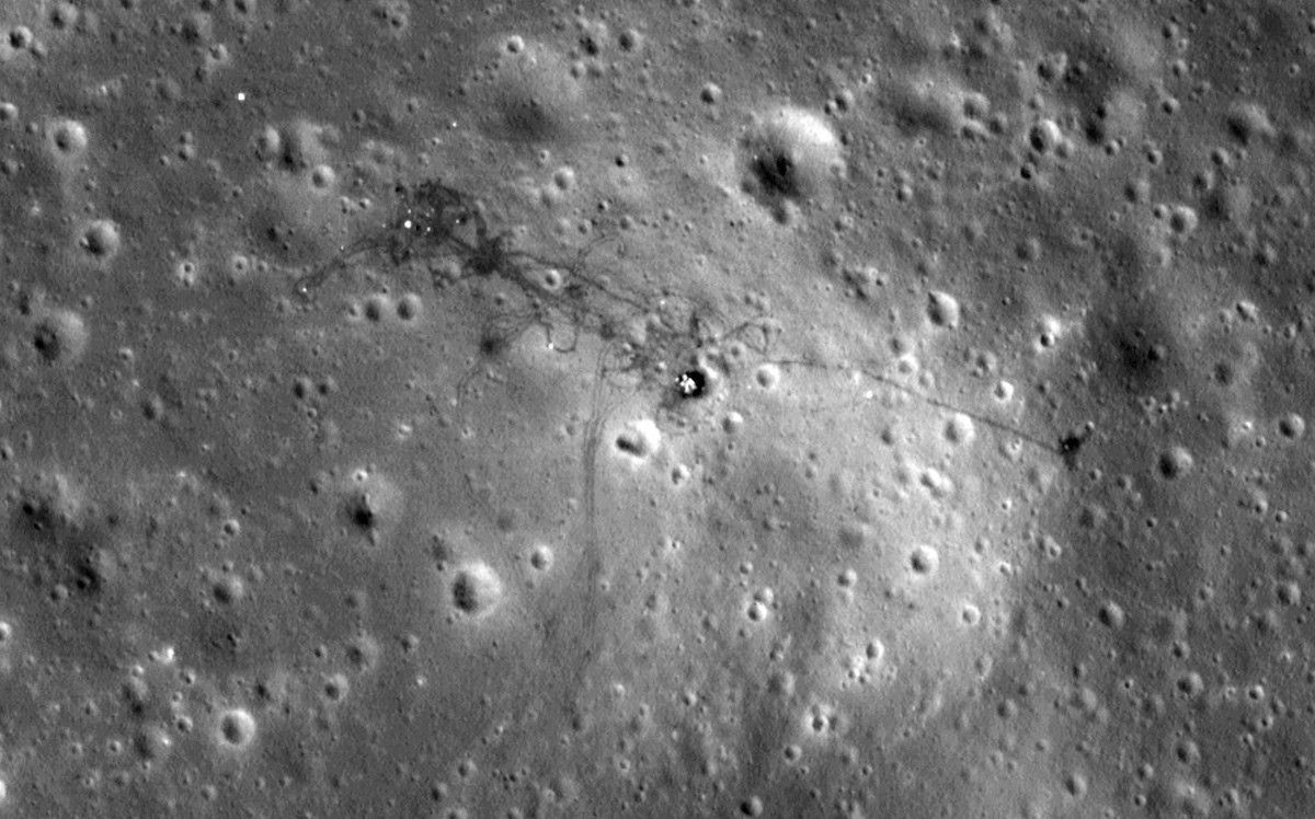
The Moon doesn’t have an atmosphere. Without it, there is no wind or rain to erode the surface. That’s why LRO is able to spot the tracks of Apollo astronauts and their rovers preserved in the regolith, or Moon soil, decades after those steps were taken. LRO’s orbital path is too far away from the Moon’s surface to resolve individual boot prints.
NASA/GSFC/Scientific Visualization Studio
8. The South Pole region is a wondrous land that we want to explore
Instruments on LRO helped NASA identify areas of interest on the Moon for human exploration, with the South Pole rising to the top of the list as a potential hot spot for new discoveries. Since its elliptical, polar orbit is closest to the Moon during passes over the South Pole, the orbiter collects more precise information about this region’s topography, temperatures and locations of frozen water than about any other region. Besides water, we’ve learned that the South Pole has other features that are beneficial to human exploration, such as prolonged periods of sunlight. More than 200 Earth days of constant illumination at the southern pole means ample power for solar panels on rovers and other equipment.
9. We know its surface in more detail than any other celestial body, including our own planet
Thanks to LRO’s super precise laser altimeter — an instrument that determines elevation by shooting a laser at the surface and measuring how long it takes for the light to bounce back — scientists have detailed maps of the shape, or topography, of the Moon’s surface. These will help NASA identify safe landing and exploration sites for commercial landers and future Artemis astronauts. The reason we have better topographic maps of the Moon than of Earth is because our planet is mostly covered by oceans, and laser light cannot penetrate them all the way to their rocky surface.
NASA360
10. It has caves that could protect astronauts from radiation
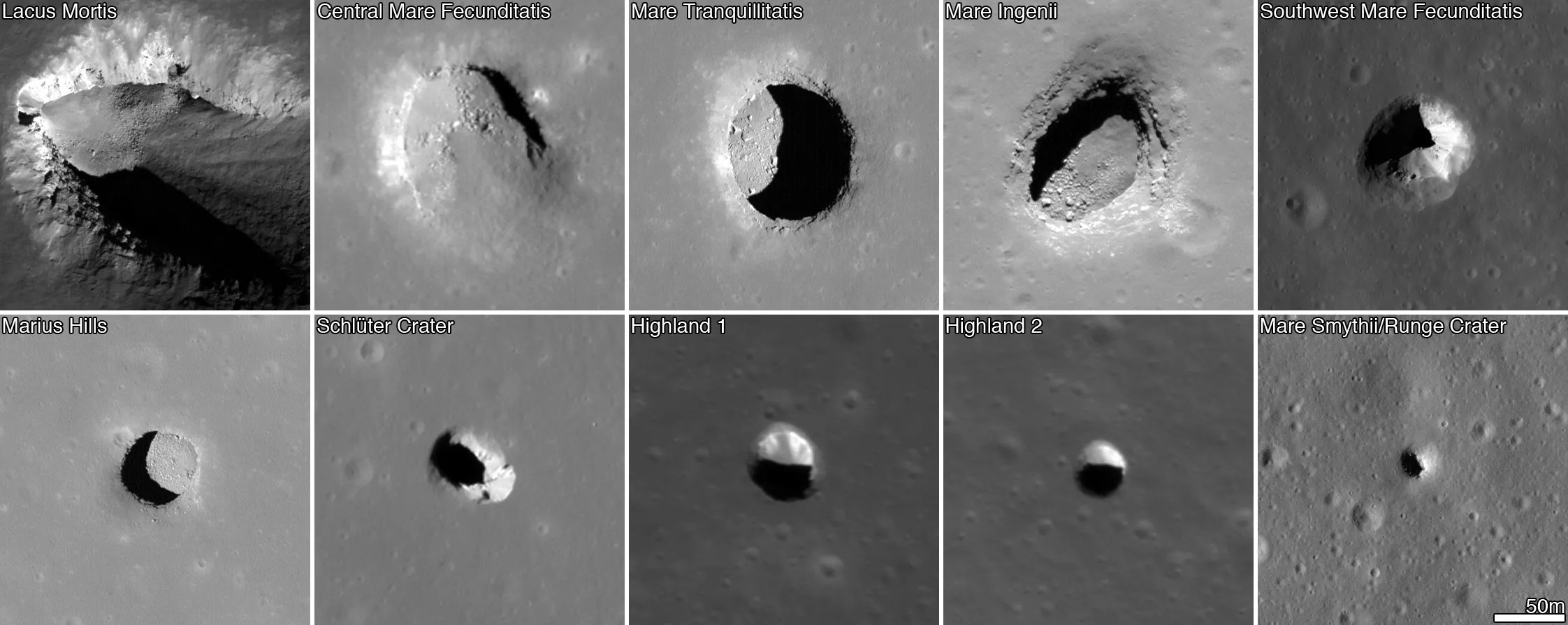
The Moon’s surface is constantly exposed to solar radiation, which poses a threat to astronauts. LRO has helped identify a possible solution: underground caves formed around cooling lava that eventually drained out and left them hollow. High-resolution images taken by the orbiter have shown hundreds of pits across the lunar surface, which scientists believe could be openings to an extensive network. These caves, known as lava tubes, are also found on Earth. Such caves could provide shelter to astronauts during intense radiation events, scientists say, and they could be ideal locations for collecting samples of Moon soil that hasn’t been altered by radiation.

