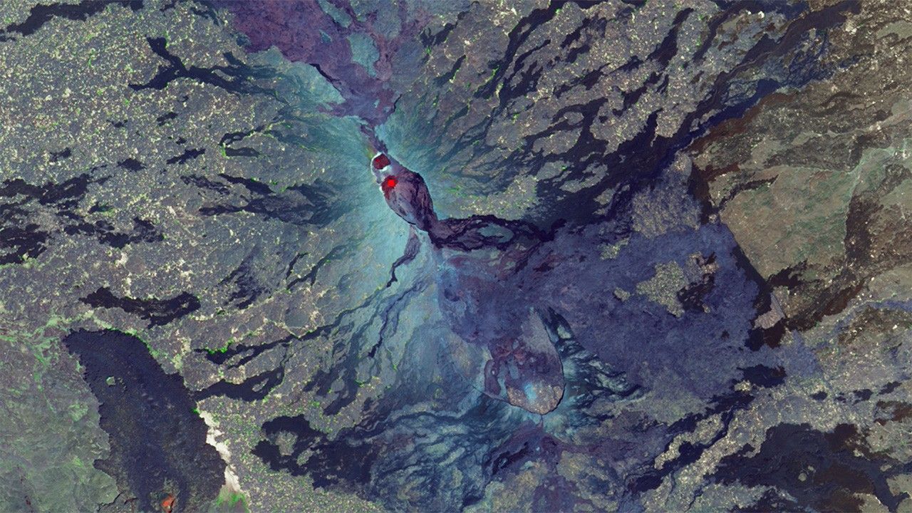
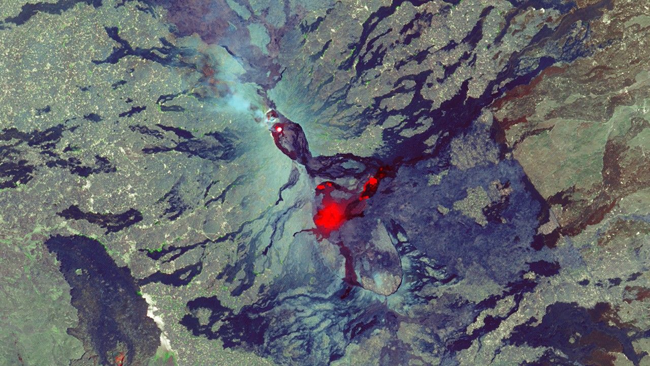
Suggested Searches

1 min read

Ethiopian volcano Erta Ale erupts

before
after
In early 2017, the Landsat 8 satellite captured volcanic activity at northern Ethiopia’s Erta Ale, a shield volcano near the Eritrea border. Translated into “smoking mountain” with a vent called “the gateway to hell,” Erta Ale oozed a lava lake on Jan. 10 (left) that outgassed on Feb. 11 (right). Landsat also detected other hot spots on the southeastern slope of the volcano, as shown in the Feb. 11 image. The satellite’s shortwave infrared (SWIR) signal infers increased temperatures where new lava is either at very shallow depths below the surface or gurgling to the surface.   Images taken by the Landsat 8 satellite. Source: U.S. Geological Survey (USGS) Landsat Missions Gallery: “Landsat Detects Eruptions at Ethiopian Volcano”; U.S. Department of the Interior / USGS and NASA.
In early 2017, the Landsat 8 satellite captured volcanic activity at northern Ethiopia’s Erta Ale, a shield volcano near the Eritrea border. Translated into “smoking mountain” with a vent called “the gateway to hell,” Erta Ale oozed a lava lake on Jan. 10 (left) that outgassed on Feb. 11 (right). Landsat also detected other hot spots on the southeastern slope of the volcano, as shown in the Feb. 11 image. The satellite’s shortwave infrared (SWIR) signal infers increased temperatures where new lava is either at very shallow depths below the surface or gurgling to the surface. Images taken by the Landsat 8 satellite. Source: U.S. Geological Survey (USGS) Landsat Missions Gallery: “Landsat Detects Eruptions at Ethiopian Volcano”; U.S. Department of the Interior / USGS and NASA.

Before and After

Ethiopian volcano Erta Ale erupts

January 10, 2017 - February 11, 2017

In early 2017, the Landsat 8 satellite captured volcanic activity at northern Ethiopia’s Erta Ale, a shield volcano near the Eritrea border. Translated into “smoking mountain” with a vent called “the gateway to hell,” Erta Ale oozed a lava lake on Jan. 10 (left) that outgassed on Feb. 11 (right). Landsat also detected other hot spots on the southeastern slope of the volcano, as shown in the Feb. 11 image. The satellite’s shortwave infrared (SWIR) signal infers increased temperatures where new lava is either at very shallow depths below the surface or gurgling to the surface. Images taken by the Landsat 8 satellite. Source: U.S. Geological Survey (USGS) Landsat Missions Gallery: “Landsat Detects Eruptions at Ethiopian Volcano”; U.S. Department of the Interior / USGS and NASA.

Downloads

Image 1

JPEG

(915 KB)

Image 2

JPEG

(938 KB)