


before
after

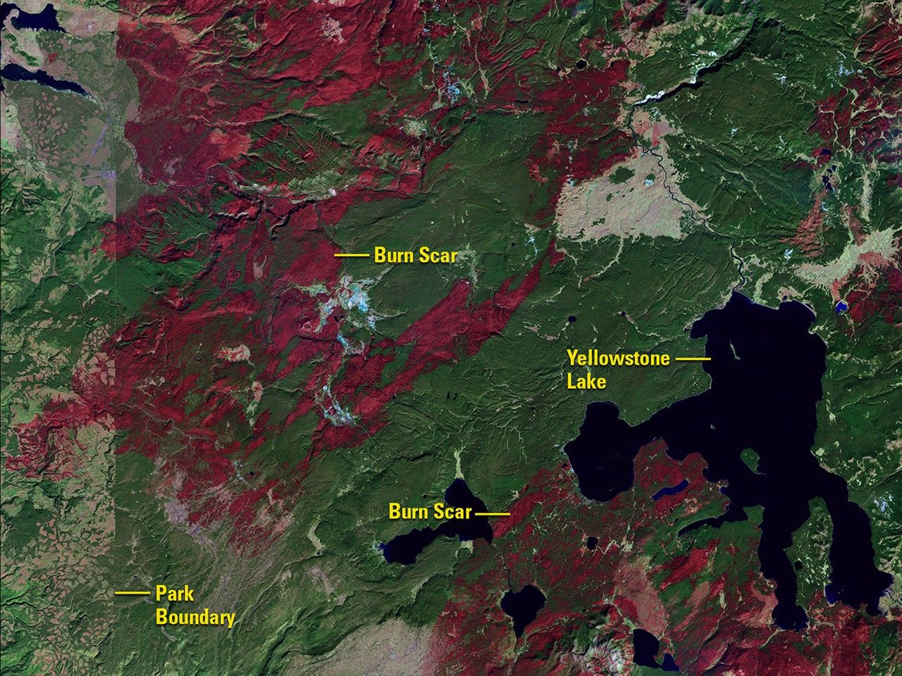
The 1988 image shows scars left by a wildfire that consumed 1.2 million acres in and around Yellowstone National Park that year. The 2016 image shows the recovery of trees and other vegetation. The park’s western border is visible in the 1988 image as a line separating dark green forest where logging is prohibited from the lighter area where trees have been cut and removed.

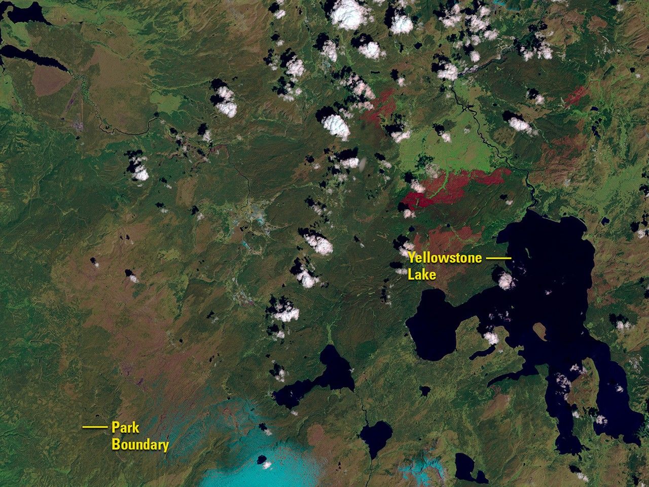
The 1988 image shows scars left by a wildfire that consumed 1.2 million acres in and around Yellowstone National Park that year. The 2016 image shows the recovery of trees and other vegetation. The park’s western border is visible in the 1988 image as a line separating dark green forest where logging is prohibited from the lighter area where trees have been cut and removed.
before
after
Before and After
Fire and recovery in Yellowstone National Park, U.S.
October 10, 1988 - June 17, 2016
The 1988 image shows scars left by a wildfire that consumed 1.2 million acres in and around Yellowstone National Park that year. The 2016 image shows the recovery of trees and other vegetation. The park’s western border is visible in the 1988 image as a line separating dark green forest where logging is prohibited from the lighter area where trees have been cut and removed. Images taken by the Thematic Mapper onboard Landsat 5 and the Operational Land Imager onboard Landsat 8. Source: U.S. Geological Survey (USGS) Landsat Missions Gallery; “Fire and Rebirth: Landsat Tells Yellowstone’s Story”; U.S. Department of the Interior / USGS and NASA.


