


![Request for Information – Potential [Placeholder for Prize]](https://assets.science.nasa.gov/dynamicimage/assets/science/psd/solar/2023/09/s/solarsystem_0.jpg?w=1024)


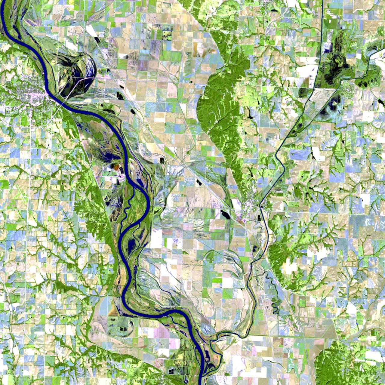
before
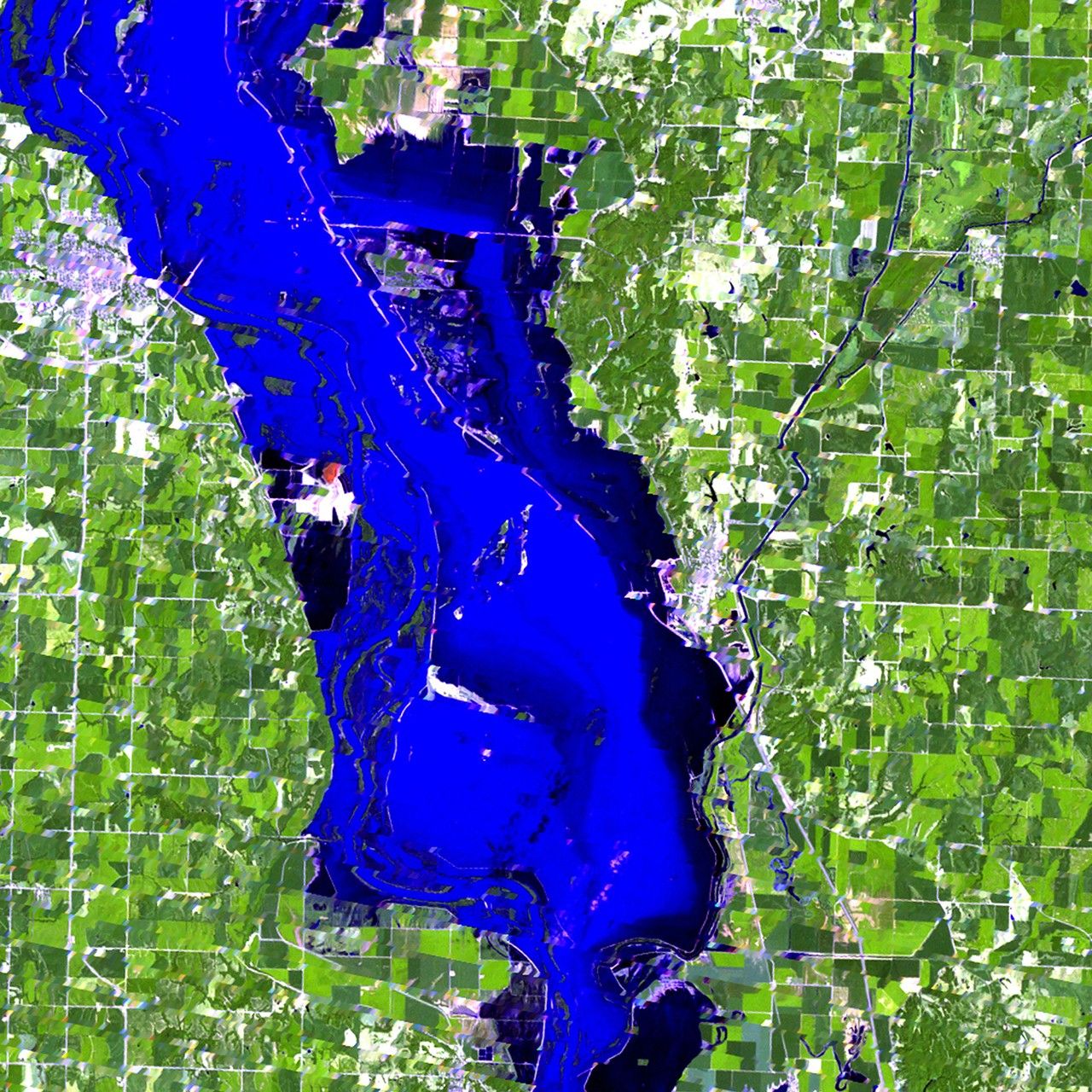
after


Before and After
Flood in Hamburg, Iowa
September 24, 2010 - August 2, 2011
In the spring of 2011, heavy rains and snowpack resulted in record releases from dams in Montana and the Dakotas, and near-record flooding along parts of the Missouri River. One especially hard-hit community was Hamburg, Iowa, where levee failure in early June caused extensive flooding and the evacuation of many homes. By late June, the U.S. Army Corps of Engineers had rebuilt the levees and Hamburg was protected from additional flooding. 2010 image taken by the Thematic Mapper sensor onboard Landsat 5. 2011 image taken by the Enhanced Thematic Mapper Plus onboard Landsat 7. Source: USGS Landsat Missions Gallery, "Missouri River Flooding Near Hamburg, Iowa," U.S. Department of the Interior / U.S. Geological Survey.


