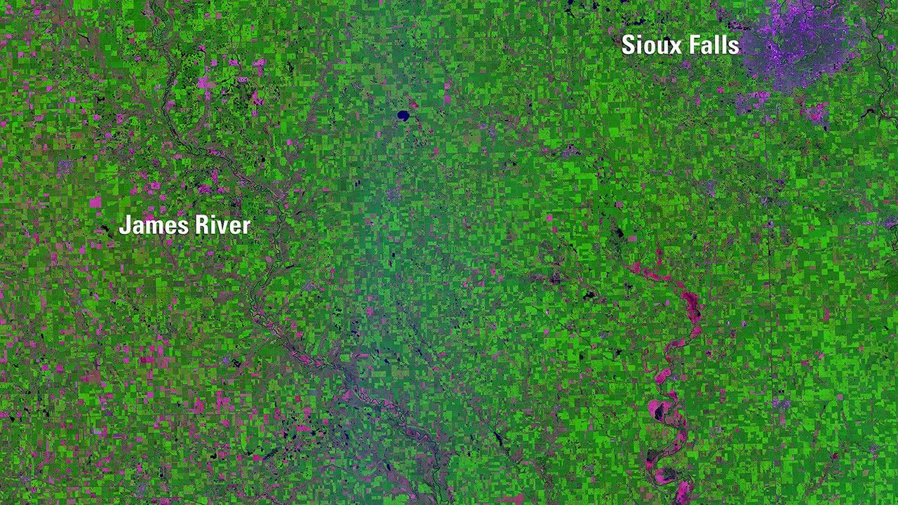
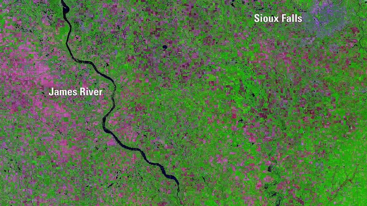
Due to the lapse in federal government funding, NASA is not updating this website.

Suggested Searches

1 min read

Flooding Limits Planting in South Dakota

before
after
Abnormally high spring rainfall and subsequent flooding in 2019 had a season-long impact on farming in the Midwest. By August 22, the U.S. Department of Agriculture reported 3.9 million "prevented planting" acres­ — fields too flooded to plant — in South Dakota, more than in any other state. In these images of southeastern South Dakota, growing vegetation is green and unplanted fields are pink. The 2019 image also shows the James River overflowing its banks.   Images taken by Landsat 8. Source: U.S. Geological Survey’s National Land Imaging Image Collections

Before and After

Flooding Limits Planting in South Dakota

Aug. 11, 2018 - July 29, 2019

Abnormally high spring rainfall and subsequent flooding in 2019 had a season-long impact on farming in the Midwest. By August 22, the U.S. Department of Agriculture reported 3.9 million "prevented planting" acres­ — fields too flooded to plant — in South Dakota, more than in any other state. In these images of southeastern South Dakota, growing vegetation is green and unplanted fields are pink. The 2019 image also shows the James River overflowing its banks. Images taken by Landsat 8. Source: U.S. Geological Survey’s National Land Imaging Image Collections

Downloads

Image 1

JPEG

(2 MB)

Image 2

JPEG

(2 MB)