


before
after

In 1990, a series of seven dams was started in the Goksu River basin to provide long-term hydroelectric power to the region. Government officials and others are using Landsat satellite data to monitor the growth and impact of these dams, since the Goksu is one of the few remaining free-flowing rivers in Turkey. The Gezende dam, completed in the early 1990s, reduced flow downstream and significantly affected aquatic species, while construction of the Ermenek dam in the early 2000s created a large reservoir that flooded fragile wildlife habitat. Images taken by the Thematic Mapper sensor aboard Landsat 5. Source: USGS Landsat Missions Gallery, "Goksu River Dam Project," U.S. Department of the Interior / U.S. Geological Survey.
NASA/USGS
Before and After
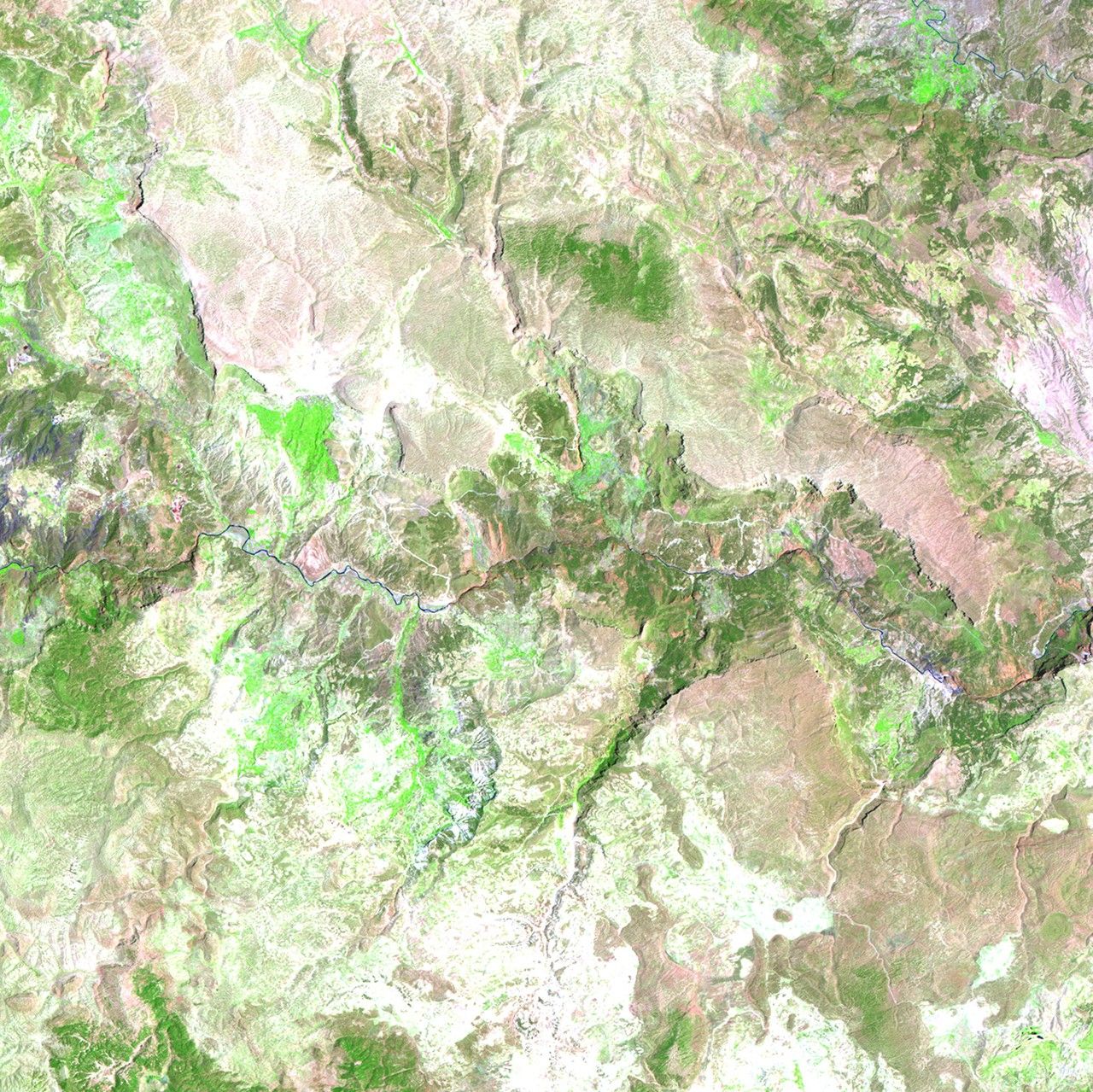
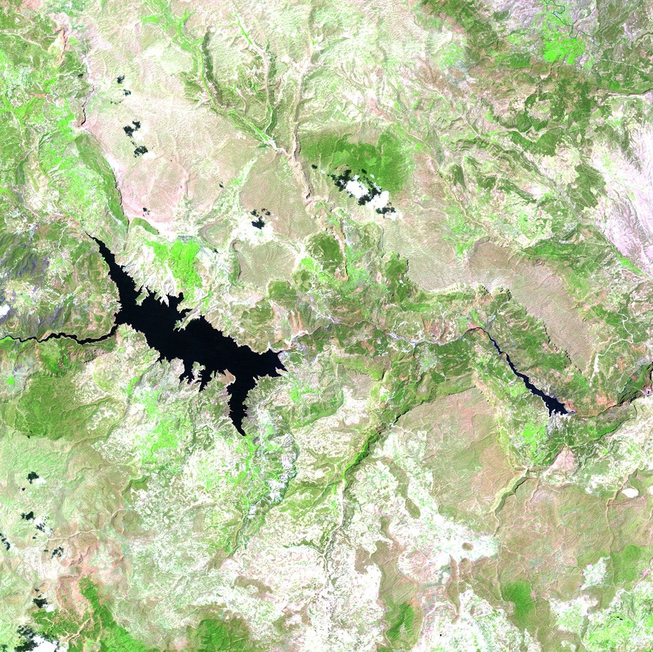
Goksu River basin dam impact, Turkey
July 11, 1987 - July 13, 2011
In 1990, a series of seven dams was started in the Goksu River basin to provide long-term hydroelectric power to the region. Government officials and others are using Landsat satellite data to monitor the growth and impact of these dams, since the Goksu is one of the few remaining free-flowing rivers in Turkey. The Gezende dam, completed in the early 1990s, reduced flow downstream and significantly affected aquatic species, while construction of the Ermenek dam in the early 2000s created a large reservoir that flooded fragile wildlife habitat. Images taken by the Thematic Mapper sensor aboard Landsat 5. Source: USGS Landsat Missions Gallery, "Goksu River Dam Project"; U.S. Department of the Interior / U.S. Geological Survey.


