


![Request for Information – Potential [Placeholder for Prize]](https://assets.science.nasa.gov/dynamicimage/assets/science/psd/solar/2023/09/s/solarsystem_0.jpg?w=1024)


before
after


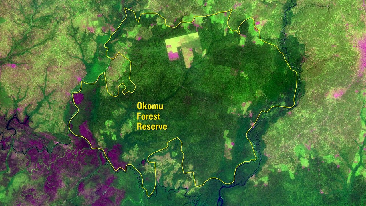
Before and After
Human activity threatens Nigeria’s Okomu Forest
December 11, 1984 - January 4, 2017
Closed-canopy tropical moist forest once covered large parts of Nigeria’s Okomu Forest Reserve. In December 1984, the Landsat 5 satellite observed that parts of the reserve had been converted to oil palm and rubber tree plantations, as seen in shades of magenta. In 1985, a 44-square-mile (about 114 square kilometers) wildlife sanctuary was carved out of the most intact area of the reserve for forest elephants and threatened primates. By 1999, the sanctuary was designated the Okomu National Park as a way to protect the area from further development. While the top half of the right image shows additional plantation expansion, the national park remains largely protected within the reserve. Left image taken by the Landsat 5 satellite. Right image taken by Landsat 8. Source: “Landscapes of West Africa: A Window on a Changing World”; U.S. Geological Survey (USGS) Landsat Missions Gallery: “West Africa Atlas Details Efforts to Manage, Preserve Okomu Forest”; U.S. Department of the Interior / USGS and NASA.


