


.jpg)

before
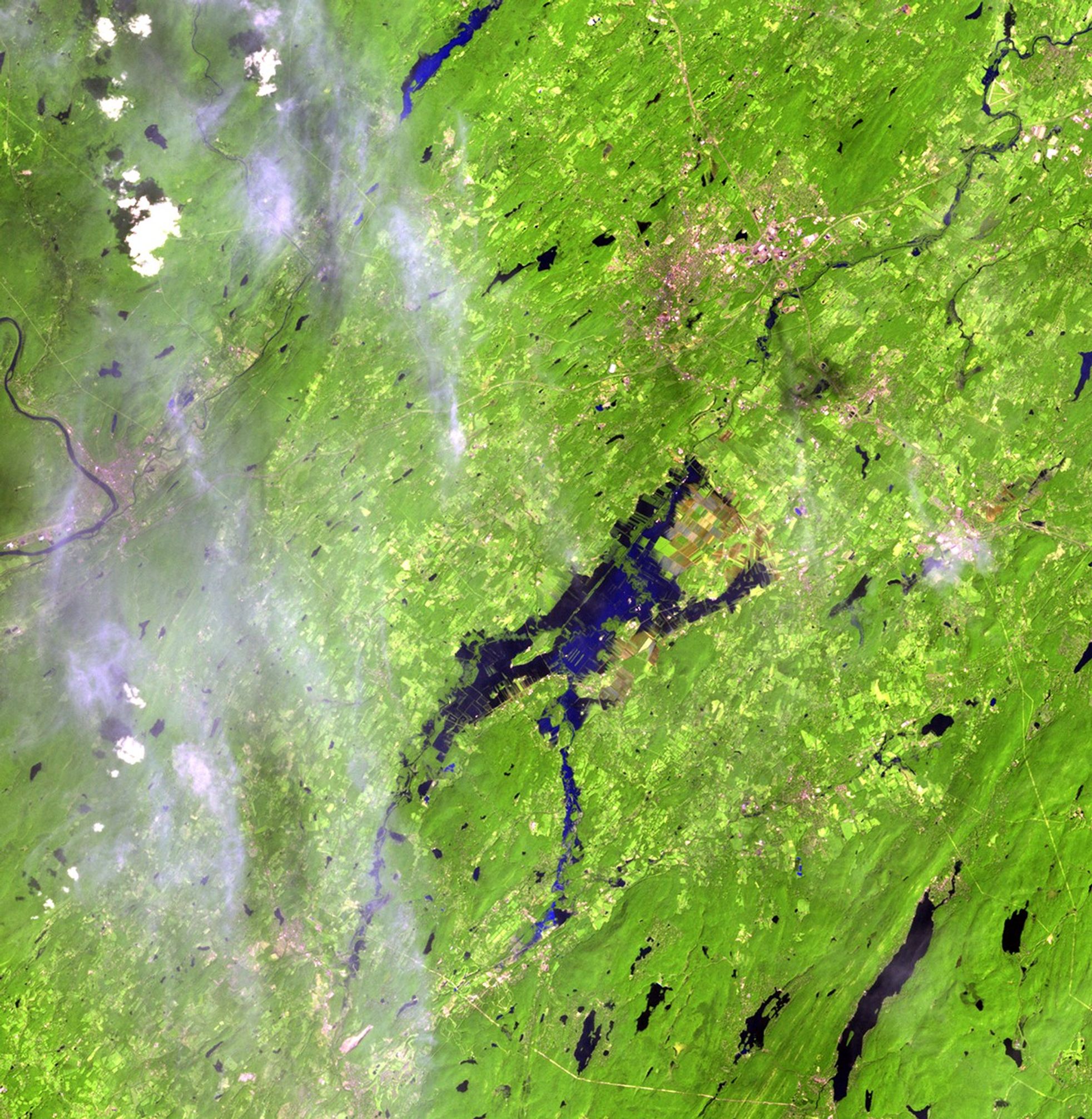
after
.jpg?w=1964&h=2014&fit=clip&crop=faces%2Cfocalpoint)
Farmland in the Black Dirt region, New York. Flooding from Hurricane Irene, shown on the right, brought an early end to the region's vegetable harvest. Located about an hour's drive from New York City, farms in the area have provided onions and other vegetables for over a century. The area used to be the bottom of a shallow lake, resulting in rich organic soil, which can be seen as deep browns and reds in the images. Images taken by the Thematic Mapper sensor aboard Landsat 5. Source: USGS Landsat Missions Gallery, "Rural New York Flooding from Hurricane Irene," U.S. Department of the Interior / U.S. Geological Survey.
NASA/USGS
Before and After
Hurricane Irene flooding, New York
July 30, 2011 - August 31, 2011
Farmland in the Black Dirt region, New York. Flooding from Hurricane Irene, shown on the right, brought an early end to the region's vegetable harvest. Located about an hour's drive from New York City, farms in the area have provided onions and other vegetables for over a century. The area used to be the bottom of a shallow lake, resulting in rich organic soil, which can be seen as deep browns and reds in the images. Images taken by the Thematic Mapper sensor aboard Landsat 5. Source: USGS Landsat Missions Gallery, "Rural New York Flooding from Hurricane Irene," U.S. Department of the Interior / U.S. Geological Survey.


