


before
after

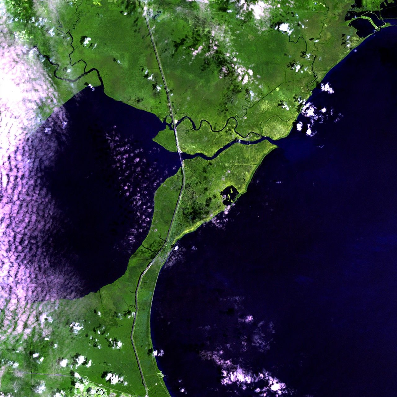
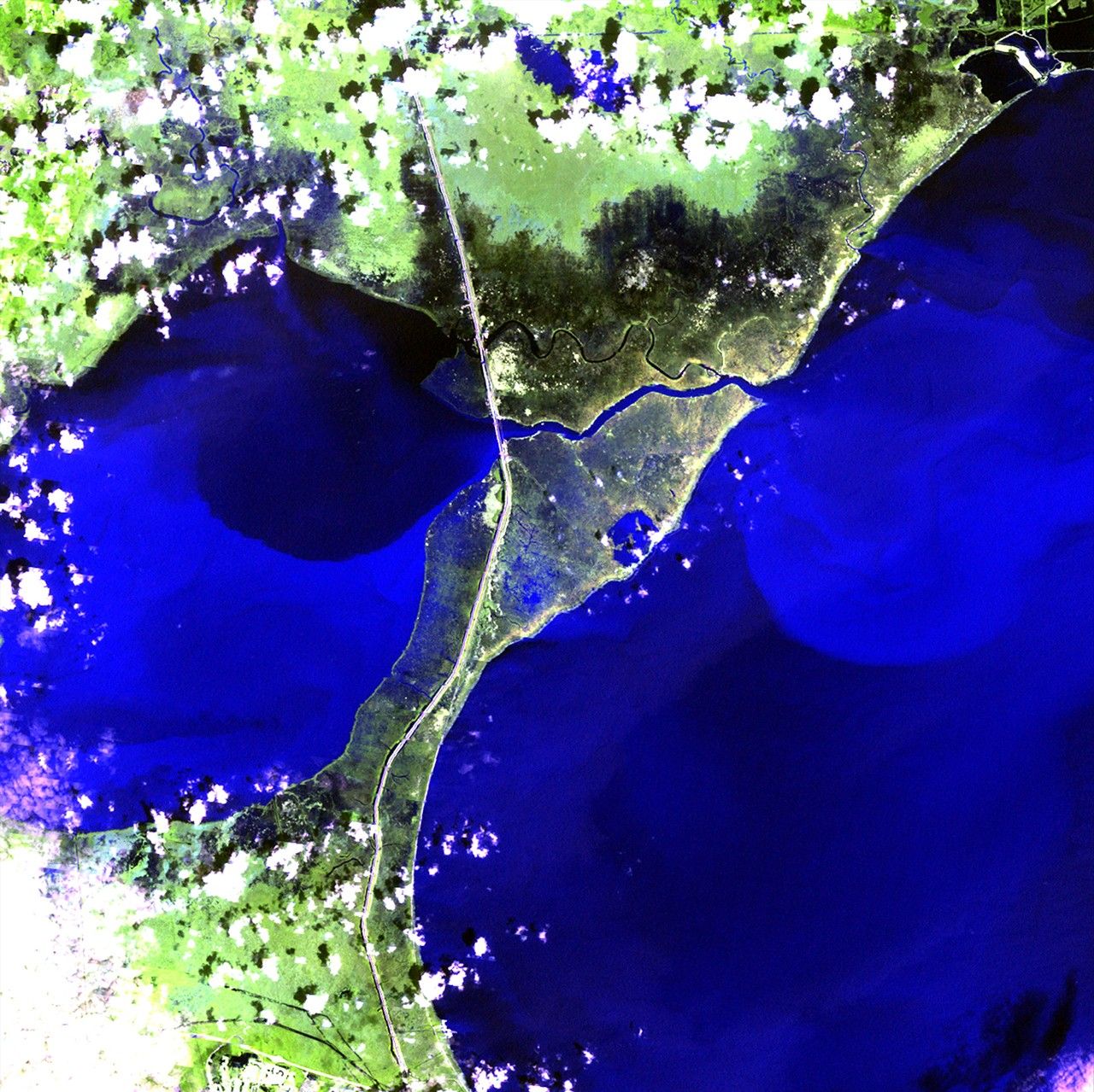
Before and After
Hurricane Isaac landfall, Louisiana
August 1, 2012 - September 2, 2012
Hurricane Isaac made landfall in Louisiana on August 28, 2012, and moved very slowly north. Levees protected the New Orleans area, but strong winds, rain, and storm surges caused massive flooding in the region between Lake Maurepas and Lake Pontchartrain, northwest of the city. In the September 2 image, dark tones show saturated land and the lighter blue tones of the two lakes represent turbid water and sediment flow. These images provide a base set of information to help officials plan reclamation and remediation efforts. Images taken by the Enhanced Thematic Mapper Plus sensor onboard Landsat 7. Source: U.S. Geological Survey (USGS) Landsat Missions Gallery, "Hurricane Isaac Flooding," U.S. Department of the Interior / USGS and NASA.


