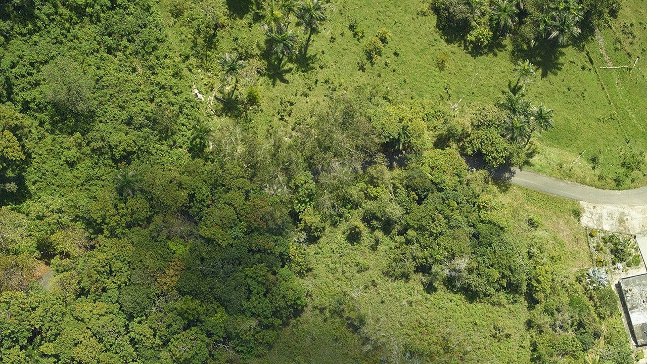
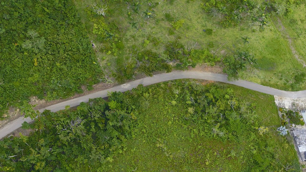
Due to the lapse in federal government funding, NASA is not updating this website.

Suggested Searches

1 min read

Hurricane Maria’s damage to Puerto Rico’s forests

before
after
These images show Hurricane Maria’s impact on a section of forest near Arecibo, Puerto Rico, in September 2017. As described by one of the NASA scientists who surveyed damage to the island’s forests, “The dense, interlocking canopies that blanketed the island before the storm were reduced to a tangle of downed trees and isolated survivors, stripped of their branches.” The U.S. Forest Service, U.S. Fish and Wildlife Service, Federal Emergency Management Agency and NASA funded the study. The 2017 image, taken before the hurricane struck, was part of a study of the regrowth of tropical forests on abandoned agricultural land.   Images taken by the airborne G-LiHT (Goddard’s Lidar, Hyperspectral and Thermal Imager) team. Source: NASA Hurricanes website

Before and After

Hurricane Maria’s damage to Puerto Rico’s forests

Spring 2017 - April 2018

These images show Hurricane Maria’s impact on a section of forest near Arecibo, Puerto Rico, in September 2017. As described by one of the NASA scientists who surveyed damage to the island’s forests, “The dense, interlocking canopies that blanketed the island before the storm were reduced to a tangle of downed trees and isolated survivors, stripped of their branches.” The U.S. Forest Service, U.S. Fish and Wildlife Service, Federal Emergency Management Agency and NASA funded the study. The 2017 image, taken before the hurricane struck, was part of a study of the regrowth of tropical forests on abandoned agricultural land. Images taken by the airborne G-LiHT (Goddard’s Lidar, Hyperspectral and Thermal Imager) team. Source: NASA Hurricanes website

Downloads

Image 1

JPEG

(2 MB)

Image 2

JPEG

(1 MB)