


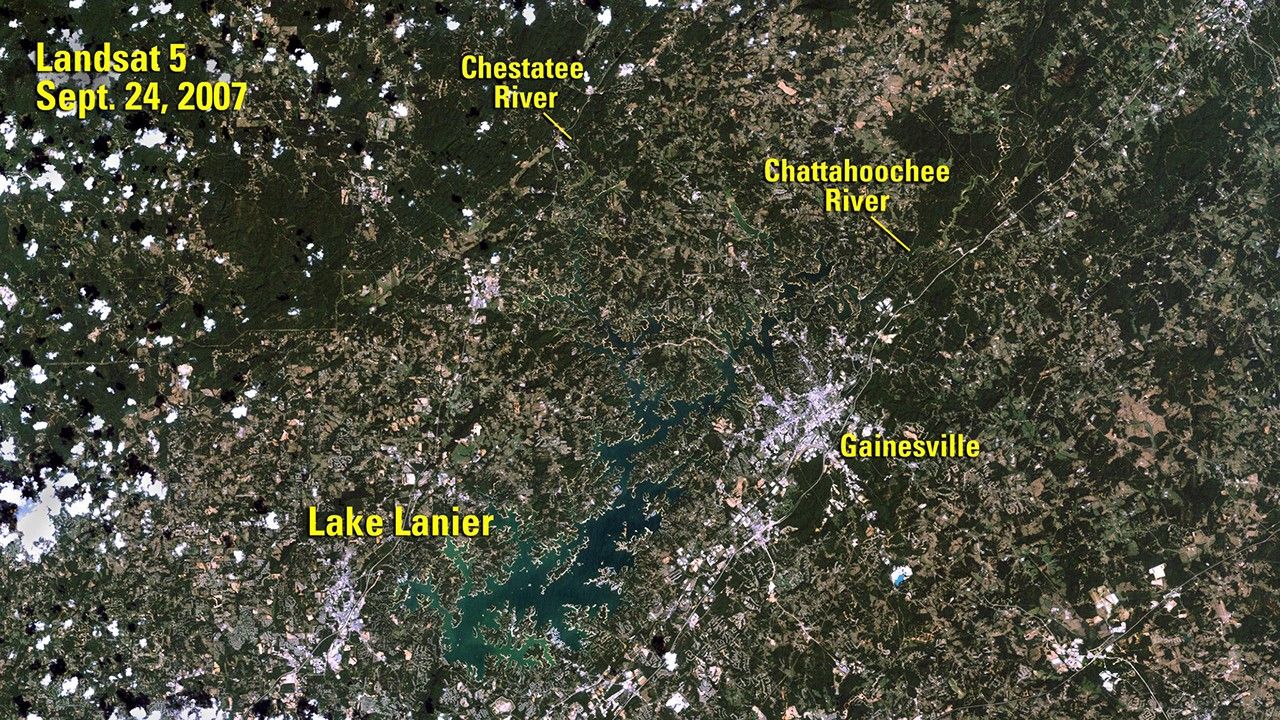

before
after
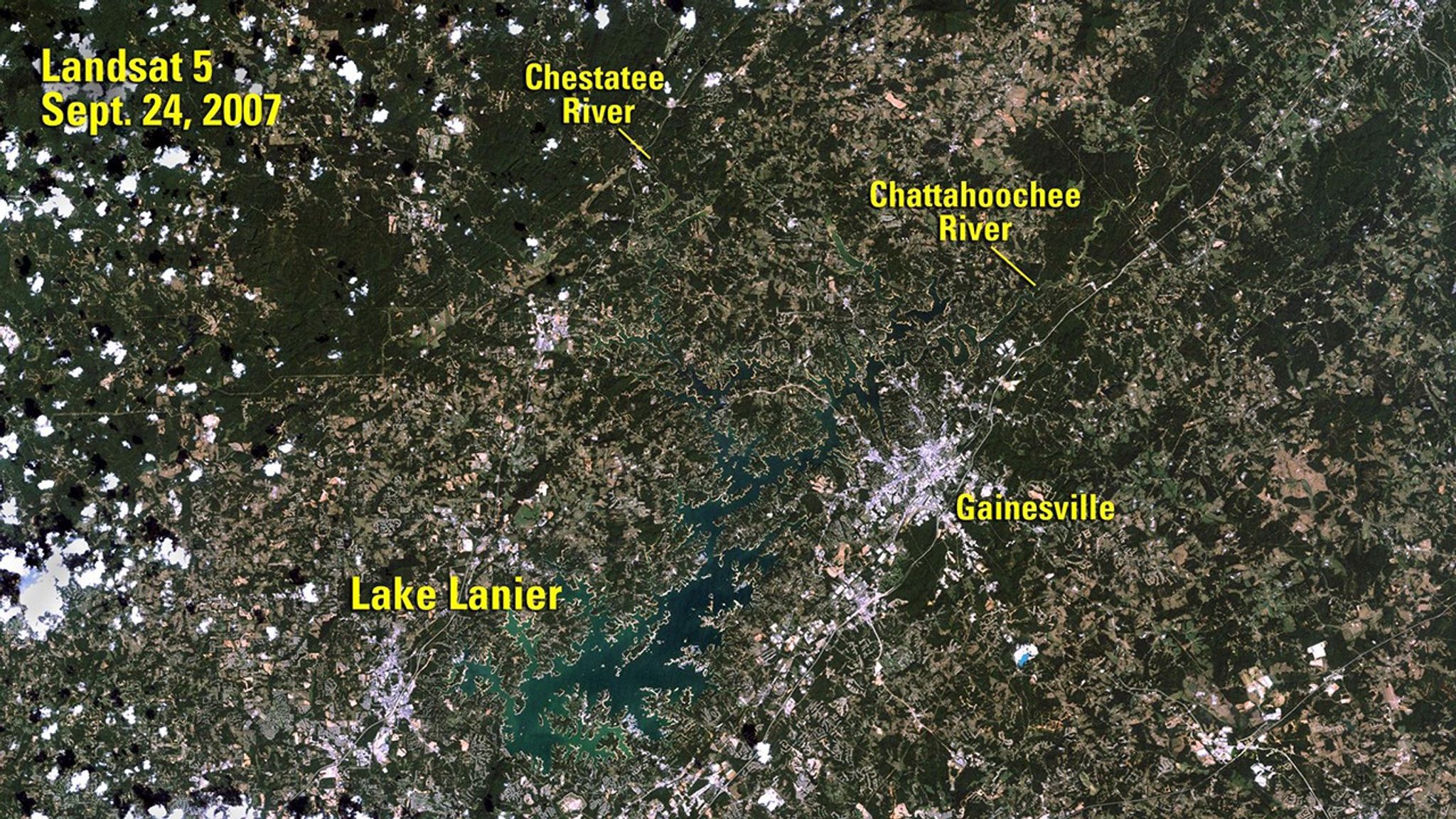
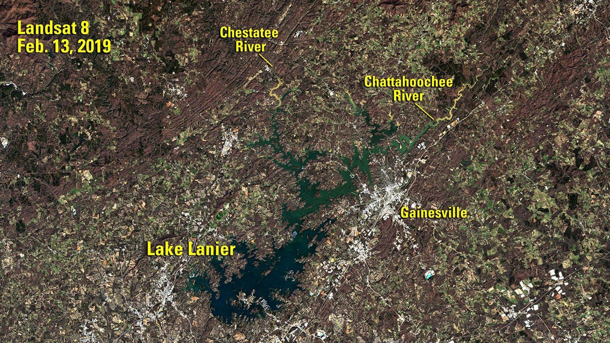
Before and After
Lake Lanier, Georgia, Near 40-Year High Water Mark
Sept. 24, 2007 - Feb. 13, 2019
Lake Lanier is a reservoir in northern Georgia, covering 59 square miles (about 153 square kilometers), that is fed by the Chattahoochee and Chestatee rivers. These images compare the lake at low and high water levels. At the time of the 2007 image, Lanier was on its way to a record low of 1,051 feet a few months later. When the 2019 image was taken, the lake was just 11 days away from reaching 1,076 feet, its highest level since the 1970s. Images taken by Landsat 5 and 8. Source: U.S. Geological Survey’s National Land Imaging Image Collections


