


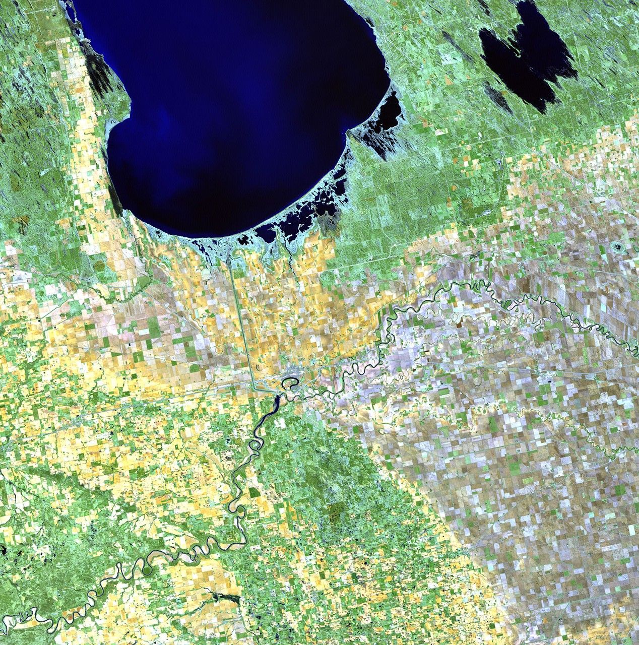

before
after

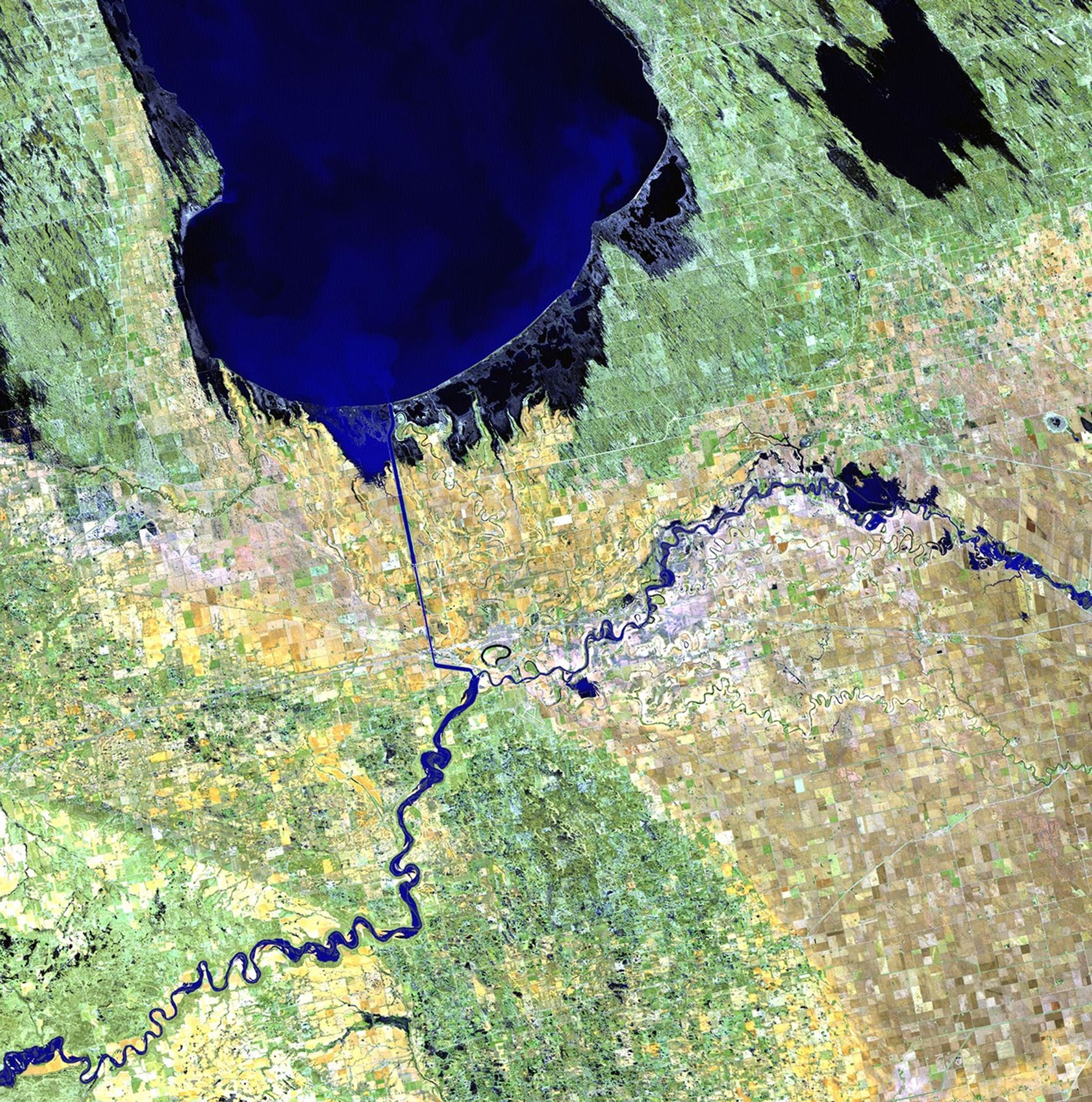
Before and After
Lake Manitoba change, Canada
May 15, 2010 - May 18, 2011
The Portage Diversion system was built in 1970 to divert water from the Assiniboine River to an 18-mile channel which empties into Lake Manitoba. The channel was kept open during the latter half of May 2011 to prevent flooding in the urban Winnipeg area. That action eased pressure on downstream dikes, but raised the level of Lake Manitoba. Response agencies are using Landsat satellite data and field measurements to monitor water levels and the extent of water spreading downstream to help them decide how to control stream levels. Images taken by the Thematic Mapper sensor aboard Landsat 5. Source: USGS Landsat Missions Gallery, "Portage Diversion, Lake Manitoba," U.S. Department of the Interior / U.S. Geological Survey.


