


before
after

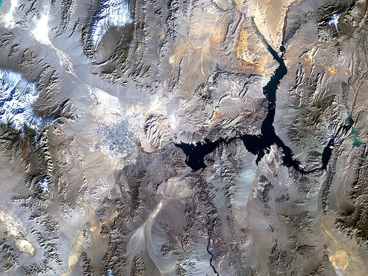
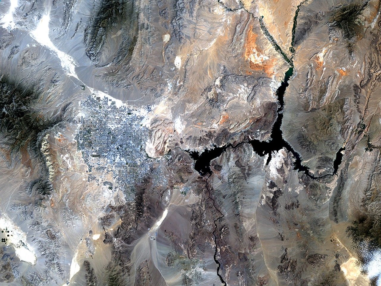
Lake Mead is one of the largest reservoirs in the world, supplying water to California, Arizona, Nevada and Mexico, including the water-guzzling Las Vegas. Through dam turbines, the lake also provides power to Nevada, southern California and northern Mexico. Since 2000, the water level has been dropping at a fairly steady rate due to lower-than-average snowfall and over a decade of drought, and as of July 2010, the lake was at 38 percent of its capacity. Water supply has been further diminished by the drawing off of water from upstream reservoirs in the upper Colorado River Basin which, historically, has been the source for the Lake Mead Reservoir. Also see this image pair of Lake Mead. Images taken by the Thematic Mapper sensor onboard Landsat 5. Source: U.S. Geological Survey (USGS) Landsat Missions Gallery, "Lake Mead, Nevada," U.S. Department of the Interior / USGS.
NASA/USGS
before
after
Before and After
Lake Mead shrinkage, Nevada
December 12, 1982 - August 11, 2010
Lake Mead is one of the largest reservoirs in the world, supplying water to California, Arizona, Nevada and Mexico, including the water-guzzling Las Vegas. Through dam turbines, the lake also provides power to Nevada, southern California and northern Mexico. Since 2000, the water level has been dropping at a fairly steady rate due to lower-than-average snowfall and over a decade of drought, and as of July 2010, the lake was at 38 percent of its capacity. Water supply has been further diminished by the drawing off of water from upstream reservoirs in the upper Colorado River Basin which, historically, has been the source for the Lake Mead Reservoir. Also see this image pair of Lake Mead. Images taken by the Thematic Mapper sensor onboard Landsat 5. Source: U.S. Geological Survey (USGS) Landsat Missions Gallery, "Lake Mead, Nevada," U.S. Department of the Interior / USGS.


