


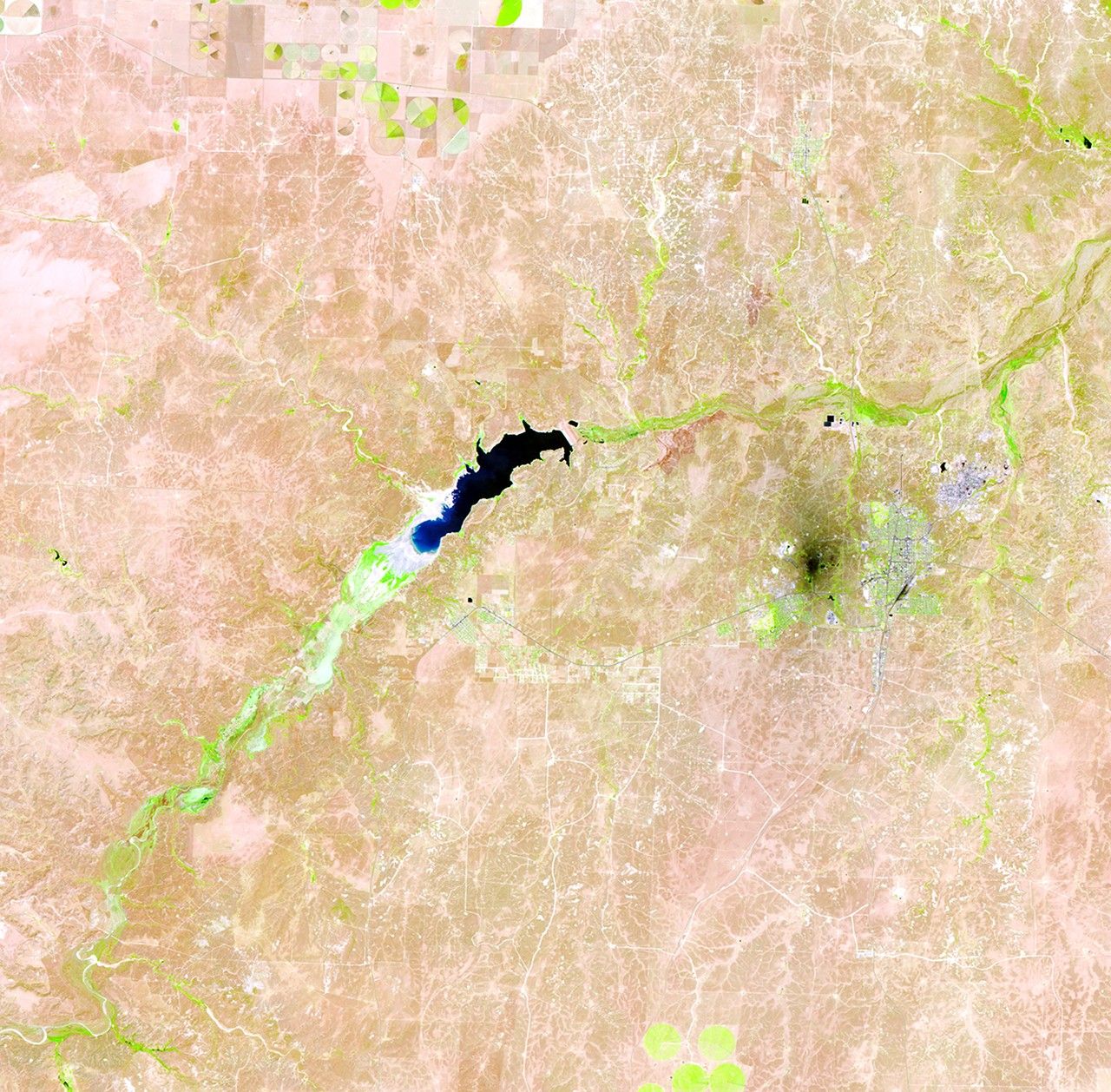
before
after
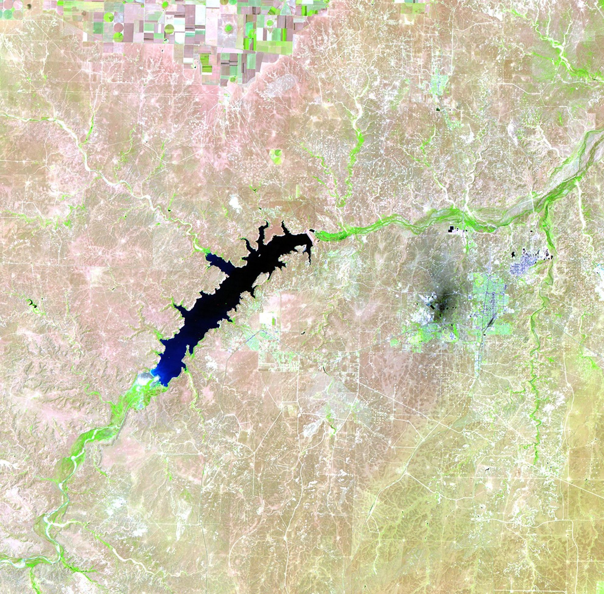
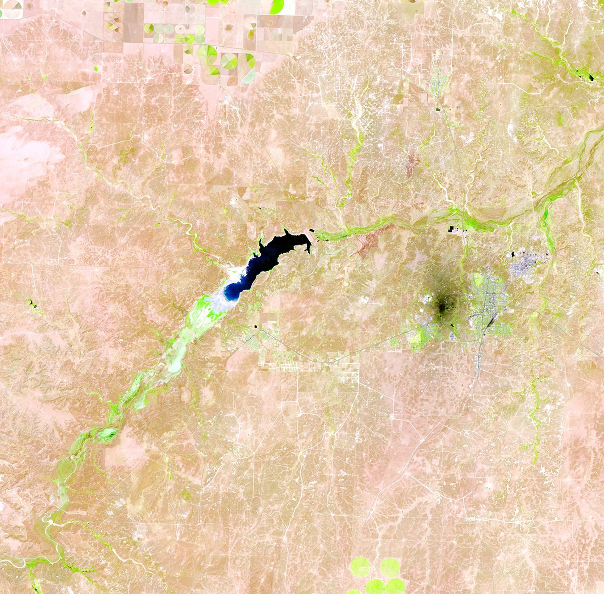
Before and After
Lake Meredith shrinkage, Texas
June 18, 1990 - June 12, 2011
Lake Meredith is a reservoir formed by the Sanford Dam on the Canadian River in the Texas panhandle. Continuous drought has diminished water levels significantly in the past few years, leading to a record low in 2011. In each image, the lake is the black feature near the center. Light tones at the lower end of the lake indicate dry land and former shores. Bright green indicates healthy vegetation along the river beds and irrigated fields in the upper center of each image. The nearby industrial area (a petroleum plant and a carbon-processing plant) appears as a dark spot. The light blue tone further east is Borger, Texas. Images taken by the Thematic Mapper sensor aboard Landsat 5. Source: USGS Landsat Missions Gallery, "Shrinking Lake Meredith, Texas," U.S. Department of the Interior / U.S. Geological Survey.


