


before
after
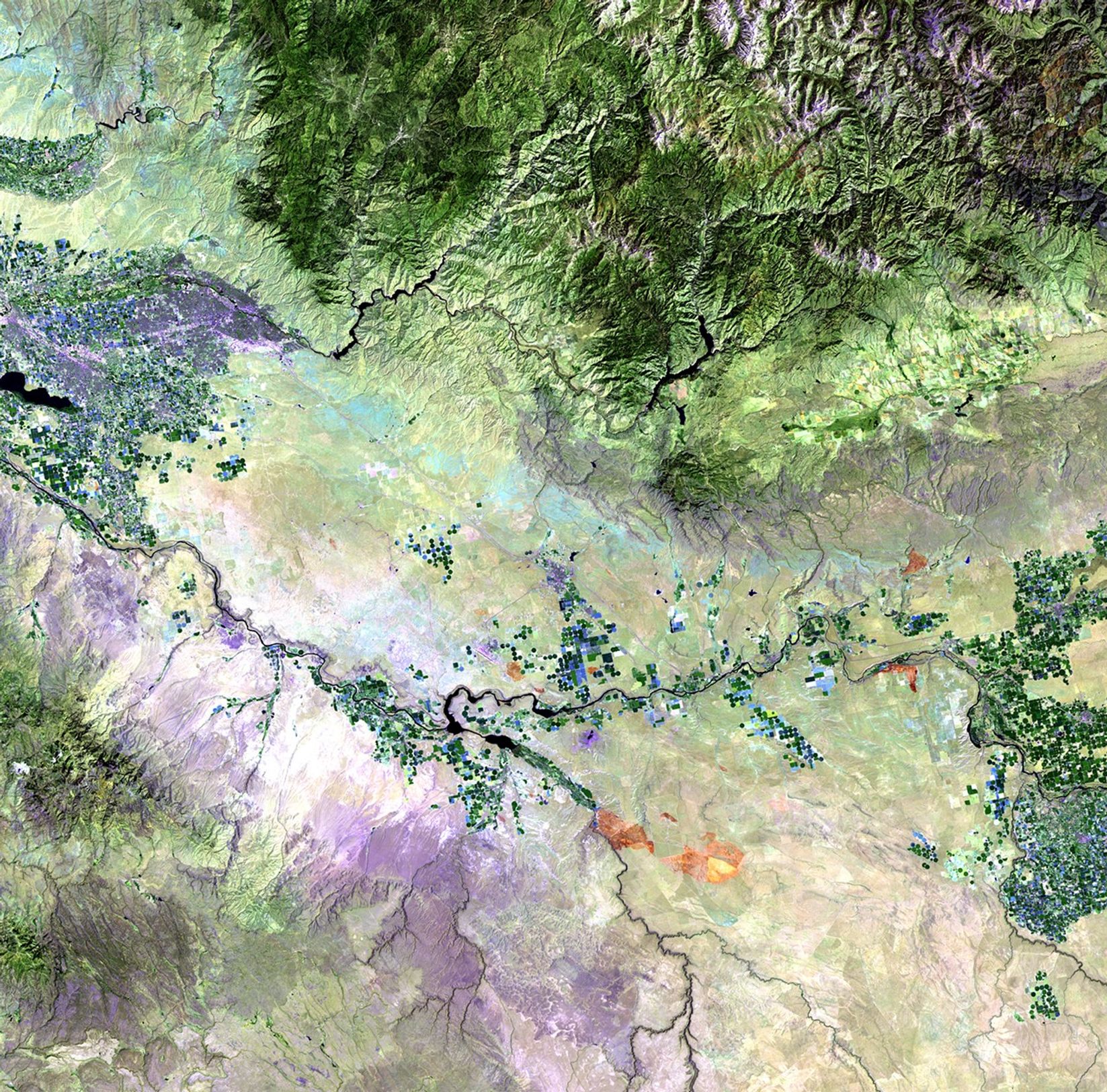
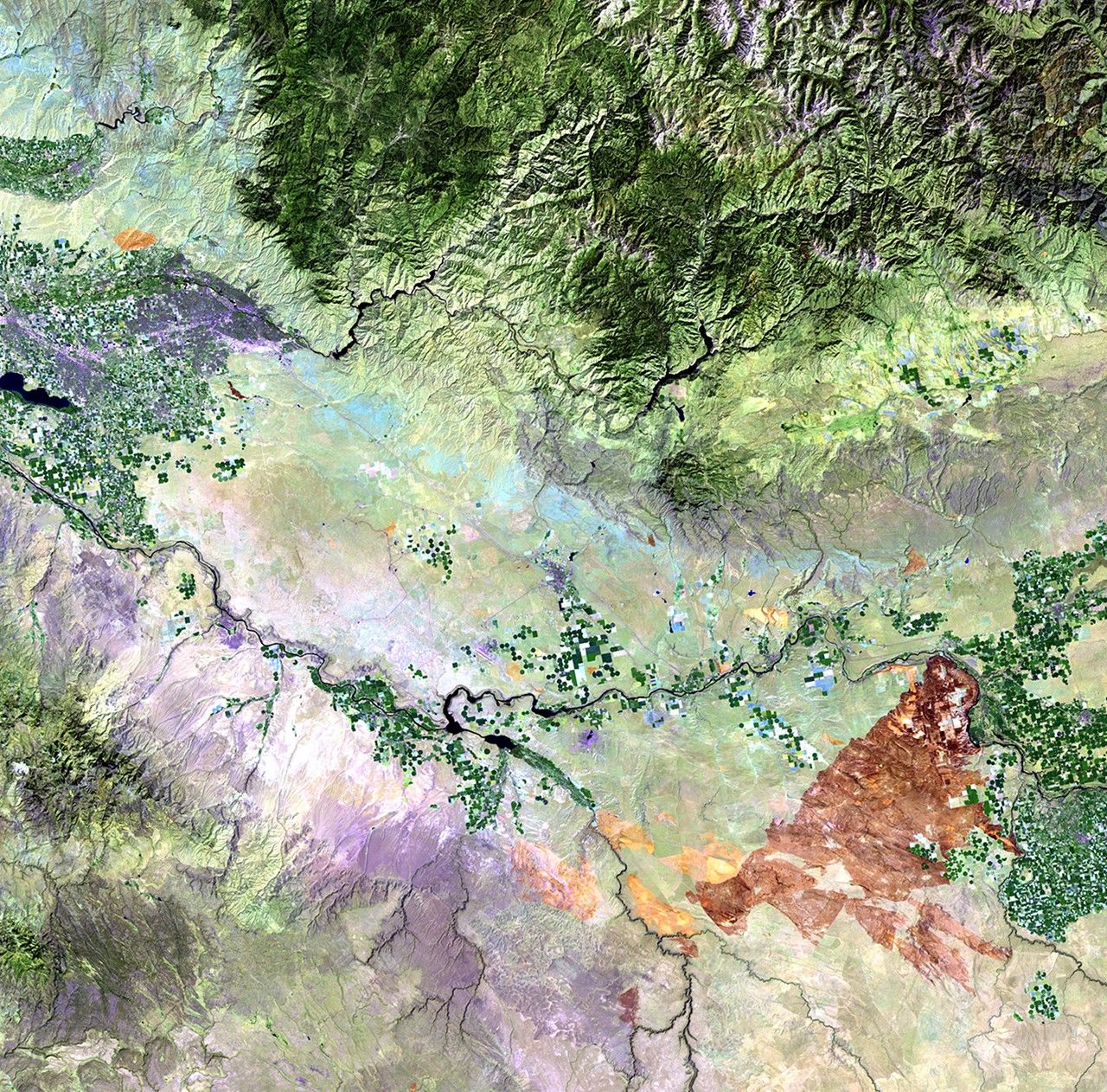
Left: July 24, 2010. Right: August 25, 2010. A series of wildfires, triggered by lightning strikes during the weekend of August 21 and 22, 2010, burned more than 300,000 acres of sage and grasses in the south-central region of Idaho. On August 23, the fire burned over 200,000 acres in a single day. Smoke from the fires dramatically impacted air quality in a number of local communities. The July 24 image shows burn marks from earlier, smaller fires, while the August 25 image shows the dark brown tone of the large fire scar. Fire and regional vegetation-management teams used the imagery to track the fire and to plan rehabilitation of the affected areas. Images taken by the Thematic Mapper sensor onboard Landsat 5. Source: USGS Landsat Missions Gallery, "Long Butte, Idaho Fire," U.S. Department of the Interior / U.S. Geological Survey.
NASA/USGS
Before and After
Long Butte fire, Idaho
July 24, 2010 - August 25, 2010
Left: July 24, 2010. Right: August 25, 2010. A series of wildfires, triggered by lightning strikes during the weekend of August 21 and 22, 2010, burned more than 300,000 acres of sage and grasses in the south-central region of Idaho. On August 23, the fire burned over 200,000 acres in a single day. Smoke from the fires dramatically impacted air quality in a number of local communities. The July 24 image shows burn marks from earlier, smaller fires, while the August 25 image shows the dark brown tone of the large fire scar. Fire and regional vegetation-management teams used the imagery to track the fire and to plan rehabilitation of the affected areas. Images taken by the Thematic Mapper sensor onboard Landsat 5. Source: USGS Landsat Missions Gallery, "Long Butte, Idaho Fire," U.S. Department of the Interior / U.S. Geological Survey.


