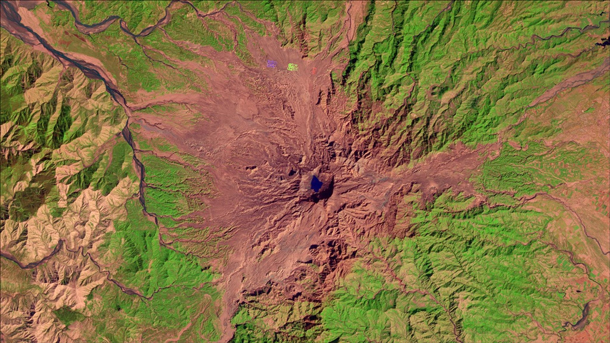
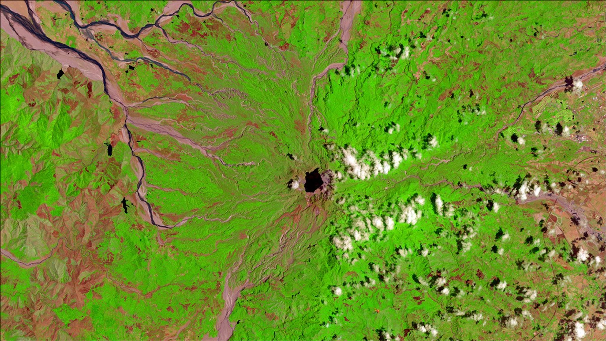
Due to the lapse in federal government funding, NASA is not updating this website.

Suggested Searches

1 min read

Mount Pinatubo, Philippines, erupted 26 years ago

before
after
Mount Pinatubo had likely been dormant for hundreds of years, making it difficult to persuade local residents to evacuate once it began showing signs of an eruption during the spring of 1991. When it did erupt on June 15, 1991, it was one of the largest volcanic eruptions of the 20th century. Today, the mountain is relatively quiet and about 984 feet (about 300 meters) shorter than it was before the eruption. In the 2017 image (right), green near the summit indicates forest regrowth, and pink stretches streaming from the mountain show scars from fast-moving floods of volcanic ash and water. Called “lahars,” these floods affected more people than the eruption itself and continue to be hazardous.   Images taken by Landsat. Source: U.S. Geological Survey (USGS) Landsat Missions Gallery: “Mount Pinatubo, Philippines, Erupted 26 Years Ago”; U.S. Department of the Interior / USGS and NASA.

Before and After

Mount Pinatubo, Philippines, erupted 26 years ago

January 26, 1992 - April 4, 2017

Mount Pinatubo had likely been dormant for hundreds of years, making it difficult to persuade local residents to evacuate once it began showing signs of an eruption during the spring of 1991. When it did erupt on June 15, 1991, it was one of the largest volcanic eruptions of the 20th century. Today, the mountain is relatively quiet and about 984 feet (about 300 meters) shorter than it was before the eruption. In the 2017 image (right), green near the summit indicates forest regrowth, and pink stretches streaming from the mountain show scars from fast-moving floods of volcanic ash and water. Called “lahars,” these floods affected more people than the eruption itself and continue to be hazardous. Images taken by Landsat. Source: U.S. Geological Survey (USGS) Landsat Missions Gallery: “Mount Pinatubo, Philippines, Erupted 26 Years Ago”; U.S. Department of the Interior / USGS and NASA.

Downloads

Image 1

JPEG

(1 MB)

Image 2

JPEG

(1 MB)