


before
after
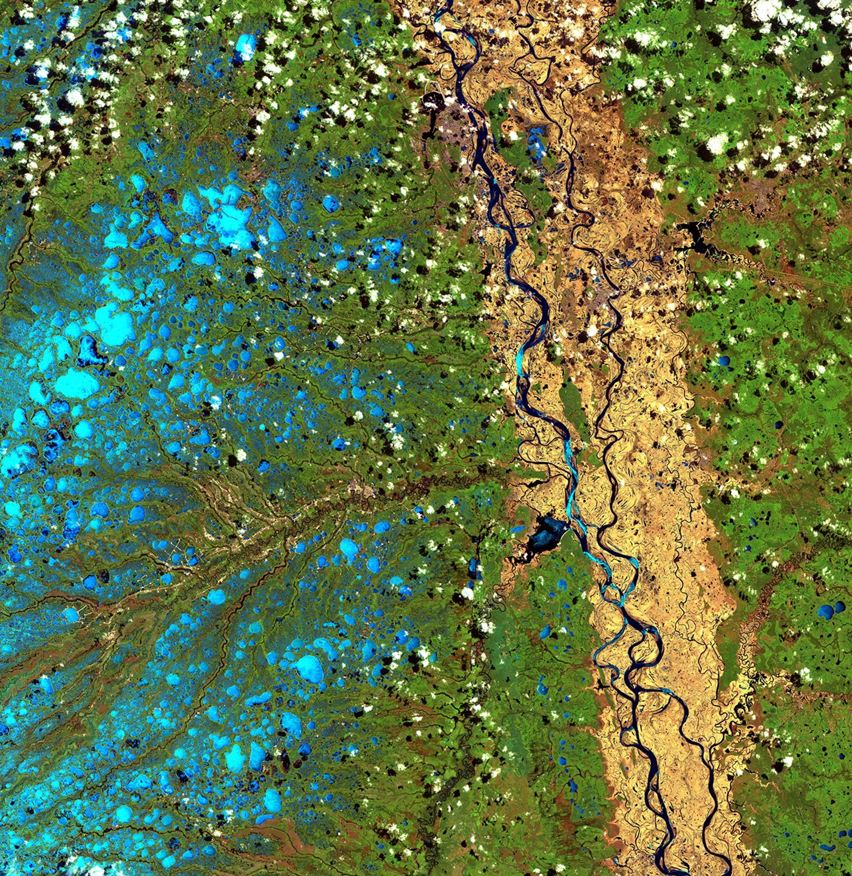
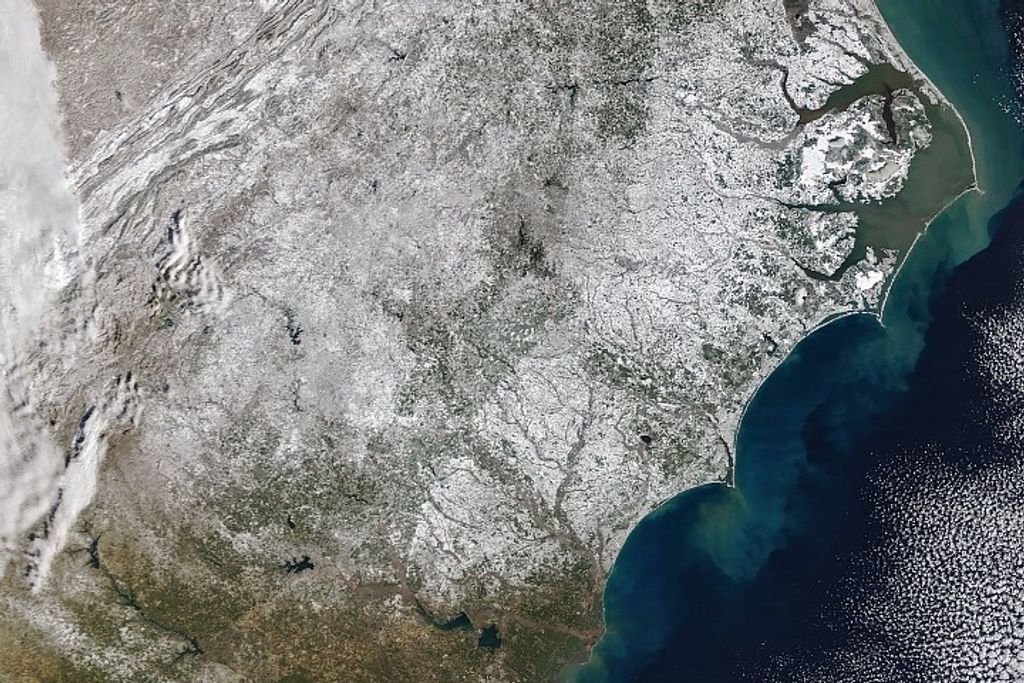
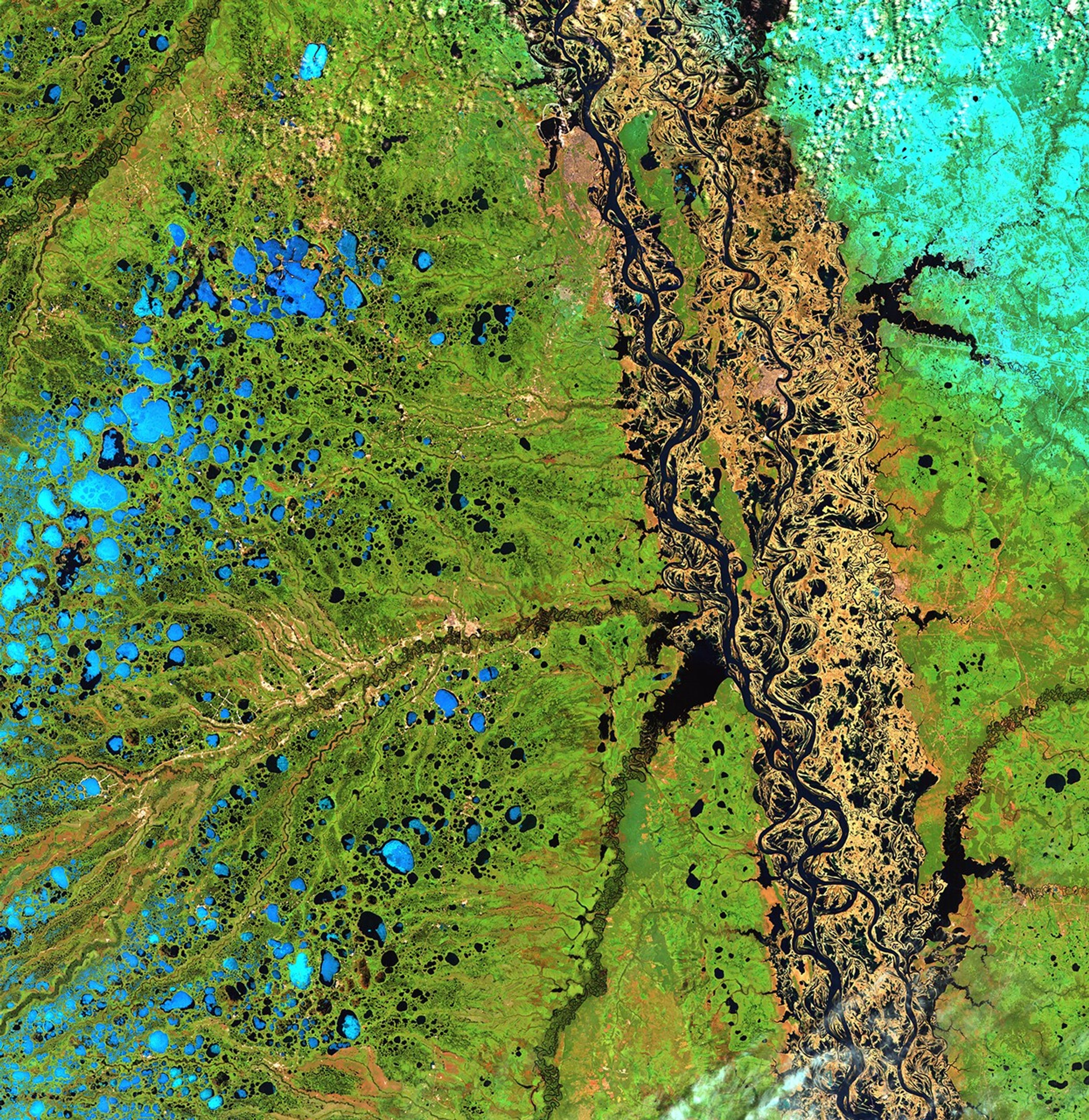
From the time they thaw in early May, the Ob River and its tributary, the Irtysh, flow from the Altay Mountains of northern China to the Arctic Ocean. The northern reaches of the Ob flow over a flat permafrost plain past the cities of Ozernyy and Nefteyvgansk in northern Russia. Because the river cannot cut deep channels into the frozen land, it spreads out over the surrounding plain during the spring melt, as shown in the image on the right. Images taken by the Thematic Mapper sensor onboard Landsat 5. Source: U.S. Geological Survey (USGS) Landsat Missions Gallery, "Ob River Flooding in Northern Russia," U.S. Department of the Interior / USGS and NASA.
From the time they thaw in early May, the Ob River and its tributary, the Irtysh, flow from the Altay Mountains of northern China to the Arctic Ocean. The northern reaches of the Ob flow over a flat permafrost plain past the cities of Ozernyy and Nefteyvgansk in northern Russia. Because the river cannot cut deep channels into the frozen land, it spreads out over the surrounding plain during the spring melt, as shown in the image on the right. Images taken by the Thematic Mapper sensor onboard Landsat 5. Source: U.S. Geological Survey (USGS) Landsat Missions Gallery, "Ob River Flooding in Northern Russia," U.S. Department of the Interior / USGS and NASA.Ob River flow, Russia
before
after
Before and After
Ob River flow, Russia
May 1, 2007 - May 17, 2007
From the time they thaw in early May, the Ob River and its tributary, the Irtysh, flow from the Altay Mountains of northern China to the Arctic Ocean. The northern reaches of the Ob flow over a flat permafrost plain past the cities of Ozernyy and Nefteyvgansk in northern Russia. Because the river cannot cut deep channels into the frozen land, it spreads out over the surrounding plain during the spring melt, as shown in the image on the right. Images taken by the Thematic Mapper sensor onboard Landsat 5. Source: U.S. Geological Survey (USGS) Landsat Missions Gallery, "Ob River Flooding in Northern Russia," U.S. Department of the Interior / USGS and NASA.


