


before
after
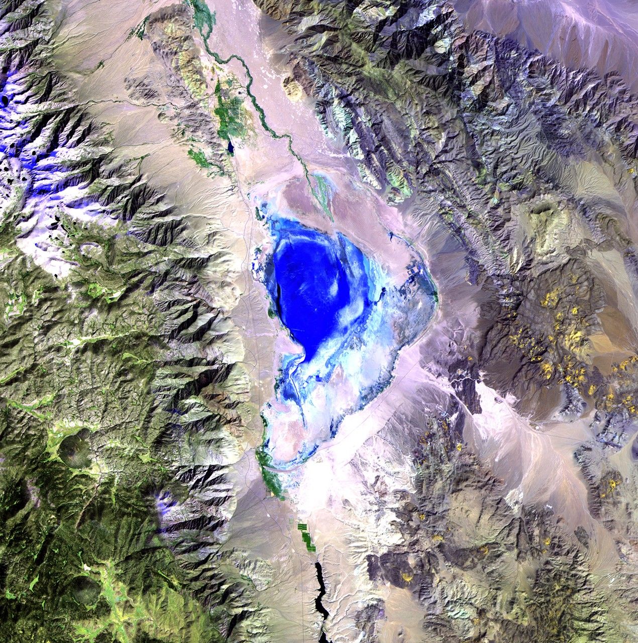
Owens Lake lies in the Owens Valley between the Sierra Nevada and Inyo Mountains, about 130 miles north of Los Angeles, California. For thousands of years, it was one of the most important stopover sites in the western U.S. for migrating waterfowl and shore birds. However, in the early 20th century, the lower Owens River, which fed the lake, was largely diverted to the Los Angeles aqueduct. Water from springs and artesian wells kept some of the lake alive, but toxic chemicals and dust impinged on the regional environment and disturbed the bird habitat. Beginning in 1999, a plan was put in place to restore the lake region and alleviate the dust build-up, using ponds, native grasses, gravel deposits and limited shallow flooding. Images taken by the Thematic Mapper sensor onboard Landsat 5. Source: USGS Landsat Missions Gallery, "Owens Lake restoration," U.S. Department of the Interior / U.S. Geological Survey.
NASA/USGS
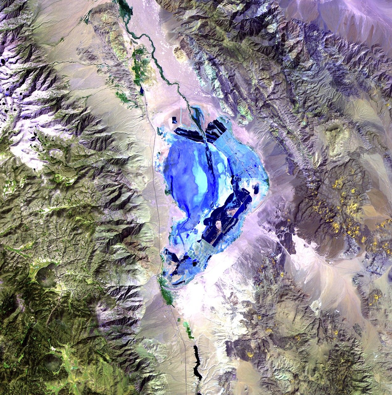
Before and After
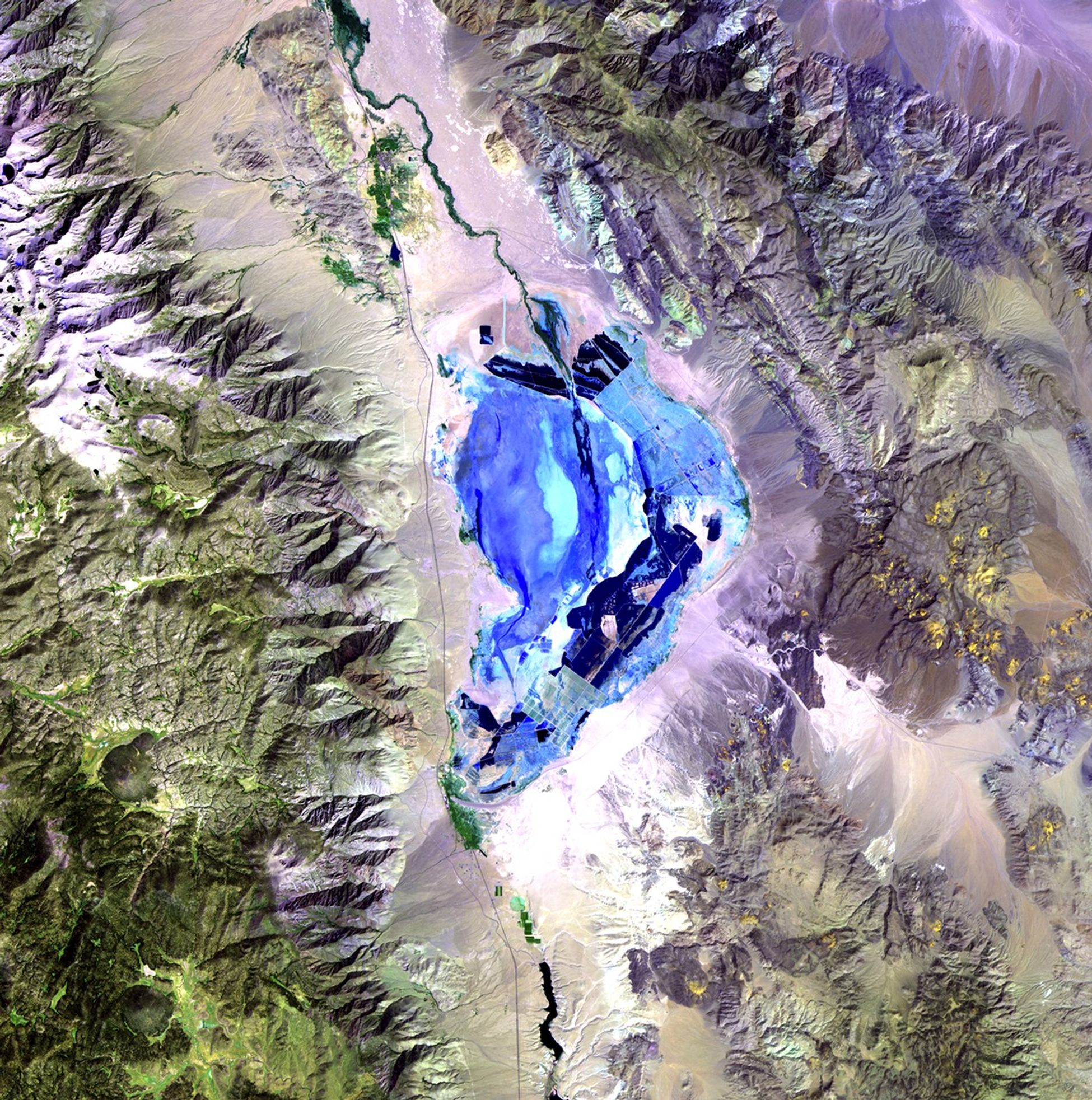
Owens Lake degradation, California
September 21, 1985 - September 10, 2010
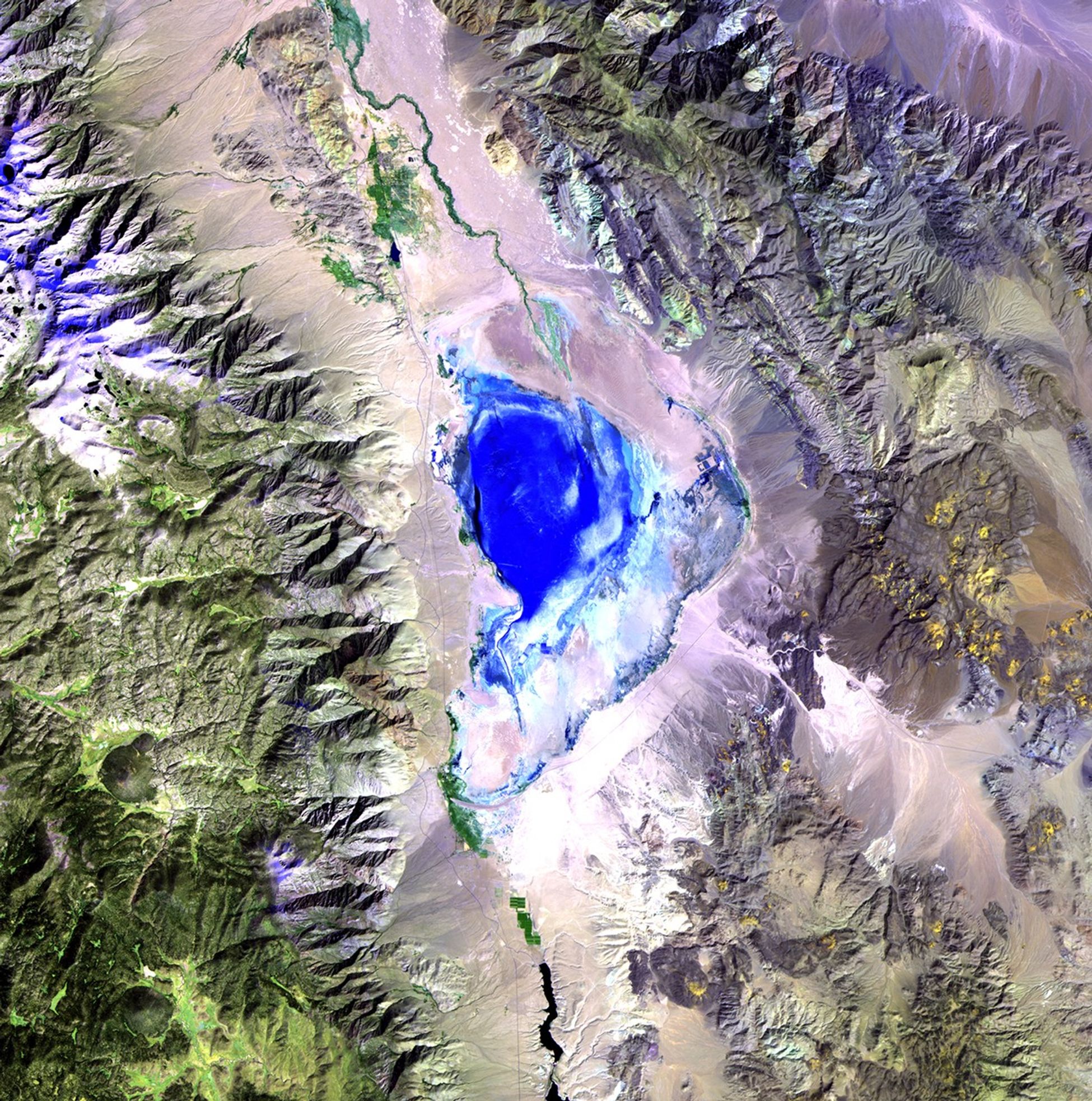
Owens Lake lies in the Owens Valley between the Sierra Nevada and Inyo Mountains, about 130 miles north of Los Angeles, California. For thousands of years, it was one of the most important stopover sites in the western U.S. for migrating waterfowl and shore birds. However, in the early 20th century, the lower Owens River, which fed the lake, was largely diverted to the Los Angeles aqueduct. Water from springs and artesian wells kept some of the lake alive, but toxic chemicals and dust impinged on the regional environment and disturbed the bird habitat. Beginning in 1999, a plan was put in place to restore the lake region and alleviate the dust build-up, using ponds, native grasses, gravel deposits and limited shallow flooding. Images taken by the Thematic Mapper sensor onboard Landsat 5. Source: USGS Landsat Missions Gallery, "Owens Lake restoration," U.S. Department of the Interior / U.S. Geological Survey.


