


before
after
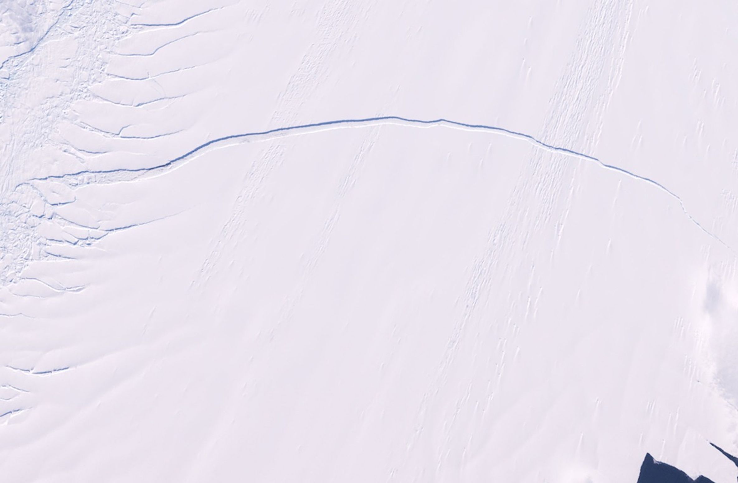
Pine Island is one of the largest and fastest-moving glaciers in Antarctica. The Pine Island Glacier Basin contributes more ice to the sea than any other ice-drainage basin in the world, and this has increased due to recent acceleration of the ice stream caused by thinning of the glacier. Scientists are concerned about the impact Pine Island's continued thinning will have on sea level. The 2011 image shows a series of splits along the western edge of the glacier. The same area in 2012 reveals a major break that will eventually extend all the way across the glacier and calve a giant iceberg expected to cover about 350 square miles (900 square kilometers). Images taken by the Enhanced Thematic Mapper Plus sensor onboard Landsat 7. Source: U.S. Geological Survey (USGS) Landsat Missions Gallery, "Pine Island Glacier," U.S. Department of the Interior / USGS.
NASA/USGS
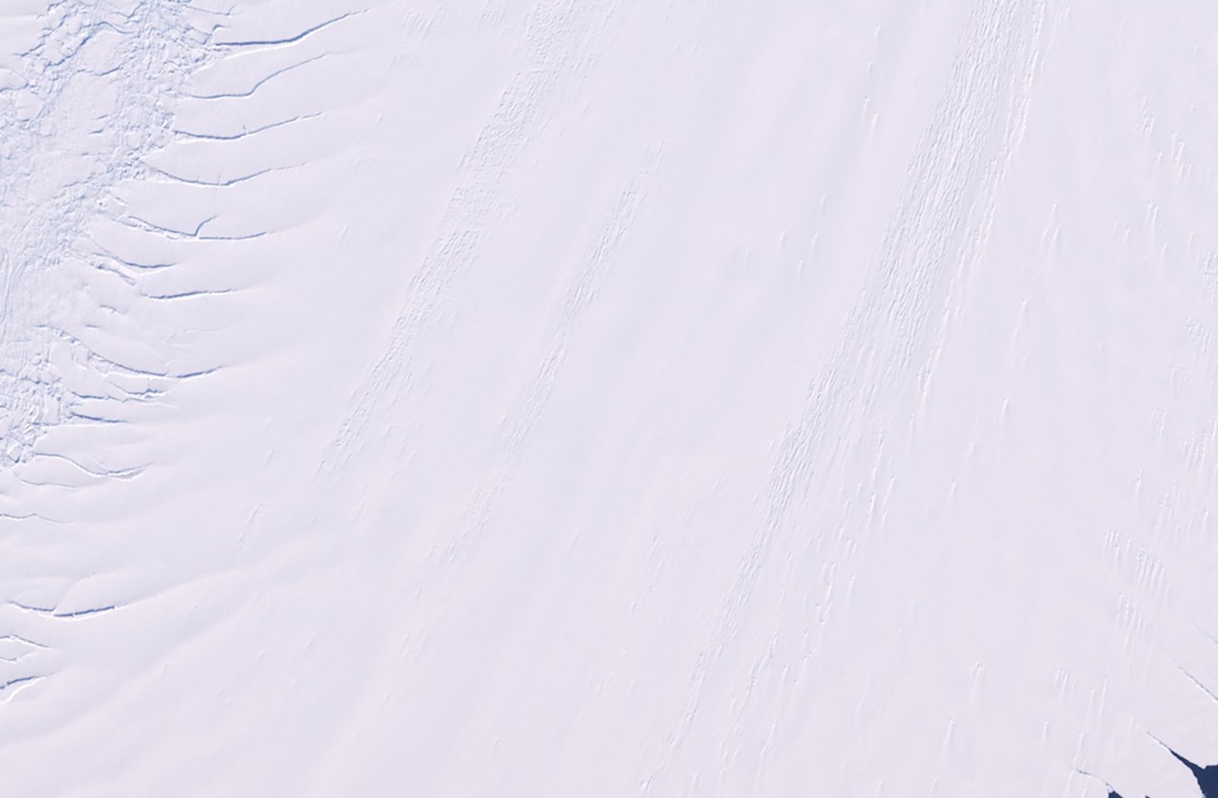
Before and After
Pine Island Glacier calving, Antarctica
January 25, 2011 - January 28, 2012
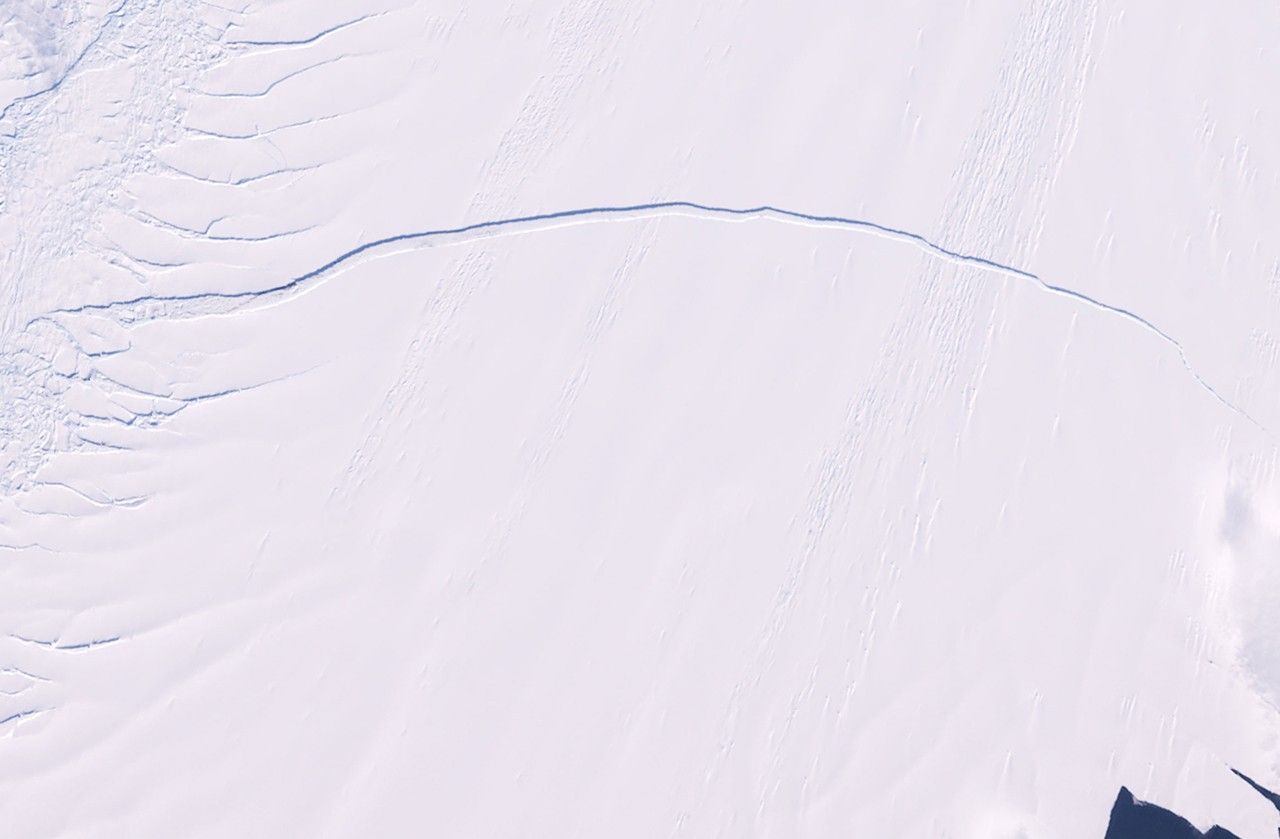
Pine Island is one of the largest and fastest-moving glaciers in Antarctica. The Pine Island Glacier Basin contributes more ice to the sea than any other ice-drainage basin in the world, and this has increased due to recent acceleration of the ice stream caused by thinning of the glacier. Scientists are concerned about the impact Pine Island's continued thinning will have on sea level. The 2011 image shows a series of splits along the western edge of the glacier. The same area in 2012 reveals a major break that will eventually extend all the way across the glacier and calve a giant iceberg expected to cover about 350 square miles (900 square kilometers). Images taken by the Enhanced Thematic Mapper Plus sensor onboard Landsat 7. Source: U.S. Geological Survey (USGS) Landsat Missions Gallery, "Pine Island Glacier," U.S. Department of the Interior / USGS.


