


before
after

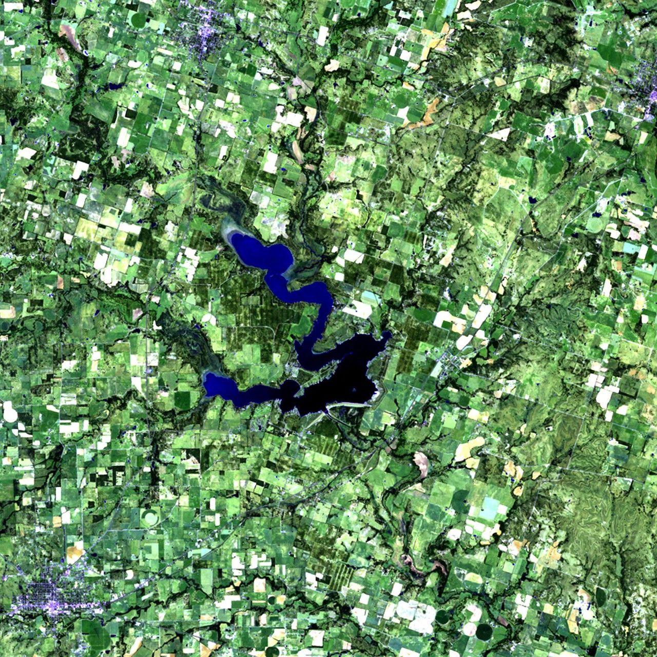
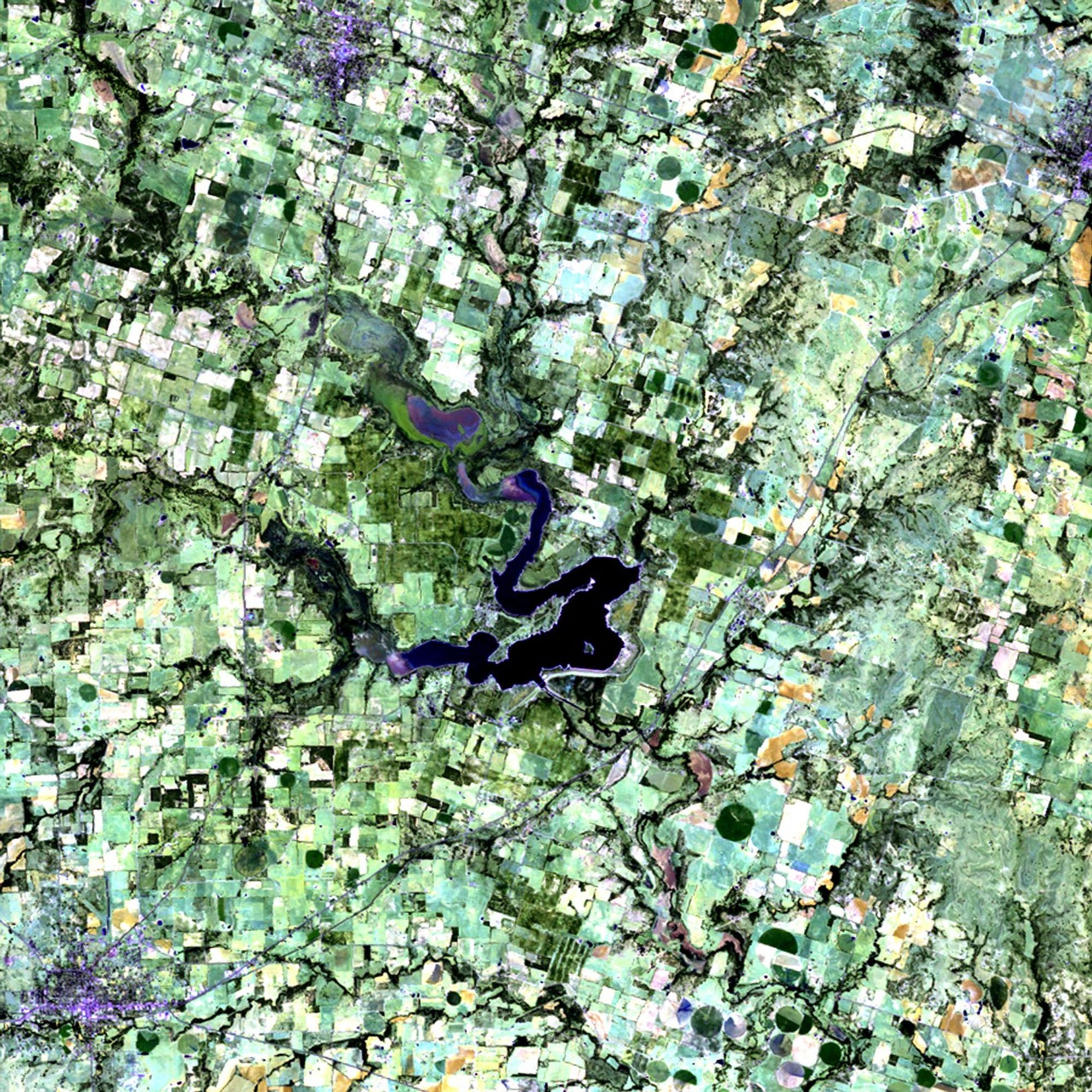
Dry conditions since mid-2010 have caused a large portion of Texas to be in an "exceptional" state of drought, the worst condition on the Federal government's drought monitor scale. The 12-month period between October 2010 and September 2011 was the driest in Texas since 1895, when the state began keeping rainfall records. Not only have crops and farmland been affected, but the levels of many lakes in the state have also fallen. Seen here is the area surrounding Proctor Lake, southwest of Dallas. Much of 2010's green vegetation has given way to barren ground (lighter shades) in 2011. Reduced water levels from the two major feeder rivers, the Sabanna and Leon Rivers, are responsible for the lake's receding shoreline. Proctor Lake reservoir was created by the U.S. Army Corps of Engineers in 1963 as a flood-control measure, and provides drinking water and recreation facilities to neighboring communities. Images taken by the Thematic Mapper sensor onboard Landsat 5. Source: USGS Landsat Missions Gallery, "Proctor Lake Affected by Texas Drought," U.S. Department of the Interior / U.S. Geological Survey.
NASA/USGS
Before and After
Proctor Lake drought, Texas
October 1, 2010 - October 4, 2011
Dry conditions since mid-2010 have caused a large portion of Texas to be in an "exceptional" state of drought, the worst condition on the Federal government's drought monitor scale. The 12-month period between October 2010 and September 2011 was the driest in Texas since 1895, when the state began keeping rainfall records. Not only have crops and farmland been affected, but the levels of many lakes in the state have also fallen. Seen here is the area surrounding Proctor Lake, southwest of Dallas. Much of 2010's green vegetation has given way to barren ground (lighter shades) in 2011. Reduced water levels from the two major feeder rivers, the Sabanna and Leon Rivers, are responsible for the lake's receding shoreline. Proctor Lake reservoir was created by the U.S. Army Corps of Engineers in 1963 as a flood-control measure, and provides drinking water and recreation facilities to neighboring communities. Images taken by the Thematic Mapper sensor onboard Landsat 5. Source: USGS Landsat Missions Gallery, "Proctor Lake Affected by Texas Drought," U.S. Department of the Interior / U.S. Geological Survey.


