


before
after
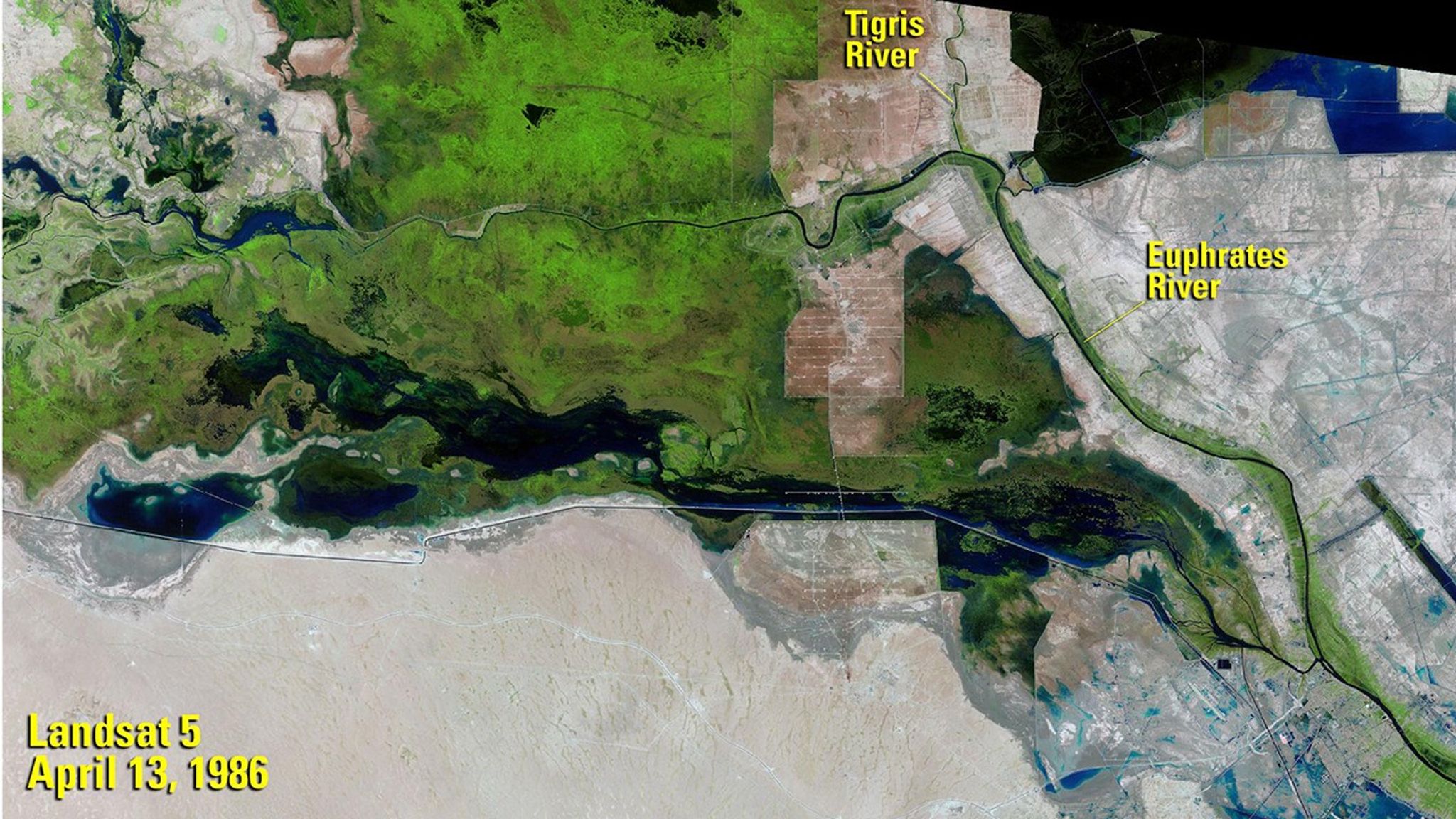
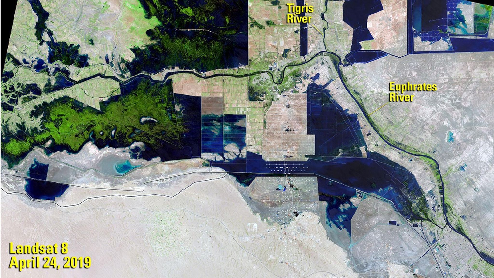
Before and After
Recovery of Iraq’s Wetlands
April 13, 1986 - April 24, 2019
UNESCO declared southern Iraq’s marshes (“al-Ahwar” in Arabic) a World Heritage Site in 2016, citing their biodiversity and contribution to ancient Mesopotamian societies. The organization says the marshlands covered some 8,000 square miles (20,000 square kilometers) until the 1970s. The 1986 image shows that as of that year, lush vegetation remained on both sides of the Euphrates River. But government projects choked off the area’s water, and by 2001, the wetlands were reduced to a few hundred square miles. With subsequent restoration efforts, they have been making a slow recovery. The 1986 image was taken by Landsat 5. The 2019 image was taken by Landsat 8. Source: U.S. Geological Survey’s National Land Imaging Image Collections and UNESCO.


