


before
after
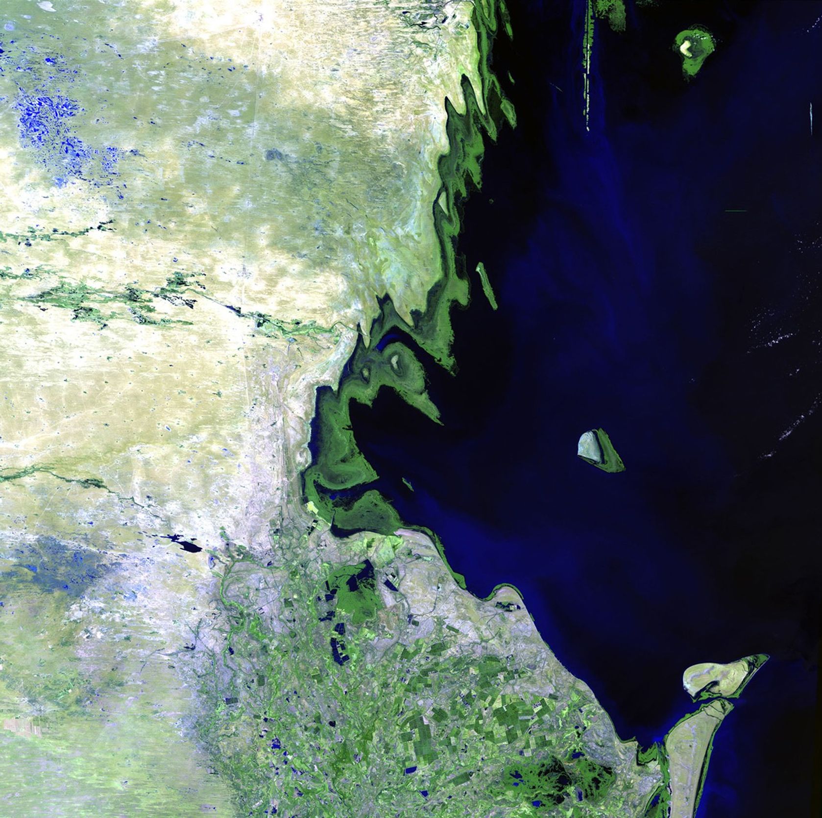
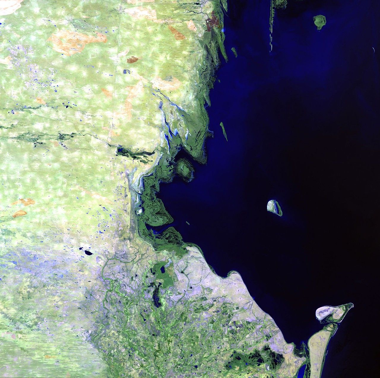
The Caspian Sea is the world's largest landlocked body of water, and it's getting bigger. In the past couple of decades, heavy rains in the greater Volga Basin have greatly increased the incoming flow from the Volga River, the Caspian's primary source of water. These images show a small portion of the shoreline. In the 2011 image, coastal settlements have been flooded, displacing inhabitants and shutting down industrial facilities. The groundwater level has also risen, leading to swamping and increasing the salinity of lowland territories. Tyuleniy Island (the prominent island) has visibly lost land mass, with the rising water contributing to the decline of the island and the marshes around it that support fowl and other animals. Images taken by the Thematic Mapper sensor onboard Landsat 5. Source: USGS Landsat Missions Gallery, "Rising Water Changes Caspian Shoreline," U.S. Department of the Interior / U.S. Geological Survey.
NASA/USGS
Before and After
Rising water, Caspian Sea
August 21, 1985 - August 29, 2011
The Caspian Sea is the world's largest landlocked body of water, and it's getting bigger. In the past couple of decades, heavy rains in the greater Volga Basin have greatly increased the incoming flow from the Volga River, the Caspian's primary source of water. These images show a small portion of the shoreline. In the 2011 image, coastal settlements have been flooded, displacing inhabitants and shutting down industrial facilities. The groundwater level has also risen, leading to swamping and increasing the salinity of lowland territories. Tyuleniy Island (the prominent island) has visibly lost land mass, with the rising water contributing to the decline of the island and the marshes around it that support fowl and other animals. Images taken by the Thematic Mapper sensor onboard Landsat 5. Source: USGS Landsat Missions Gallery, "Rising Water Changes Caspian Shoreline," U.S. Department of the Interior / U.S. Geological Survey.


