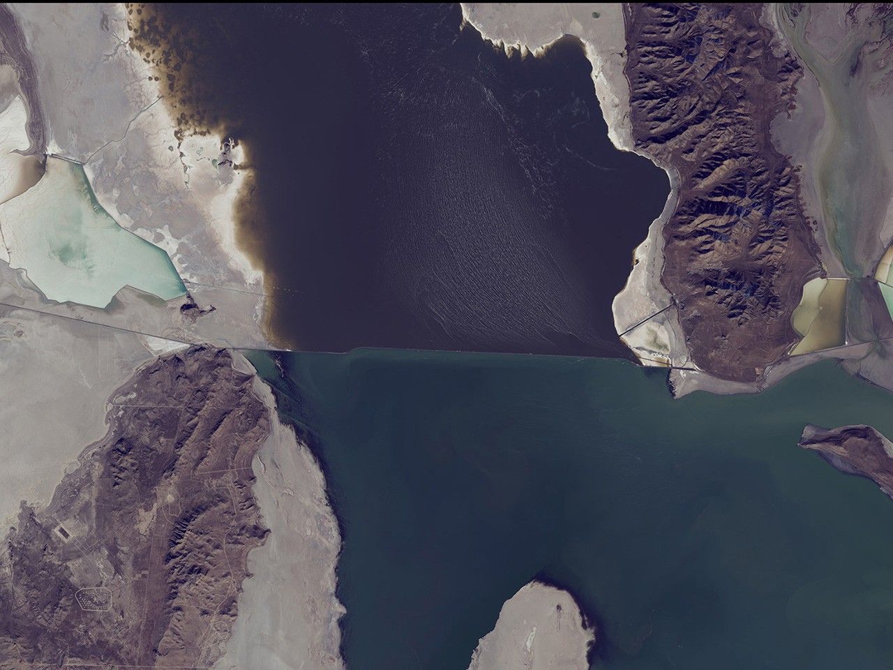
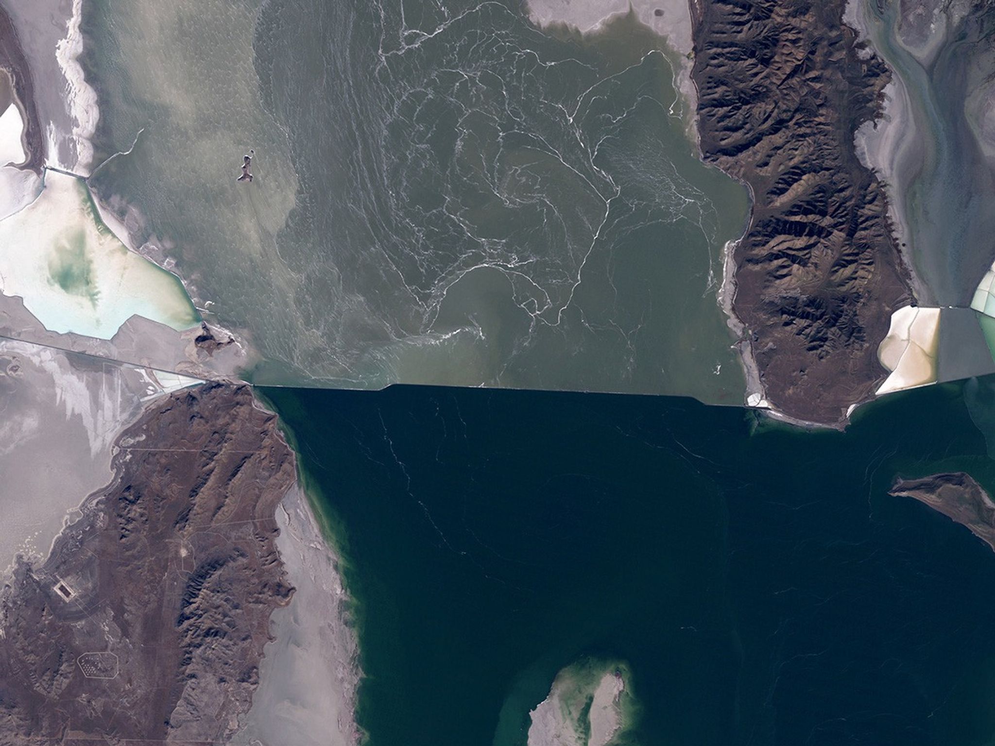
Suggested Searches

1 min read

Shrinking Great Salt Lake, Utah

before
after
The water level of the north arm of Great Salt Lake, Utah, has reached a record low of 4,191.6 feet because the smaller snowpack of recent years has reduced the spring runoff that feeds the lake. The south arm’s water has dropped below the level where it could cross the breach that separates the arms. Water from the north arm is pumped to evaporation ponds, seen on the right side of these images, from which salt, potassium and other minerals are extracted. Also see this USGS article.   Images taken by the Thematic Mapper sensor onboard Landsat 5 and the Operational Land Imager onboard Landsat 8. Source: Landsat Missions Gallery “Great Salt Lake North Arm Reaches Record Low.” U.S. Department of the Interior / USGS and NASA; and USGS Newsroom.
The water level of the north arm of Great Salt Lake, Utah, has reached a record low of 4,191.6 feet because the smaller snowpack of recent years has reduced the spring runoff that feeds the lake. The south arm’s water has dropped below the level where it could cross the breach that separates the arms. Water from the north arm is pumped to evaporation ponds, seen on the right side of these images, from which salt, potassium and other minerals are extracted. Also see this USGS article. Images taken by the Thematic Mapper sensor onboard Landsat 5 and the Operational Land Imager onboard Landsat 8. Source: Landsat Missions Gallery “Great Salt Lake North Arm Reaches Record Low.” U.S. Department of the Interior / USGS and NASA; and USGS Newsroom.

Before and After

Shrinking Great Salt Lake, Utah

November 2, 2011 - November 13, 2015

The water level of the north arm of Great Salt Lake, Utah, has reached a record low of 4,191.6 feet because the smaller snowpack of recent years has reduced the spring runoff that feeds the lake. The south arm’s water has dropped below the level where it could cross the breach that separates the arms. Water from the north arm is pumped to evaporation ponds, seen on the right side of these images, from which salt, potassium and other minerals are extracted. Also see this USGS article. Images taken by the Thematic Mapper sensor onboard Landsat 5 and the Operational Land Imager onboard Landsat 8. Source: Landsat Missions Gallery “Great Salt Lake North Arm Reaches Record Low.” U.S. Department of the Interior / USGS and NASA; and USGS Newsroom.

Downloads

Image 1

JPEG

(753 KB)

Image 2

JPEG

(642 KB)