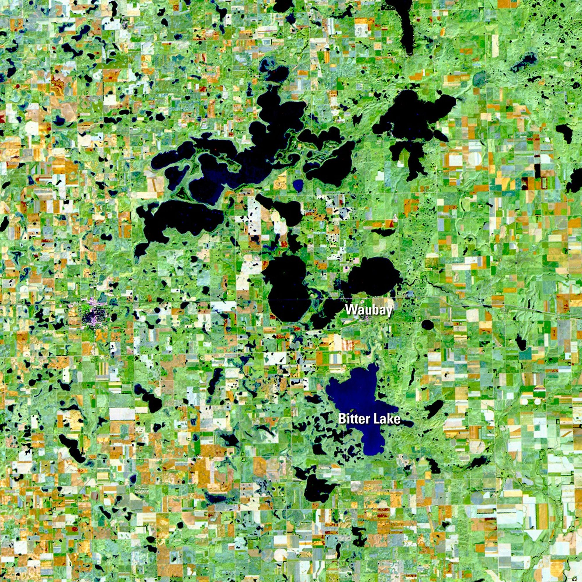
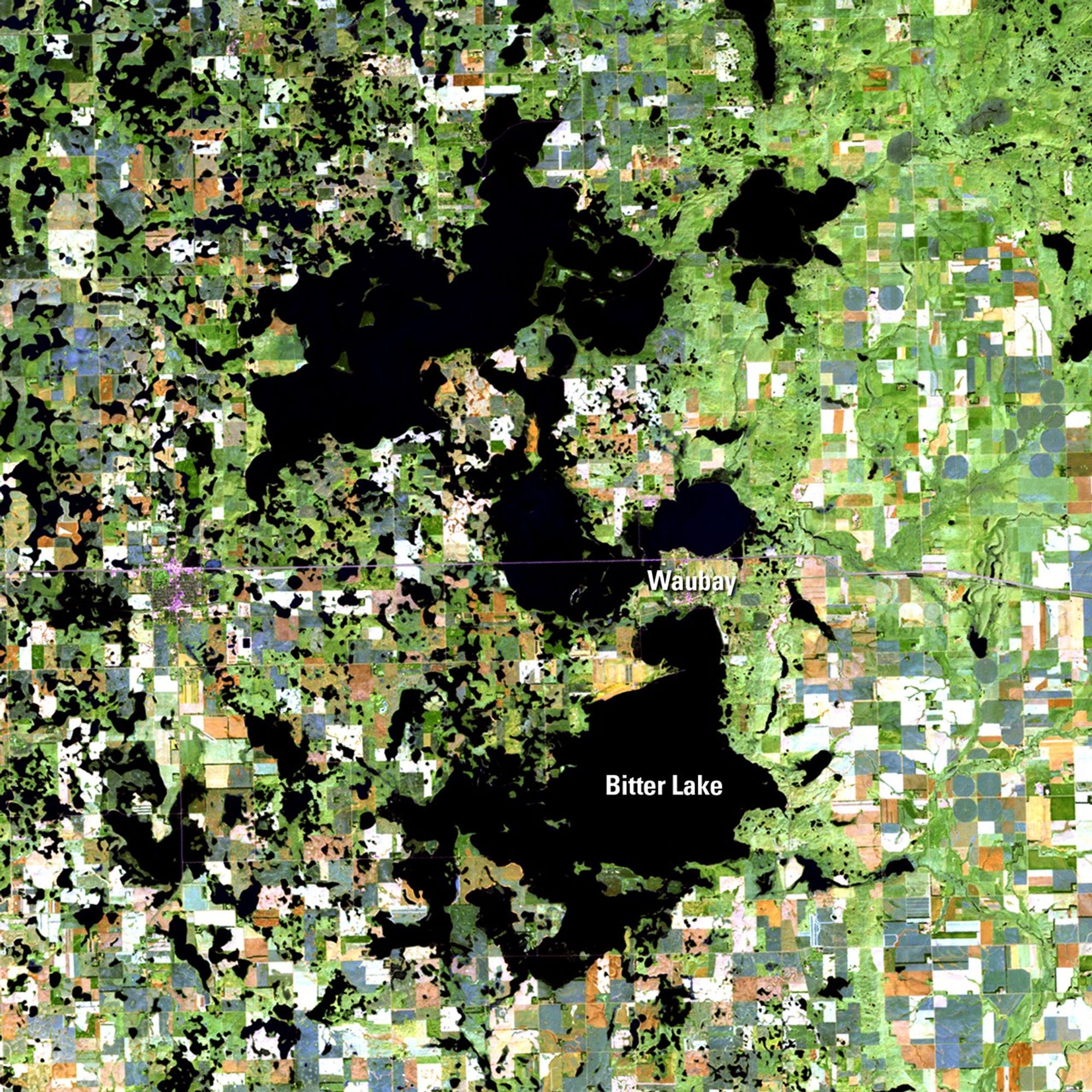
Due to the lapse in federal government funding, NASA is not updating this website.

Suggested Searches

1 min read

The Coteau des Prairies flood, South Dakota

before
after
The Coteau des Prairies is a plateau with many small lakes, created from repeated glaciation in northeastern South Dakota. In the past two decades, rising lake waters have been swallowing up farm fields, pasture ranges, roads and homesteads. Bitter Lake is the southern boundary for water flowing from Waubay, Blue Dog, and Rush Lakes from the north, with no established outlet for the water to flow further south. During wet times such as those preceding the 2011 picture, the groundwater levels rise, lake water can't drain into the soil and the area floods.   Images taken by the Thematic Mapper sensor onboard Landsat 5. Source: U.S. Geological Survey (USGS) Landsat Missions Gallery, "The Lakes of Eastern Day County, South Dakota," U.S. Department of the Interior / USGS and NASA.
The Coteau des Prairies is a plateau with many small lakes, created from repeated glaciation in northeastern South Dakota. In the past two decades, rising lake waters have been swallowing up farm fields, pasture ranges, roads and homesteads. Bitter Lake is the southern boundary for water flowing from Waubay, Blue Dog, and Rush Lakes from the north, with no established outlet for the water to flow further south. During wet times such as those preceding the 2011 picture, the groundwater levels rise, lake water can't drain into the soil and the area floods. Images taken by the Thematic Mapper sensor onboard Landsat 5. Source: U.S. Geological Survey (USGS) Landsat Missions Gallery, "The Lakes of Eastern Day County, South Dakota," U.S. Department of the Interior / USGS and NASA.

Before and After

The Coteau des Prairies flood, South Dakota

October 11, 1991 - October 2, 2011

The Coteau des Prairies is a plateau with many small lakes, created from repeated glaciation in northeastern South Dakota. In the past two decades, rising lake waters have been swallowing up farm fields, pasture ranges, roads and homesteads. Bitter Lake is the southern boundary for water flowing from Waubay, Blue Dog, and Rush Lakes from the north, with no established outlet for the water to flow further south. During wet times such as those preceding the 2011 picture, the groundwater levels rise, lake water can't drain into the soil and the area floods. Images taken by the Thematic Mapper sensor onboard Landsat 5. Source: U.S. Geological Survey (USGS) Landsat Missions Gallery, "The Lakes of Eastern Day County, South Dakota," U.S. Department of the Interior / USGS and NASA.

Downloads

Image 1

JPEG

(5 MB)

Image 2

JPEG

(4 MB)