


before
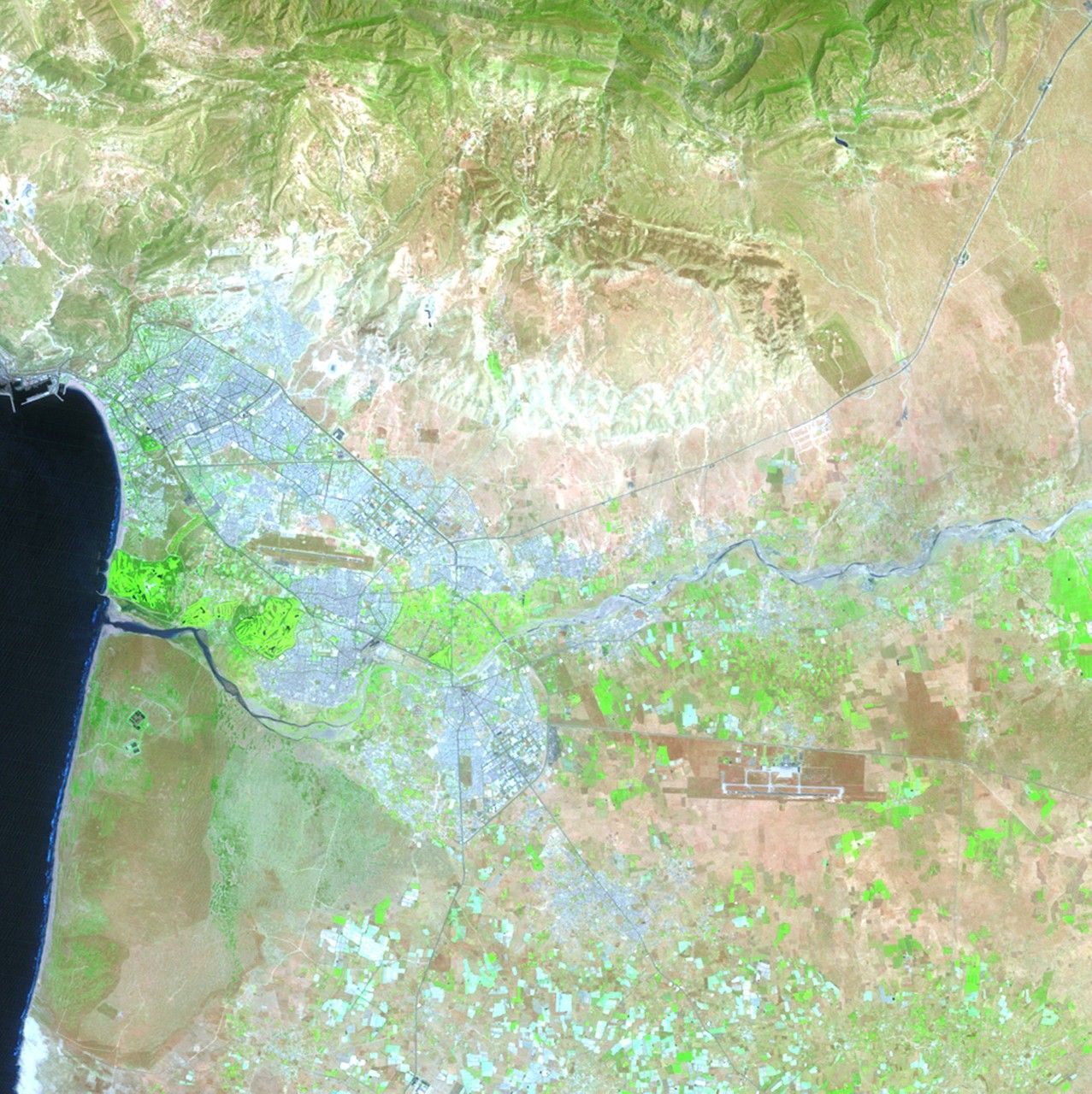
after
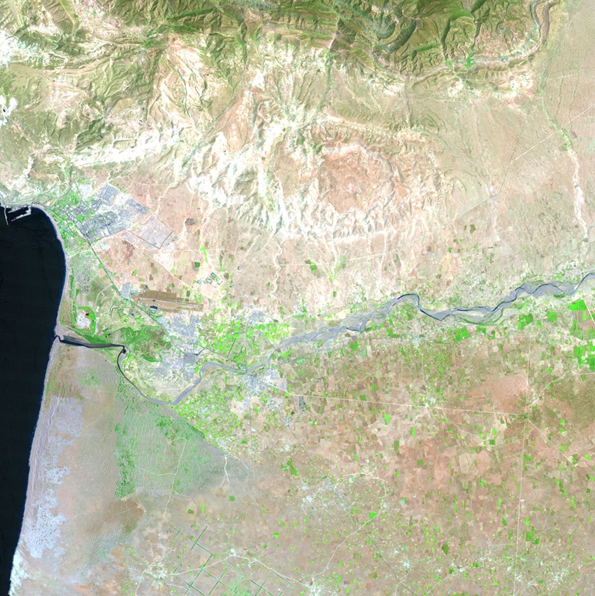
The Moroccan cities of Agadir, Inezgane and Tikiouine are close to the Atlantic coastline (seen in blue in the images), and stretch into the foothills of the Atlas Mountains. Agadir was nearly destroyed by an earthquake in 1960. Reconstruction has focused on tourism, turning this area into a winter destination. The 1985 image shows the area 25 years into the rebuilding. By 2011, the urban areas reach into the Sahara Desert. Growth has been influenced by the expanding fishing industry and modern commercial ports. Images taken by the Thematic Mapper sensor onboard Landsat 5. Source: USGS Landsat Missions Gallery, "Urban Growth in Morocco, 1985-2011," U.S. Department of the Interior / U.S. Geological Survey.
NASA/USGS
Before and After
Urban growth, southwestern Morocco
July 2, 1985 - June 24, 2011
The Moroccan cities of Agadir, Inezgane and Tikiouine are close to the Atlantic coastline (seen in blue in the images), and stretch into the foothills of the Atlas Mountains. Agadir was nearly destroyed by an earthquake in 1960. Reconstruction has focused on tourism, turning this area into a winter destination. The 1985 image shows the area 25 years into the rebuilding. By 2011, the urban areas reach into the Sahara Desert. Growth has been influenced by the expanding fishing industry and modern commercial ports. Images taken by the Thematic Mapper sensor onboard Landsat 5. Source: USGS Landsat Missions Gallery, "Urban Growth in Morocco, 1985-2011," U.S. Department of the Interior / U.S. Geological Survey.


