


before
after

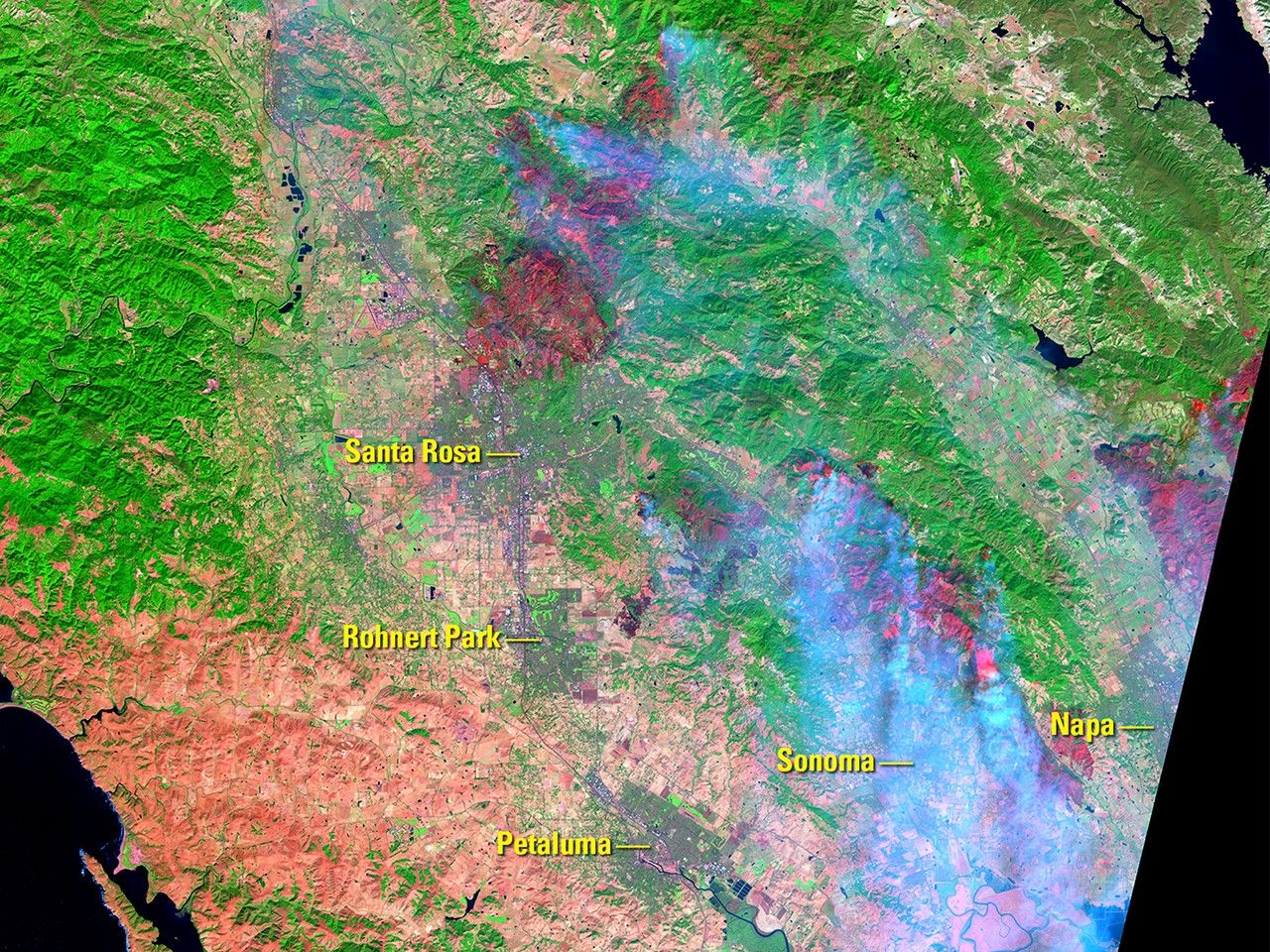
Wildfires fanned by wind gusts of 50 mph (80 kph) broke out on Oct. 8, 2017, burning more than 100,000 acres of California wine country by the time of the Oct. 11 image. A wet winter had encouraged the growth of vegetation, which dried out during a hot, dry summer and became fuel for the fires. Burned areas appear maroon and smoke appears light blue in the Oct. 11 image. The colors are false because the images were made from infrared data. Images taken by Landsat 8. Source: USGS Land Remote Sensing Image Collections.

Wildfires fanned by wind gusts of 50 mph (80 kph) broke out on Oct. 8, 2017, burning more than 100,000 acres of California wine country by the time of the Oct. 11 image. A wet winter had encouraged the growth of vegetation, which dried out during a hot, dry summer and became fuel for the fires. Burned areas appear maroon and smoke appears light blue in the Oct. 11 image. The colors are false because the images were made from infrared data. Images taken by Landsat 8. Source: USGS Land Remote Sensing Image Collections.
Wildfires fanned by wind gusts of 50 mph (80 kph) broke out on Oct. 8, 2017, burning more than 100,000 acres of California wine country by the time of the Oct. 11 image. A wet winter had encouraged the growth of vegetation, which dried out during a hot, dry summer and became fuel for the fires. Burned areas appear maroon and smoke appears light blue in the Oct. 11 image. The colors are false because the images were made from infrared data. Images taken by Landsat 8. Source: USGS Land Remote Sensing Image Collections.
Wildfires fanned by wind gusts of 50 mph (80 kph) broke out on Oct. 8, 2017, burning more than 100,000 acres of California wine country by the time of the Oct. 11 image. A wet winter had encouraged the growth of vegetation, which dried out during a hot, dry summer and became fuel for the fires. Burned areas appear maroon and smoke appears light blue in the Oct. 11 image. The colors are false because the images were made from infrared data. Images taken by Landsat 8. Source: USGS Land Remote Sensing Image Collections.
before
after
Before and After
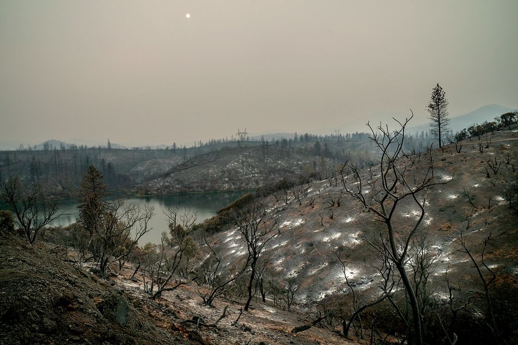
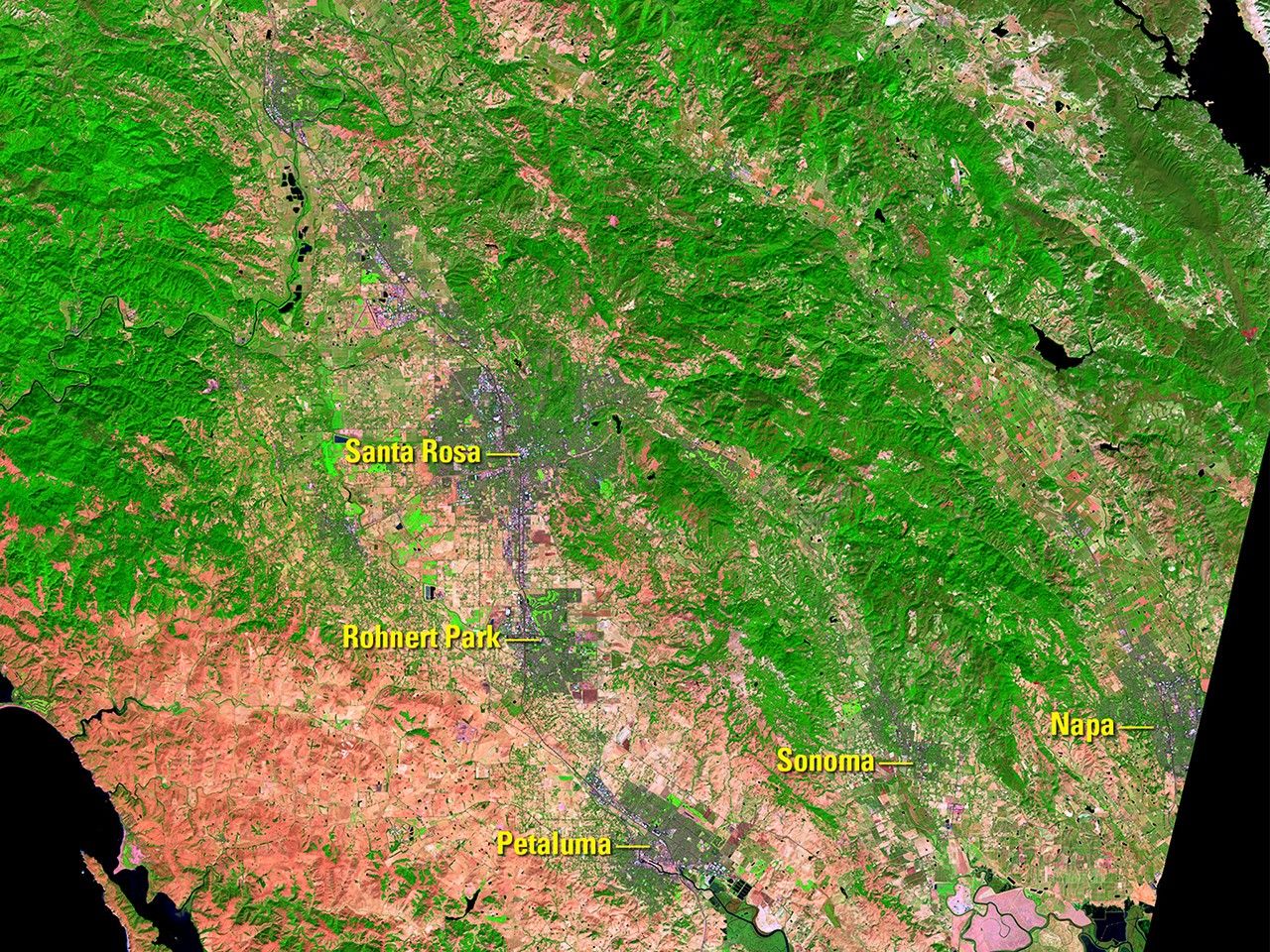
Wildfires burn Northern California's wine country
Sept. 25, 2017 - Oct. 11, 2017
Wildfires fanned by wind gusts of 50 mph (80 kph) broke out on Oct. 8, 2017, burning more than 100,000 acres of California wine country by the time of the Oct. 11 image. A wet winter had encouraged the growth of vegetation, which dried out during a hot, dry summer and became fuel for the fires. Burned areas appear maroon and smoke appears light blue in the Oct. 11 image. The colors are false because the images were made from infrared data. Images taken by Landsat 8. Source: USGS Land Remote Sensing Image Collections.