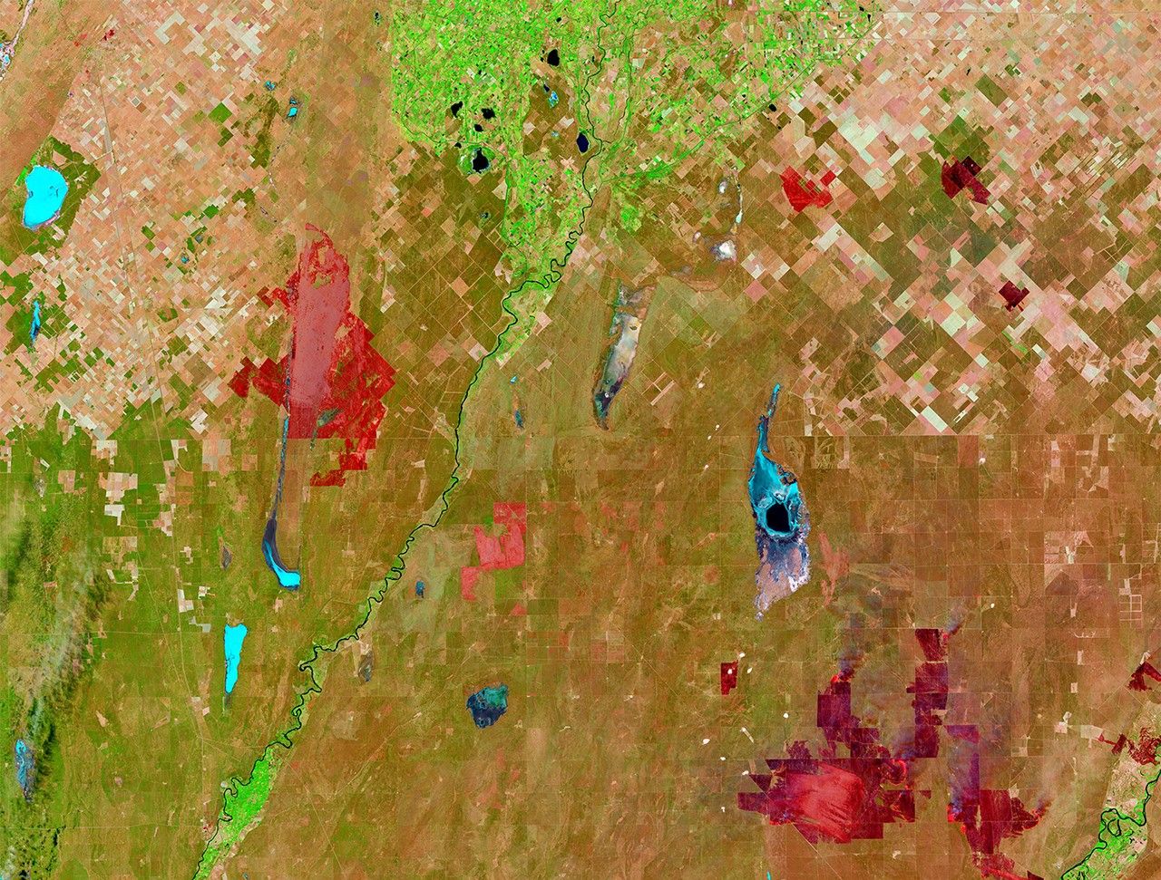
Suggested Searches

1 min read

Wildfires scorch Argentina’s Pampas region

before
after
Starting in mid-December 2016, roughly two dozen wildfires consumed about 2.5 million acres in the Pampas region of Argentina. Likely caused by thunderstorms following a stretch of severe drought, the first fires started southwest of the city of Bahía Blanca, as shown by small red burn scars in the Dec. 22 image (left), which cover an area of about 100,000 acres. The fires persisted despite rain at the end of December. On January 7, 2017, the Landsat 8 satellite’s Operational Land Imager (OLI) captured dramatic imagery of larger red burn scars across Argentina’s La Pampa and Rio Negro provinces.   Images taken by the Landsat 8 satellite. Source: U.S. Geological Survey (USGS) Landsat Missions Gallery: “Wildfires Scorch Pampas Region of Argentina”; U.S. Department of the Interior / USGS and NASA.

Before and After

Wildfires scorch Argentina’s Pampas region

December 22, 2016 - January 7, 2017

Starting in mid-December 2016, roughly two dozen wildfires consumed about 2.5 million acres in the Pampas region of Argentina. Likely caused by thunderstorms following a stretch of severe drought, the first fires started southwest of the city of Bahía Blanca, as shown by small red burn scars in the Dec. 22 image (left), which cover an area of about 100,000 acres. The fires persisted despite rain at the end of December. On January 7, 2017, the Landsat 8 satellite’s Operational Land Imager (OLI) captured dramatic imagery of larger red burn scars across Argentina’s La Pampa and Rio Negro provinces. Images taken by the Landsat 8 satellite. Source: U.S. Geological Survey (USGS) Landsat Missions Gallery: “Wildfires Scorch Pampas Region of Argentina”; U.S. Department of the Interior / USGS and NASA.

Downloads

Image 1

JPEG

(3 MB)

Image 2

JPEG

(3 MB)