


Landsat 1 Graphics Library
Discover the story of Landsat 1 through a collection of satellite images, mission diagrams, clean room photos, and other historic visuals. This gallery showcases the spacecraft’s design, launch, and groundbreaking Earth observations that marked the start of modern land imaging.


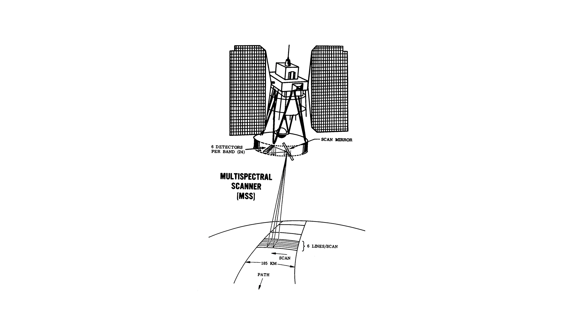


![This schematic appears in the ERTS Reference Manual that was prepared by General Electric prior to the Landsat 1 (ERTS-1) launch in 1972. The schematic shows the Landsat 1 flight profile, from liftoff (0) to spacecraft separation (10). The manual tells us, “an all-inertial guidance system, consisting of an inertial sensor package and guidance computer, controls the vehicle and sequence of operations from liftoff to spacecraft separation. The flight profile is presented in [this figure] .”](https://assets.science.nasa.gov/dynamicimage/assets/science/missions/landsat/2020/07/launch.jpg?w=1152&h=1152&fit=clip&crop=faces%2Cfocalpoint)