


Mt. St. Helens from Landsat
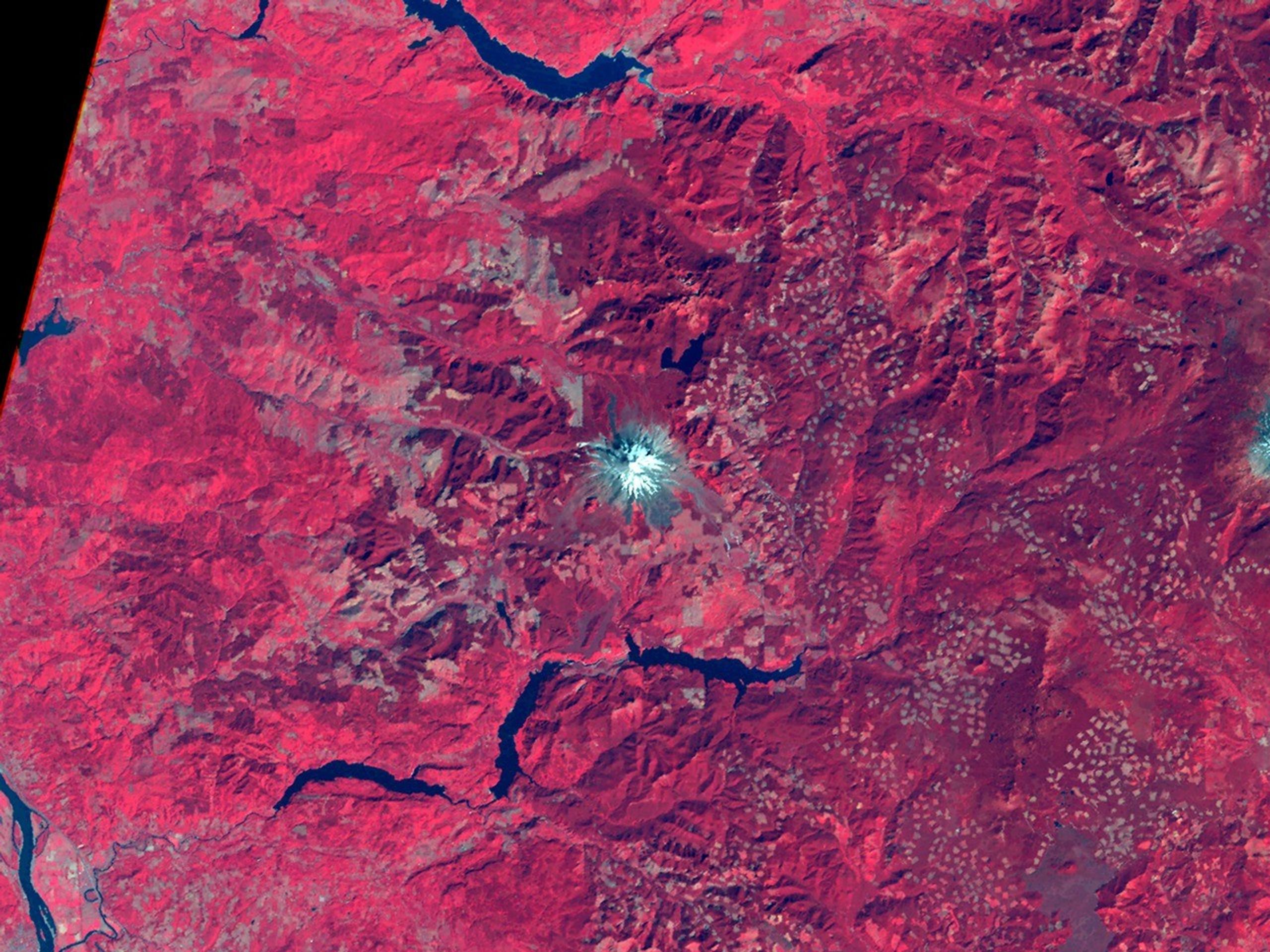
This 1973 Landsat 1 false-color infrared image shows Mount St. Helens almost a decade before its catastrophic 1980 eruption. Created using MSS bands 7, 5, and 4 displayed as red, green, and blue, the visualization highlights healthy forest vegetation in bright red, with the snow-capped peak appearing light blue at the center. This pre-eruption landscape would be dramatically altered when the mountain erupted, destroying much of the surrounding forest that appears intact in this view.
Image Credit: NASA/Jesse Allen
- X
https://science.nasa.gov/image-detail/amf-0c573cd7-52b8-40af-8c3b-4abb0c5ff747/
Image CreditNASA/Jesse Allen
Size2560x1920px
