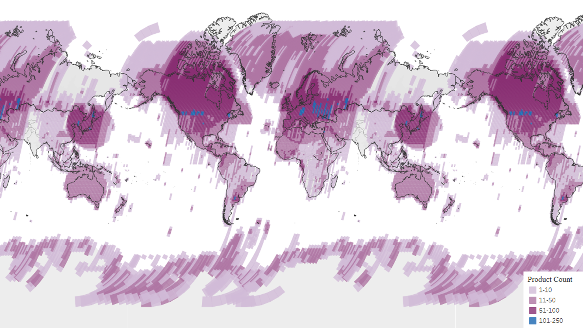


Landsat 4 scene acquisitions
Landsat 4 global density map from the USGS EROS archive. The colors on the maps show detail about the number of scenes per Path/Row.
Image Credit: USGS
- X
https://science.nasa.gov/image-detail/amf-1fb08ae6-be0c-422e-99bb-ef37e505f25f/
Image CreditUSGS
Size1920x1080px