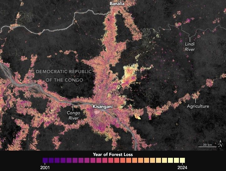
Reshaping the Forests Around Kisangani
Satellite data show decades of gradual but persistent change to forests around one of the Democratic Republic of the Congo’s largest cities.
- X
https://science.nasa.gov/image-detail/amf-2004c280-1c20-4ded-ba24-e12ce55a87ed/
Size720x545px