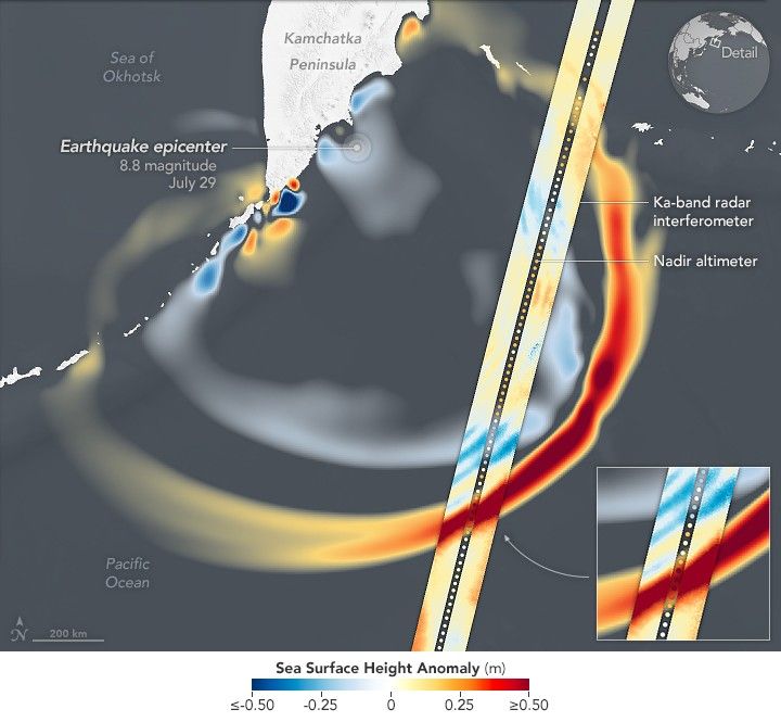
SWOT Spots Tsunami Wave After Kamchatka QuakeData provided by the water satellite are helping to improve tsunami forecast models. Facebook Pinterest X LinkedIn Email https://science.nasa.gov/image-detail/amf-3a38bc75-067c-40e1-9ac0-fa431f332688/Copy URL to clipboard> DownloadShareTagsEarth Observatory Image of the DaySize720x665px