


MSS Whiskbroom Diagram
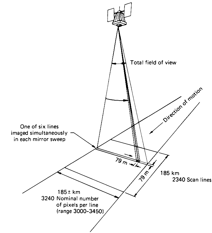
Multispectral Scanner (MSS) imaging concept showing the relationship between satellite position and ground coverage pattern. The diagram illustrates how the scanner captures six scan lines simultaneously during each mirror sweep, creating 79 m pixels across a 185 km swath containing approximately 3240 pixels per line. As the satellite moves in its orbit, it creates 2340 scan lines to form a complete image scene, demonstrating the whiskbroom scanning technique used in early Earth observation satellites.
Image Credit: NASA
- X
https://science.nasa.gov/image-detail/amf-3a5ff63b-d533-4261-aa91-84f71ab5a1fb/
Image CreditNASA
Size693x762px
