Suggested Searches

Technical diagram of the Multispectral Scanner (MSS) sensor showing its operational concept. The illustration depicts a satellite in orbit above Earth with a scanning mirror system that captures data in a 185 km swath width. The diagram includes MSS detector details showing a 4-band, 6-detector per band array, spectral ranges for bands 1-4 (.5-.6, .6-.7, .7-.8, .8-1.1 micrometers), scan direction indicators, and technical specifications including ground IFOV of 82.6 m, data rate of 15 mbps, and quantization level of 64.

Landsat-D MSS Diagram

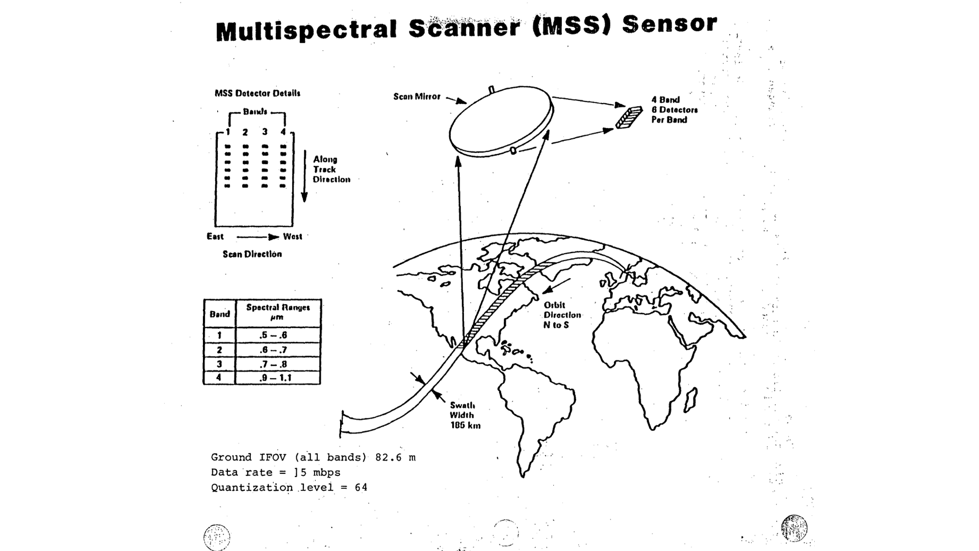
Technical diagram illustrating the MSS sensor system used on Landsat satellites, showing its scanning mechanism, detector configuration, and Earth observation capabilities with a 185 km imaging swath.

Image Credit: NASA
Download