


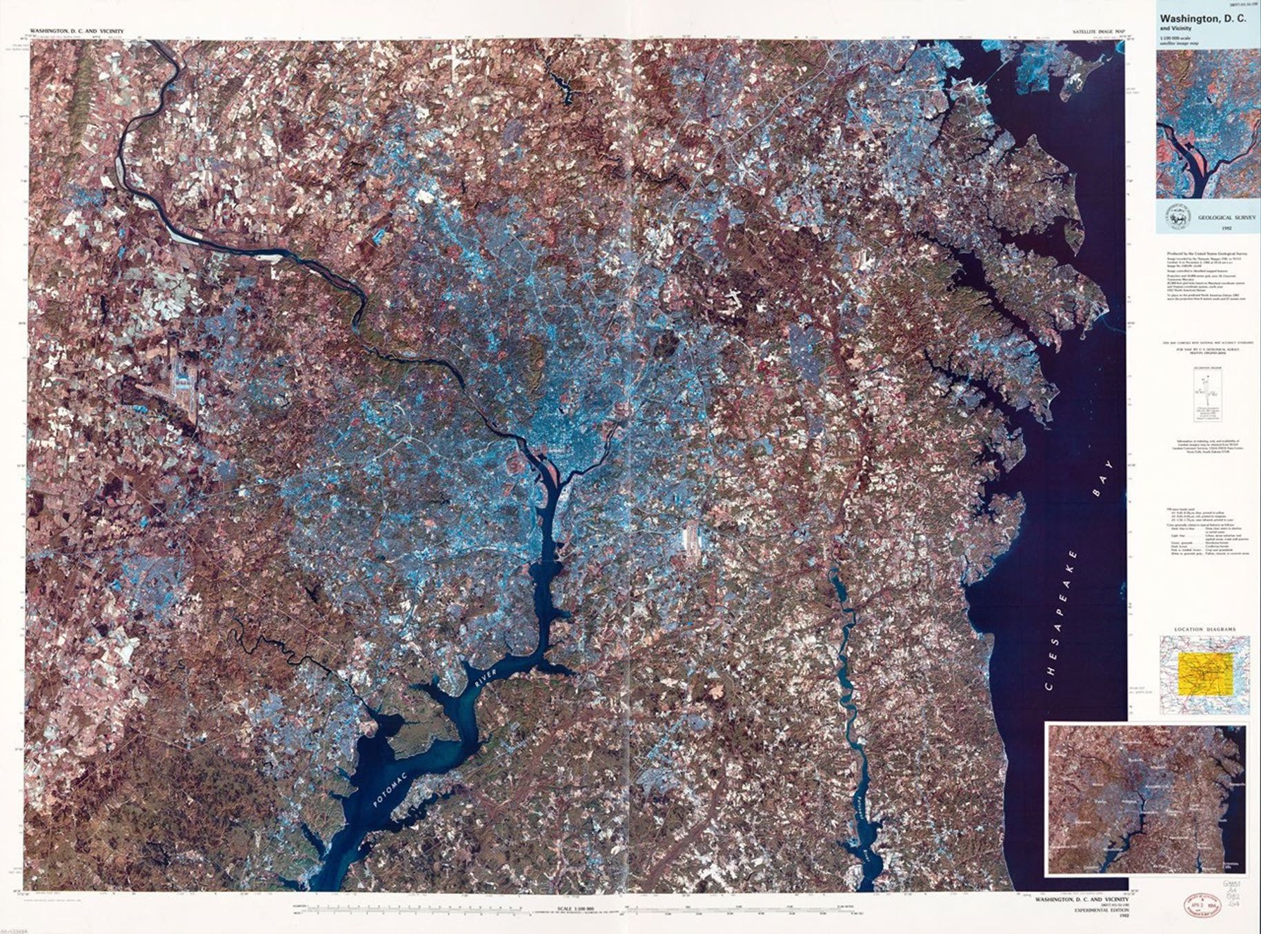
Landsat 4 Thematic Mapper (TM) image of Washington DC
Landsat 4 image of Washington DC and northern Virginia on November 2, 1982 at 10:14am. The image is a composite of TM bands 1, 3, and 5. Dark blue to blue colors represent deep clear water to shallow turbid water. Urban areas appear light blue. Deciduous forests appear greenish and coniferous forests appear dark brown. Pink to reddish brown colors represent crops or grasslands and white to greenish gray are fallow fields or concrete areas.
Image Credit: NASA
- X
https://science.nasa.gov/image-detail/amf-75bc4cc4-0acc-4a75-99a5-b178f060ce76/
Image CreditNASA
Size1828x1355px
