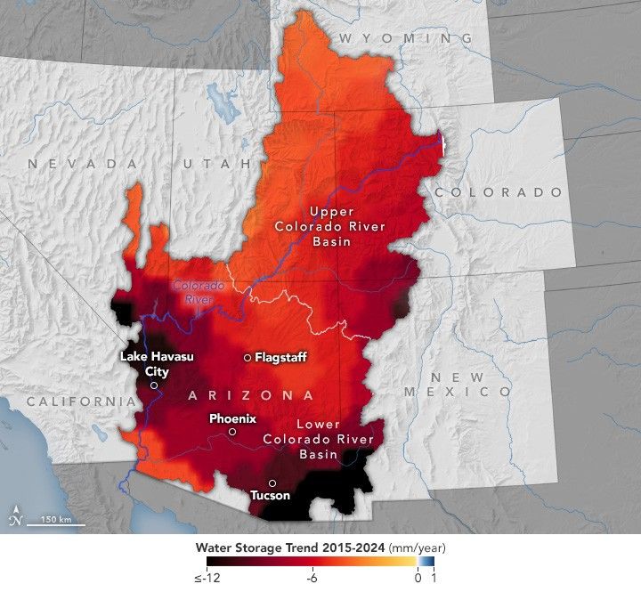
Arizona’s Declining GroundwaterDecades of satellite observations show that the aquifers in the southern part of the state are ailing. Facebook Pinterest X LinkedIn Email https://science.nasa.gov/image-detail/amf-75da827a-4551-444a-bd1b-aaa4d975d55a/Copy URL to clipboard> DownloadShareTagsEarth Observatory Image of the DaySize720x665px