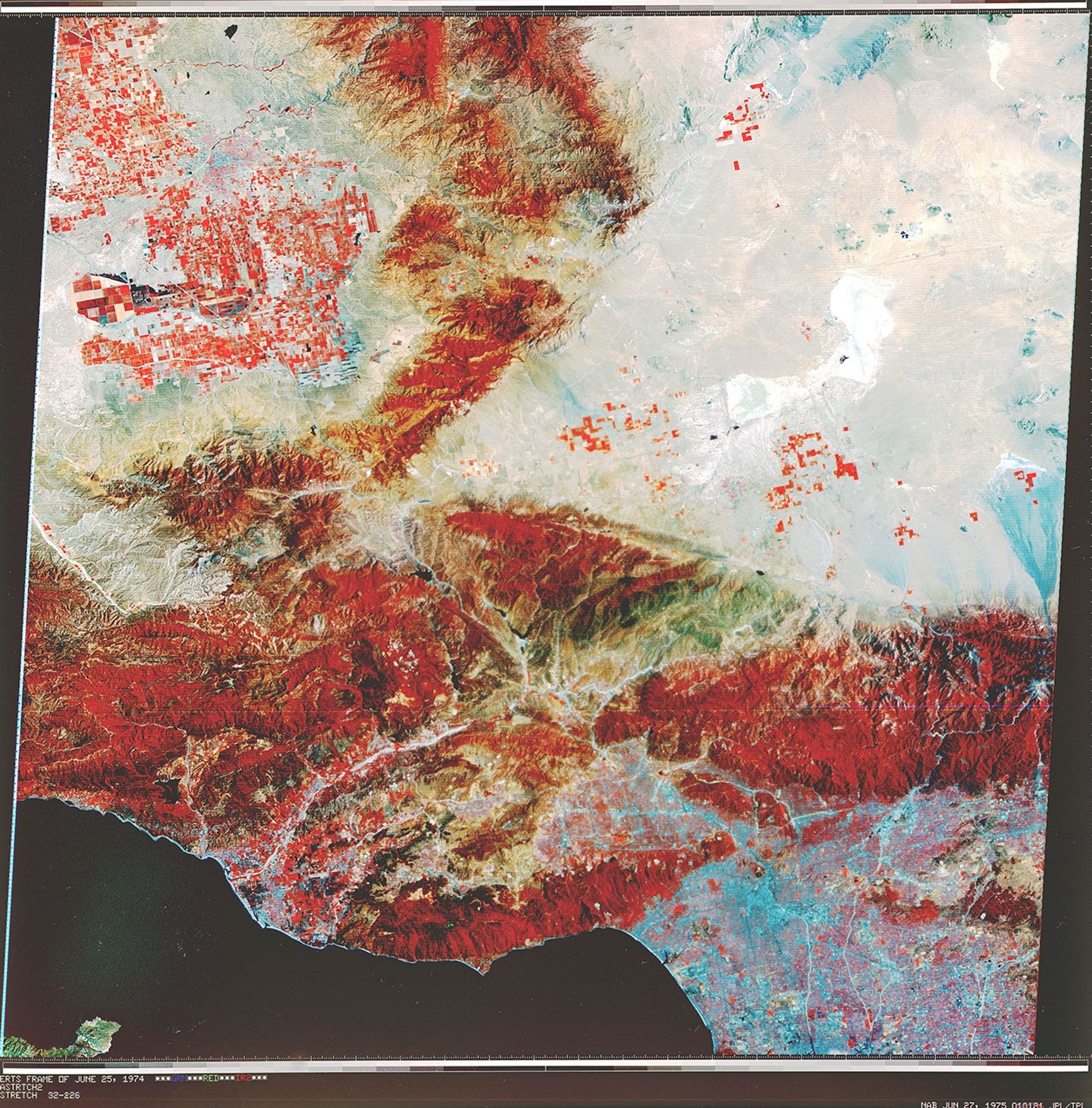
Early Landsat View of Los Angeles and VicinityPIA02988Image Credit: NASA/JPL Facebook Pinterest X LinkedIn Email https://science.nasa.gov/image-detail/amf-91a8c8c5-b4c2-4621-ad3a-34982c811b90/Copy URL to clipboard> DownloadShareImage CreditNASA/JPLSize3739x3795px