


Landsat 9 Rollout at SLC-3
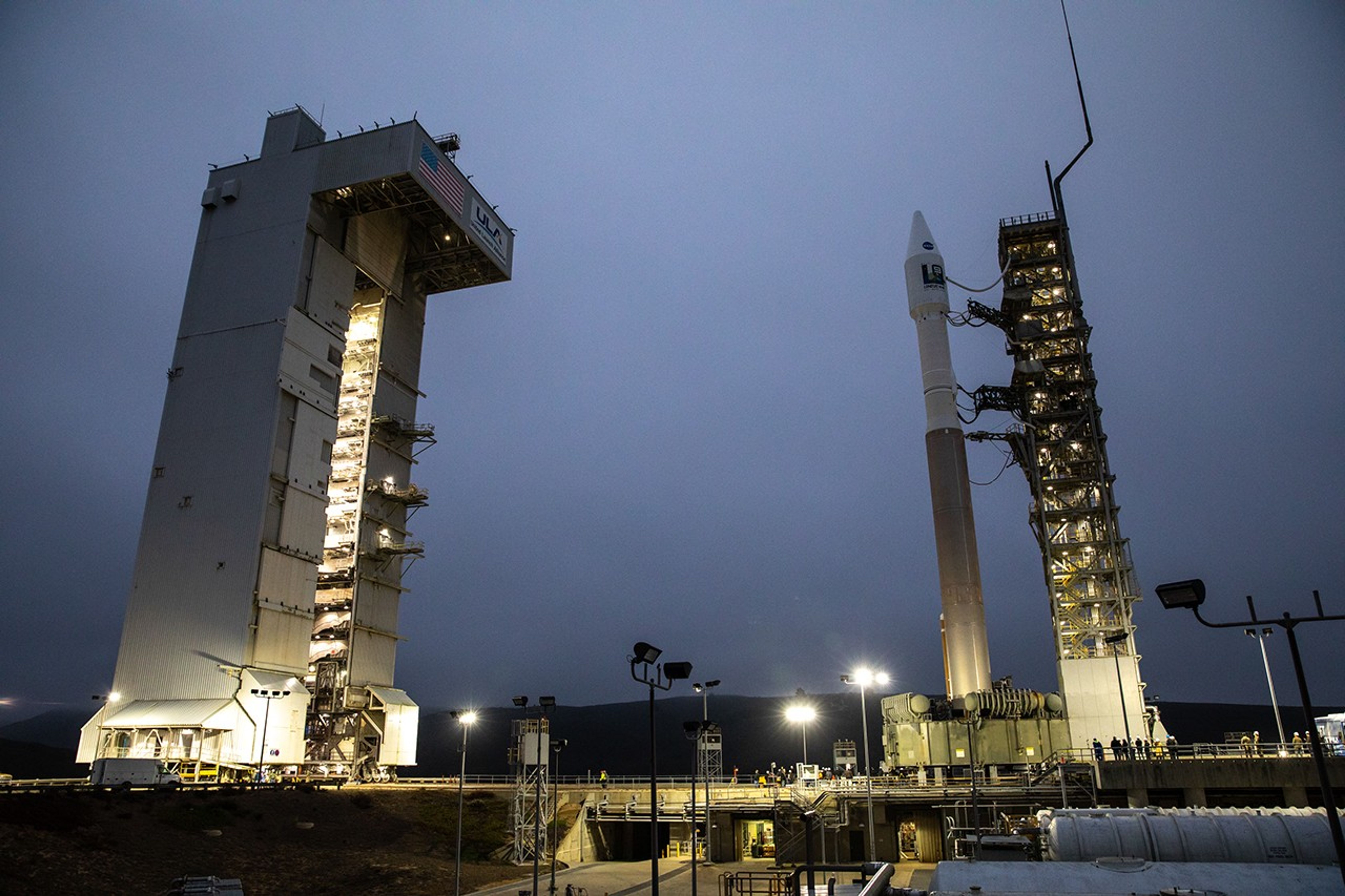
The United Launch Alliance Atlas V 401 rocket with NASA’s Landsat 9 satellite arrives at the launch pad at Space Launch Complex 3 (SLC-3) at Vandenberg Space Force Base in California, on Sept. 27, 2021, after rolling out from the Vertical Integration Facility. Landsat 9 is scheduled to launch at 2:12 p.m. EDT (11:12 a.m. PDT) today, Sept. 27, atop the Atlas V from SLC-3. The launch is managed by NASA’s Launch Services Program based at Kennedy Space Center. The Landsat 9 satellite will continue the nearly 50-year legacy of previous Landsat missions. It will join its sister satellite, Landsat 8, in orbit to monitor key natural and economic resources from orbit. Landsat 9 is managed by the agency’s Goddard Space Flight Center in Greenbelt, Maryland. The satellite will carry two instruments: the Operational Land Imager 2, which collects images of Earth’s landscapes in visible, near infrared and shortwave infrared light, and the Thermal Infrared Sensor 2, which measures the temperature of land surfaces. Like its predecessors, Landsat 9 is a joint mission between NASA and the U.S. Geological Survey.
Image Credit: NASA
- X
https://science.nasa.gov/image-detail/amf-da4b28b4-ed11-479e-b36c-f7b27da5002d/
Image CreditNASA
Size6720x4480px
