Landsat TDRSS Coverage
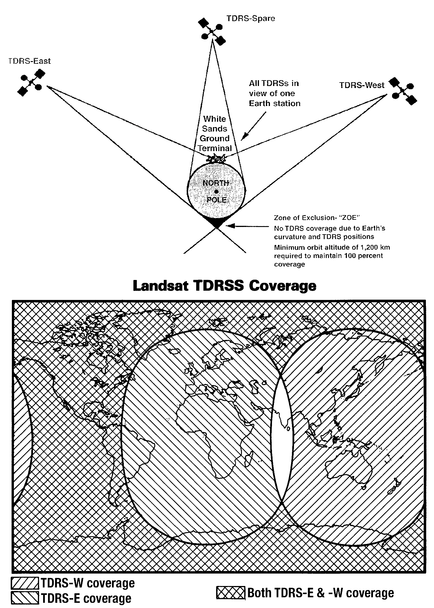
Landsat TDRSS (Tracking and Data Relay Satellite System) communication architecture showing the three-satellite constellation (TDRS-East, TDRS-West, TDRS-Spare) and their coverage zones. The diagram illustrates the global relay network with the White Sands Ground Terminal as the central hub, highlighting the small polar "Zone of Exclusion" where satellite visibility is limited. The world map demonstrates how the overlapping coverage areas provide near-global data relay capability for Landsat operations.
Image Credit: NASA
- X
https://science.nasa.gov/image-detail/amf-e7e7038e-ceb1-4458-809d-9c93512f91d9/
Image CreditNASA
Size1500x2100px