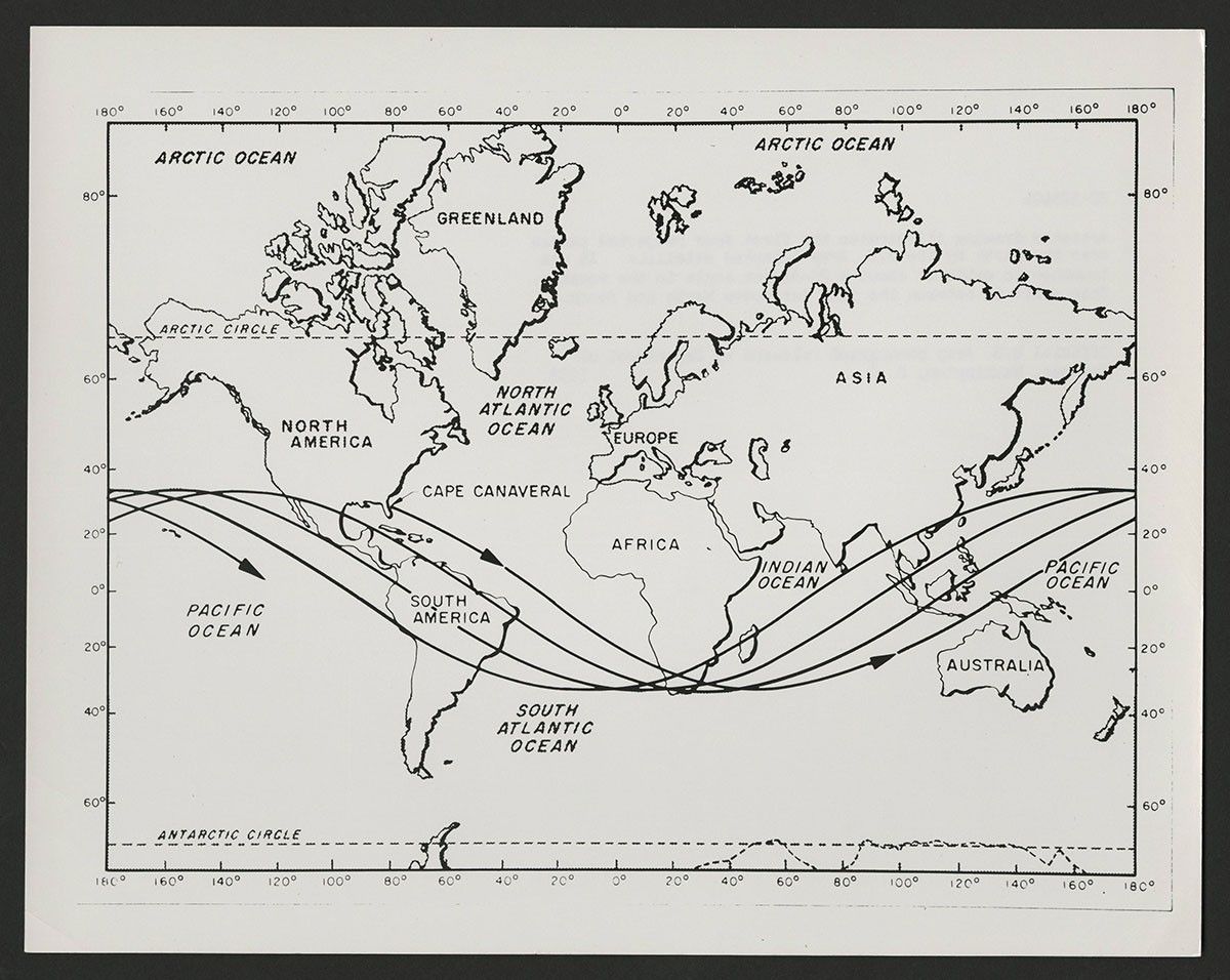
U.S. Army Projected Pass Illustration
This official U.S. Army illustration captioned: "Artist’s drawing illustrates the first four projected passes over the Earth of the satellite launched by the U.S. Army. It was launched to orbit at about a 20-degree angle to the equator. Its orbit is between the 35th latitudes North and South."
Image Credit: James A. Van Allen Papers (RG 99.0142), University Archives, The University of Iowa Libraries
- X
https://science.nasa.gov/image-detail/amf-fb1af51e-e457-47df-a460-9935e45873b3/
Image CreditJames A. Van Allen Papers (RG 99.0142), University Archives, The University of Iowa Libraries
Size1200x956px