![Satellite image shown in false color. the land and broader sea are grayscale, with the Jacuí and surrounding floodplains shown in a scale of blue from near white to a navy blue, the darker the color the deeper the water in meters. The River runs left to right with a few contributing tributaries coming down to the river from the top of the image and at their center runs a dark blue channel that are the ordinary banks for the river, however, near the mouth there is a zoomed in section of the image showing how expansive and deep sections of the flooding have become.](https://science.nasa.gov/wp-content/uploads/2023/06/brazilflooding-opera-20240506.jpg?w=4096&format=jpeg)
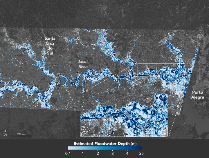
Southern Brazil Submerged
This map reveals the depth of floodwater that covered Rio Grande do Sul in May 2024. View the full story
Credits: NASA Earth Observatory / Lauren Dauphin
TakenMay 6, 2024
Image CreditNASA Earth Observatory / Lauren Dauphin
Size640x484px